Site
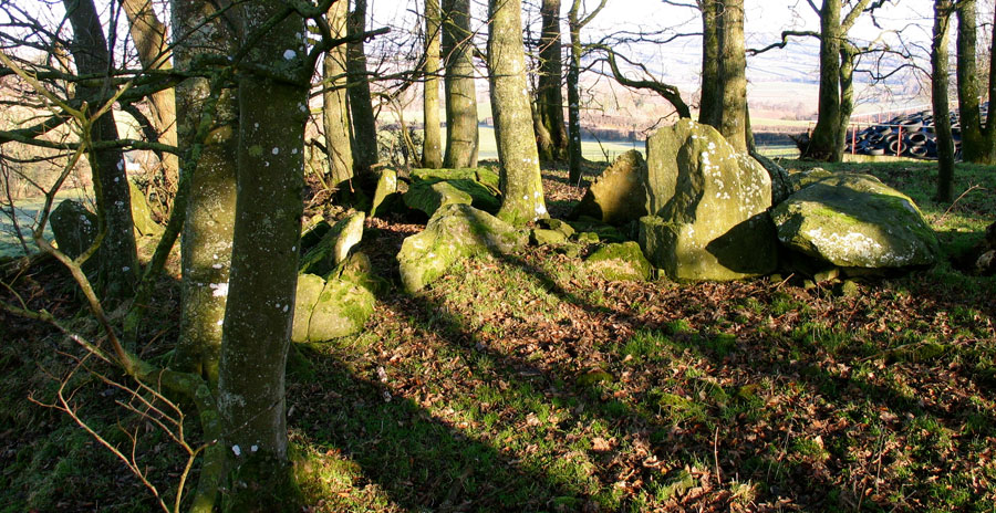
A is one of the few remaining structures at Kilmonaster. It is a round
cairn, 22 meters in diameter with a large cruciform chamber and quartz
kerbstones.
Kilmonaster, Co Donegal
The Kilmonaster
megalithic complex in east Donegal is a little known and studied collection
of passage cairns, now in a much ruined state. Most of what is known about
the site today was put together from antiquarian reports in the mid 1900's,
when a lot of the monuments were already ruined.
Kilmonaster had perhaps 14 passage cairns, some of which may have been like Carrowmore monuments and some, like the one above, were probably more like Newgrange.
I visited two monuments while I was there, both about 250 meters apart.
There was also a faint outline in the ground, which was probably a third
monument. The monument above is quite large, perhaps 22 meters in diameter,
and has a big cruciform chamber. The site is largely destroyed, and is
close by some farm sheds and buildings. There is a plentiful supply of quartz in this
area, and several of the monuments have large impressive quartz kerbstones.
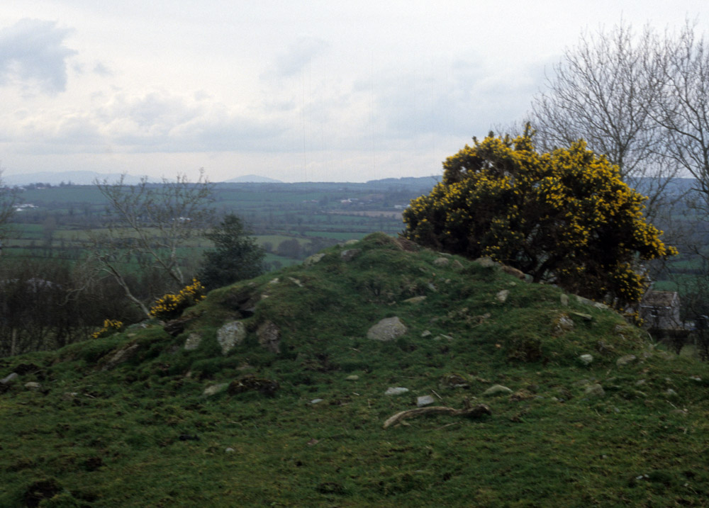
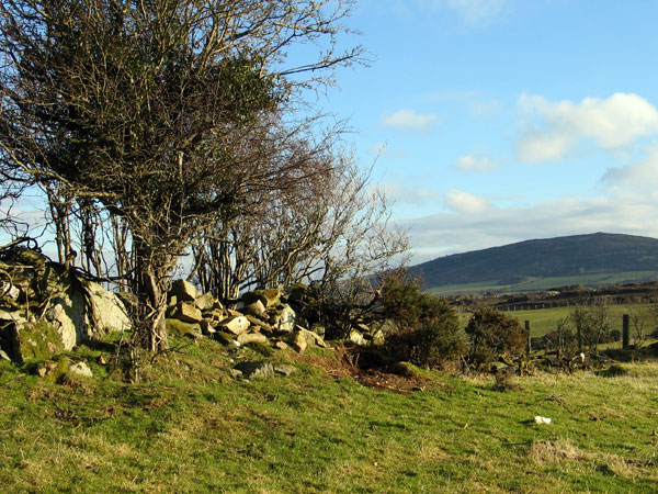
A tiny cairn at Carnowen, the western portion of the Kilmonaster megalithic complex.
The sites are located on and around Kilmonaster and Craigtown Hills, between the
rivers Finn and Deel, both of which join the Foyle not far to the east.
Navigation by curragh in and out to the sea would have been pretty easy
in the stone age. To the east of Kilmonaster rises Croghaun Hill, with
a cairn within a hillfort on its summit. Over to the west is a lower hill,
Cairn Owen (above) which has a surviving tiny cairn, and possibly 2 or
3 destroyed monuments. Just across the River Deel to the north of Cairn
Owen is the Beltany Tops stone circle, which some think may be a much
disturbed passage mound.
Boyle Sommerville
surveyed the area in 1923 and made some preliminary astronomical observations,
mainly from the Beltany circle. The complex
has all the hallmarks of a classic chambered cairn layout, with Cairn
Owen making up the third portion of the complex.
I visited this site for the first time on Easter Saturday, 2002. The monuments
at Kilmonaster are quite ruined due to being located in fine farm land
which was granted to Scottish settlers during the plantation of Ulster
in the 1600's.
The remains of Site D at Kilmonaster. There are some cupmarks on the capstone.
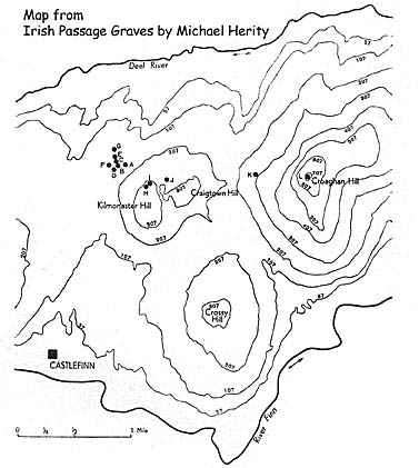
Below is a section from Irish Passage Graves, Michael Herity,
1974., which reconstructs a small complex of monuments:
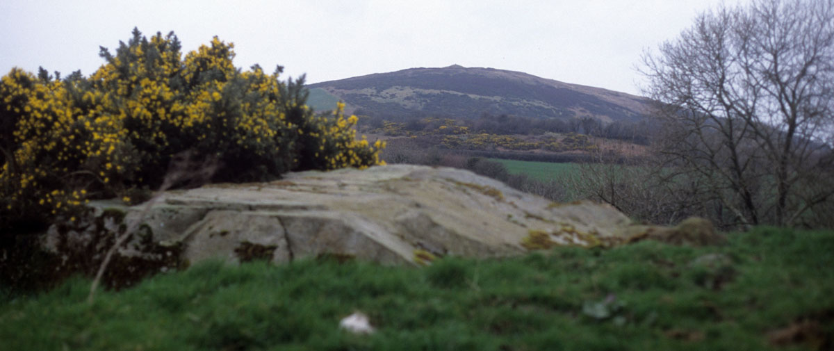
The view across from Carnowen to the cairn on the summit of Croghaun Hill.
O'Nuallain has reconstructed a cemetery of twelve tombs known to have existed here
in the last century by a combination of field survey and reconstruction
from Ordnance Survey documents, particularly James Fagan's account. The
focal tomb is sited at 221 m (724') on Croaghan Hill and the cemetery
stretches to the west of it in the territory between the Deel and Finn
rivers.
A map of the Kilmonaster monuments.
Site
A - A cruciform passage grave sited on a low ridge; parts of the kerb
of quartz blocks remaining indicate a diameter of 22 m.
Site B -
This structure and Site C were about 120 m west of Site A. It is now destroyed,
but in 1845 a chamber and kerb probably stood here.
Site C -
A chamber is probably indicated by the map of 1845; the site, immediately
northwest of B, is now destroyed.
Site D -
Sited 150 m west-south-west of Site A, this ruined chamber with its capstone
displaced is probably the remains of another passage grave. Fagan records
that 'a large quantity of human bones' was dug out in 1839.
Site E -
Sited 180 m north-west of Site A, this structure was shown as a semicircle
of stones with others enclosed by this, probably the remains of a chamber
and its kerb. Human bones and 'ashes' were found here.
Site F -
225 m west of Site A, this tomb had a circular cairn 22 m in diameter
with a number of cists and probably also a megalithic chamber within it.
Fagan mentions 'neat flags bearing sundry rude devices' covering some
of the cists, probably Bronze Age rather than passage grave art.
Site G -
This monument may be still extant: a low mound 15 m in diameter. Fagan
describes 'several stone coffins containing human bones', and a 'Brass
hatchet' found with a skeleton in one of them. This may have been used
as a multiple-cist cairn.
Site H -
About 91m (300') up on the north slope of the low rise of Kilmonaster
Hill, and 400 m south-east of Site A, this site was shown in 1845 as a
minute enclosure with a kerb surrounding it. Fagan recorded its dimensions
as 7.2 m by 4.2 m and that it was enclosed by large flags'.
Site I -
54m to the north of Site H stood a tomb 3.3m square enclosing a grave
under a large capstone 2.1 m long by 1.2 m broad.
Site J -
A megalithic tomb, six of its orthostats remaining, surrounded by the
remains of a mound. The orthostats may form a chamber and one side of
the passage of a passage grave. Fagan records the finding of 'every description
of human bones'.
Site J. The view is to the cairn on Croughan Hill to the east.
Site J, a fairly ruined megalithic chamber which looks to be the remains of
an undifferentiated passage cairn has been incorporated into a field wall.
The view is to the cairn on Croughan Hill to the east.
Site K -
On the slopes of Croaghan Hill. Destroyed. Fagan's description indicates
a long megalithic structure, 6.6 m long and o.6m to 1.2 m wide
with a flat stone covering the south end.
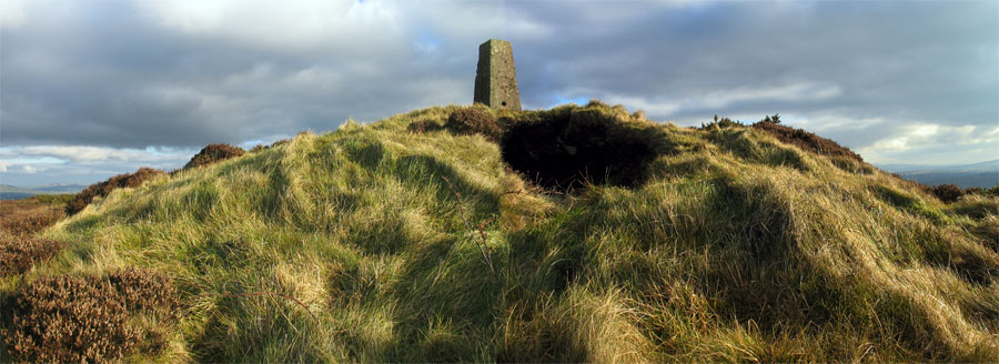
Site L -
A large circular cairn, 21 m in diameter, crowning the summit of Croaghan
Hill at 221 m (724') above sea level, is delt with in the section below.
Croghaun, Co Donegal
It is a steep but rewarding climb to get to this monument, mainly for the view.
The surrounding land is cultivated except for some rough pasture on top.
The cairn is on the highest point and commands a wide view. Truskmore,
the highest part of the Dartry
range in Sligo/Leitrim can be seen, as can Nephin in Mayo. The quartz cone of Errigal stands out clearly on the horizon to the northwest, 44 kilometers away. The sun will drop behind Errigal a few weeks before and after midsummer when viewed from the cairn.
The chamber in the cairn appears to have collapsed or been looted. I had no
compass, but it appears to have been oriented to the southwest. Layers of
clay, like those at Knowth, can be seen where it has collapsed.
The cairn
is surrounded by a stone wall which probably dates from the same time
as the cairn. It is classed as a hillfort, some 80 meters in diameter.
Kilmonaster is about three kilometers to the west, and Beltany
about five kilometers to the northwest.
The
cairn on the summit of Croghaun hill, with a collapsed chamber oriented
towards the southwest.