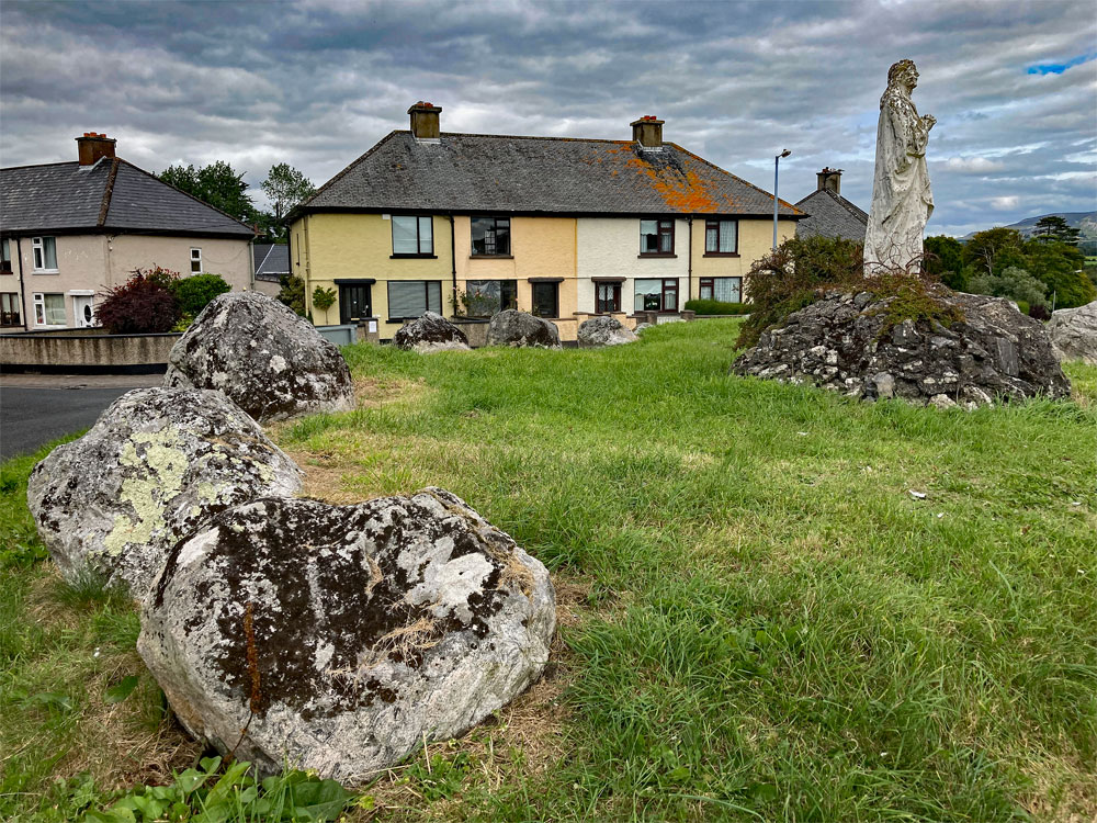
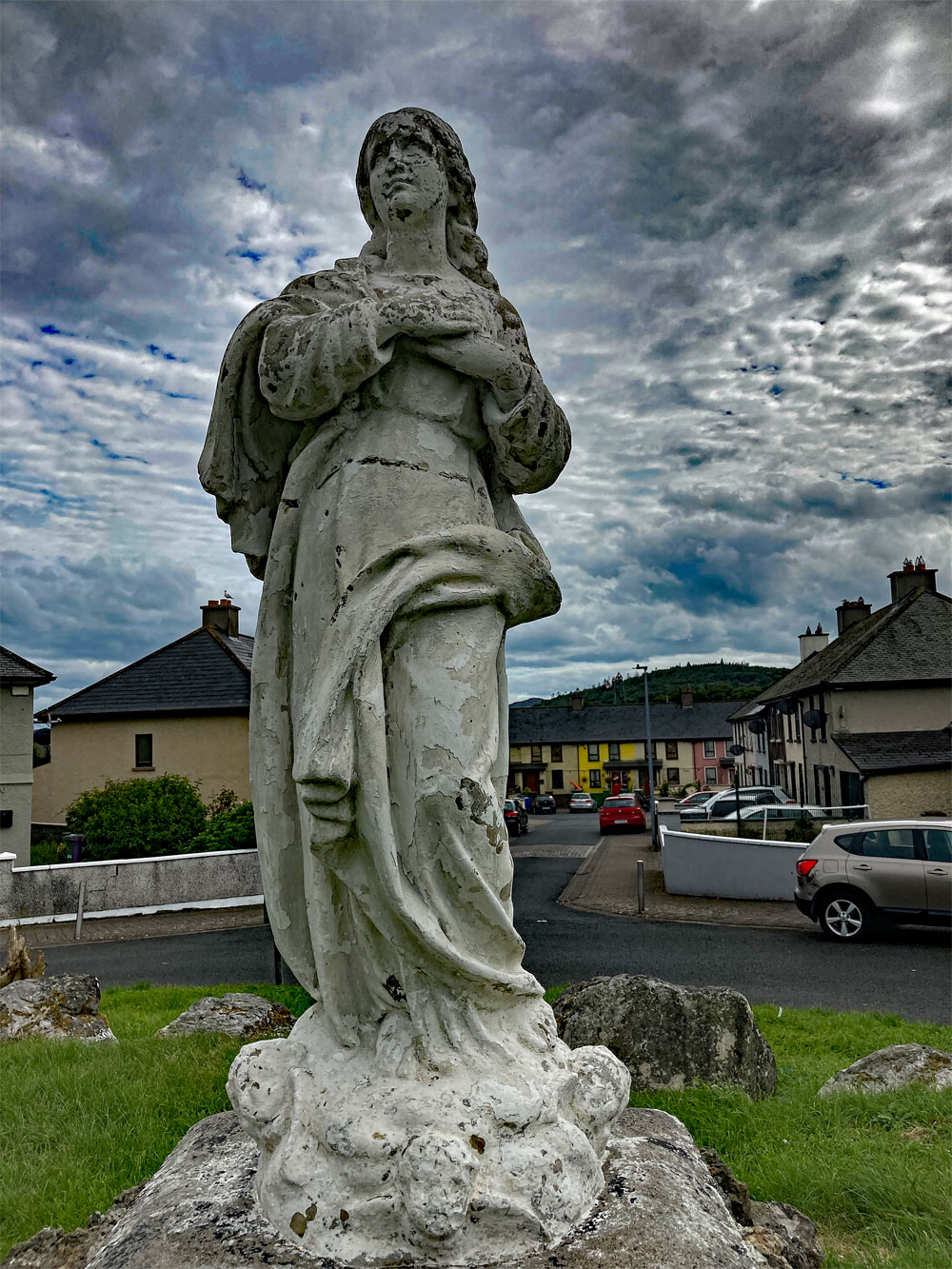
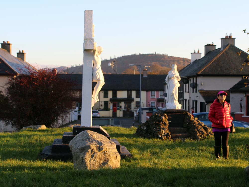
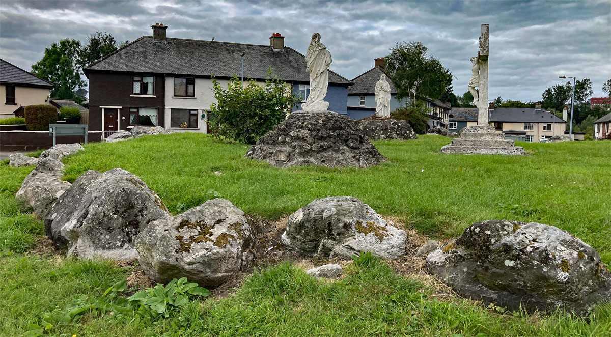
The Christian statues were added to the site in the Marian festivities in the 1950's; crosses
were erected on many ancient Irish sites including Kesh Corran and Sheemor at that time.
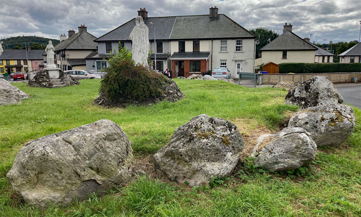
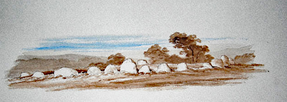
The Abbeyquarter stone circle.
The Abbeyquarter stone circle is one of the most unusual monuments in County
Sligo, or indeed anywhere in Ireland. It is known locally as the Garavogue
Fairy Fort. The circle of fourty-four boulders is twenty-three meters in diameter and stands
on a knoll overlooking the River Garavogue. The Shelly River is only five kilometers
long, flowing from Lough Gill through Sligo Town and into the sea.
Abbeyquarter Stone Circle, possbly one of the first monuments left by colonising neolithic farmers who occupied the area from around 4,000BC, when the causewayed enclosure at Magheraboy was constructed.
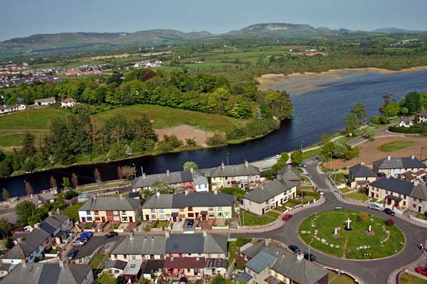
The Abbeyquarter monument is the oldest building in Sligo town. It is a stone
circle of the same type as those found in Carrowmore, which may originally had a central chamber of some kind standing at the centre. The Carrowmore circles, which are contemporary with Abbeyquarter, have been securely dated and range in use from 5,800 to 5,000 years ago.
The Abbeyquarter circle occupys a stratiegic location marking an ancient ford on the Shelly river, named Garavogue after the great hag or cailleach, the primal goddess of the early neolithic farmers. In the Sligo are, where many early passage-graves are found, they are always associated with the cailleach, who carries the stones down from the mountains around her home, and constructs the monuments. Abbeyquarter may be the oldest of all the early passage-graves, the primary burial place of the first group colonists to arrive to Sligo.
The Abbeyquarter Circle was lucky to survive largely intact as the town of Sligo grew and expanded from the twelth century onwards. The name indicates the circle was on lands owned by the
Abbey of Sligo, the oldest medieval building in the town, dating to 1254. In the Seventeenth century
the Abbeyquarter stone circle, then known as the Sligo Stones, appeared on the Seal of Sligo Town in conjunction with a hare, which is often seen as a symbol for a witch.
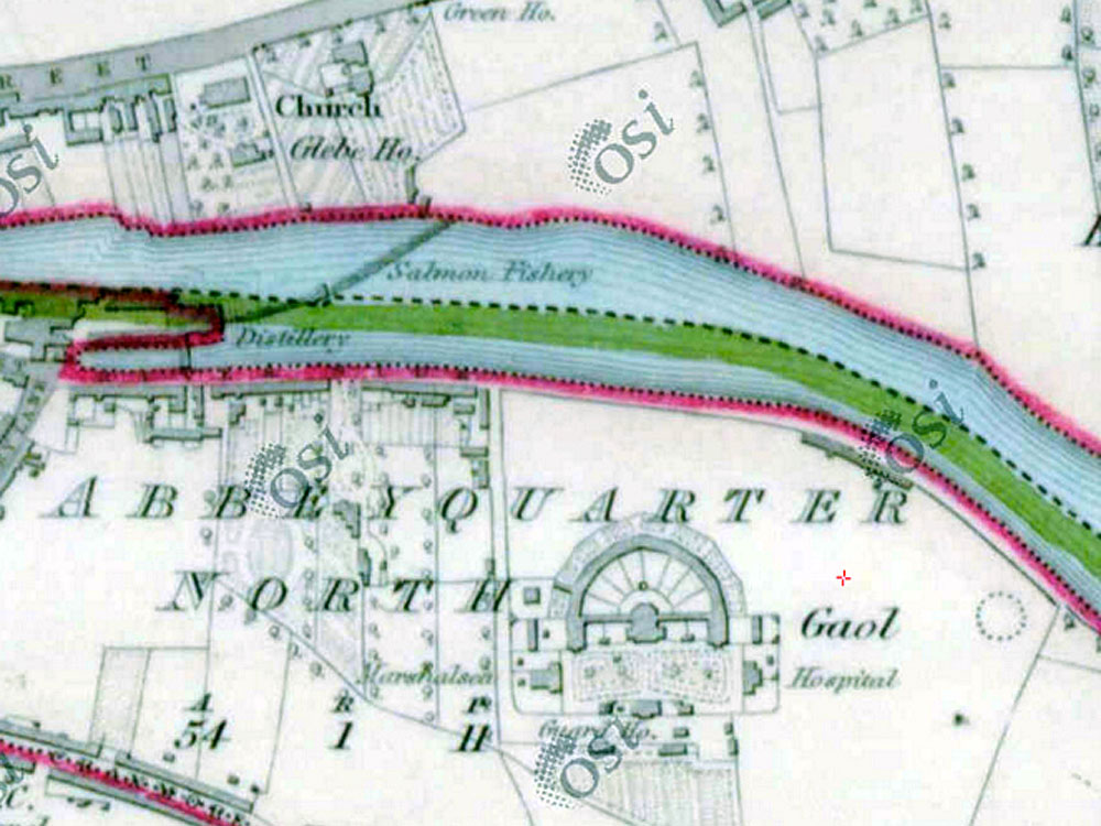
The Ordnance Survey map from 1837 shows the Abbeyquarter passage grave and its proximity to the river Garavogue amd the newly-built Sligo Gaol.
Sligo County Prison was built on a six acre plot of land west of the circle, with the construction beginning in 1814 and completed in 1818. The Catholic Church erected three statues at the centre of the Abbeyquarter circle in 1950, to celebrate the year of the Assumption and the Resolution of the Dogma. Crosses were erected all over Ireland throughout the early 1950's to celebrate the Pope's definition of the Dogma of the Assumption, which dealt with the corporeal condition of Mary on her assumption.
the Abbeyquarter stone circle, a tertre or early neolithic passage grave within a roundabout close to the river Garavogue on the east side of Sligo town. Carns Hill, capped by two massive neolithic cairns can be seen a kilometer to the south.
The Christian statues were added to the neolithic monument in 1950. This has to be the most accessible neolithic monument in Ireland.
Other crosses at ancient monuments in the region were erected at Tobernalt three kilometers south of Abbeyquarter, on the cliffs above the Caves of Kesh Corran near Ballymote, and on the Hill of Sheemor near Carrick on Shannon in Co Leitrim.
A map view of the Abbeyquarter passage-tomb showing its relationship with the River Garavogue, which connects Lough Gill to the sea.
Today the Abbeyquarter Stone Circle sits within a roundabout surrounded by houses
in the estate called Garavogue Villas. It is one of the most surreal yet one of the easiest monuments to visit in Ireland.
The enormous study, The Dolmens of Ireland, their Distribution, Structural Characteristics, and Affinities in Other Countries; together with the folk-lore attaching to them and traditions of the Irish people, was published by William Copeland Borlase in three volumes in 1897. The Dolmens of Ireland collected all the currently available information about megalithic remains.
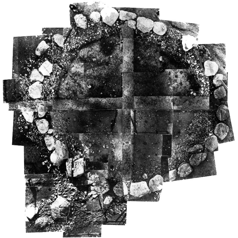
This circle of boulders is nearly perfect, forming a ring on a raised mound 65 feet in diameter. The inside surface is perfectly level. On the north there are two stones, seemingly the remains of an inner circle. There are several gaps in the ring, one of which is on the north side, immediately opposite the two stones.
The Abbeyquarter circle is closely related to Carns Hill to the south, where each of the twin summits is capped by a massive neolithic cairn.
Three large boulders, which Colonel Wood-Martin thinks may have been rolled out of their place in the circle, have somewhat the appearance of the commencement of an avenue leading up to it. A little north of the centre, two stones are to be seen which seem to have formed a portion of a dolmen or cist. One of them is a flat slab; the other, seemingly, a supporting stone.
An excavation at the foot of the latter disclosed "traces of the flooring of the cist, upon which were some bones, the greater portion of which were calcined." This cist was, Colonol Wood-Martin thinks, only "a division, or septum," of the original structure.
A garden at Garavogue Villas, close the Abbeyquarter circle, is home to one of Sligo's largest
collection of garden gnomes.
Dr. Frazer states that the discoveries consisted of "1 3/4 lb. of calcined bones, seemingly all human, but in a very fragmentary state; 2 1/2 ozs. of uncalcined human bones; three molars, and one incisor tooth of a young person; the tooth of a goat, and another, probably of a dog; also bones of goat or sheep."
This circle, in point of its standing on a bank, of the contiguity of the stones, and their number, and of its diameter, may be compared with one on the island of Inishowen, or Ennishowen, in Lough Mask.
The Abbeyquarter stone circle or passage-grave is an early form of the monument imported into Sligo by neolithic colonists who most likely came from Brittany. These early monuments generally consist of a free-standing burial chamber constructed at the centre of a circular platform or tertre, which raises and elevates the grave and the human remains above the level of the surrounding terrain.
The latest research indicates that these neolithic farmers originated in Anatolia, where the first temples are constructed 10,000 years ago and cattle are domesticated. These migrating farmers practice some form of organised ritual and religion, having made a bargin of some kind with the deities in exchange for the secrets of farming. They tend to build symbolic monuments which represent the Land of the Dead, with passages to facilitate journeys to the afterlife. The Abbeyquarter circle, burial monument and territorial marker, may well be one of the first of its kind to appear in the west of Ireland. The Abbeyquarter circle is the closest passage-tomb to the causewayed enclosure at Magheraboy, which has been dated to 4,150 BC.
The large platform or tertre at Abbeyquarter is twenty-three meters in diameter and enclosed by a circle of fourty-four large, glacial gneiss boulders. The Christian statues were erected in 1950.