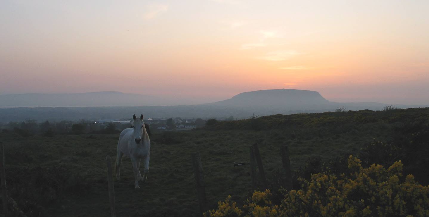
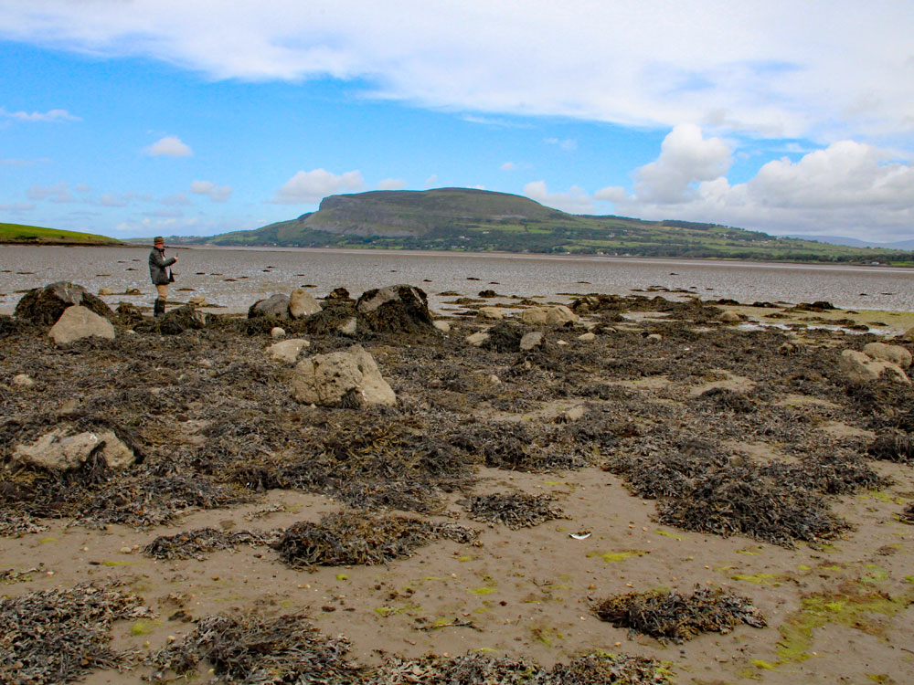
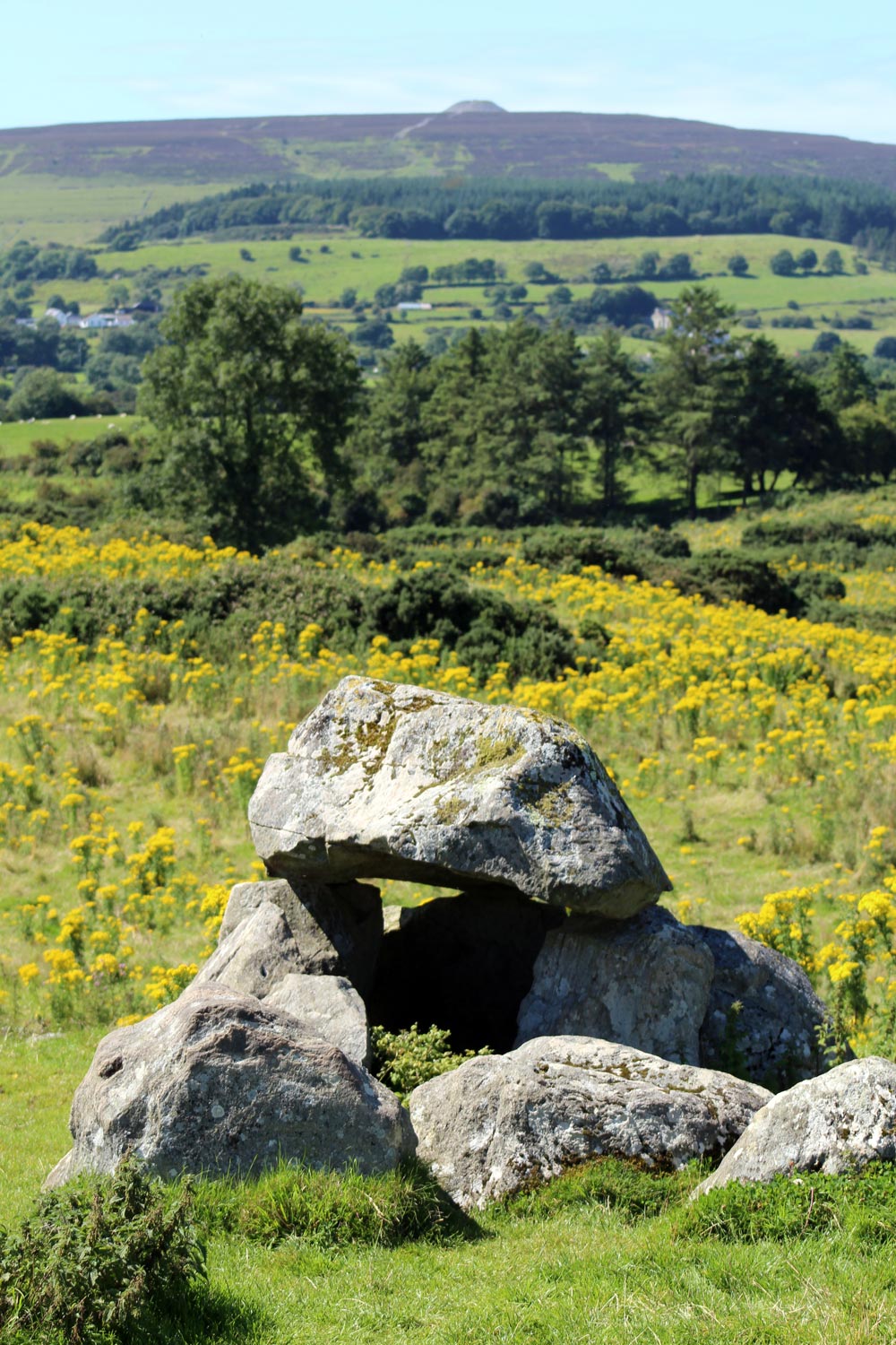
Knocknarea mountain
When the Fianna were washed and dressed, the Red Woman brought them into a great hall, where there was the brightness of the sun and of the moon on every side. From that she brought them into another great room; and although Finn and his men had seen many grand things up to that time, they had never seen any sight so grand as what they saw in this place. There was a king sitting in a golden chair, having clothes of gold and of green, and his chief people were sitting around him, and his musicians were playing. And no one could know what colour were the dresses of the musicians, for every colour of the rainbow was in them. And there was a great table in the middle of the room, having every sort of thing on it, one better than another.
The king rose up and gave a welcome to Finn and to his men, and he bade them to sit down at the table; and they ate and drank their fill, and that was wanting to them after the hunt they had made. And then the Red Woman rose up, and she said: "King of the Hill, if it is your will, Finn and his men have a mind to see the wonderful beast, for they spent a long time following after it, and that is what brought them here."
The Red Woman, Lady Gregory, Gods and Fighting Men, 1904.
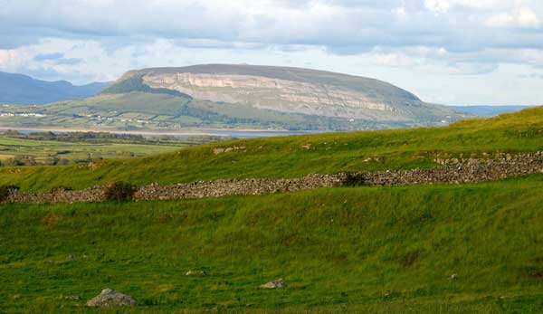
The Hill of Knocknarea is the most prominent and beautiful mountain in County Sligo, it's only possible rival being the majestic plateau of Benbulben. Knocknarea is a limestone hum rising to 320 meters above sea level at the west end of the Cuil Iorra Peninsula. The mountain is surrounded by water on three sides, and looks out across the Atlantic Ocean in the west. Knocknarea has a very powerful presence, somewhat like Uluru on the other side of the planet. The mountain dominates the landscape of Sligo and is visible from most of the neolithic sites in the region.
It is highly likely that the mountain was regarded as sacred by the mesolithic hunter gatherers who would have been attracted here by the abundant wildlife and shellfish. The early dates from charcoal found close to the monuments at Carrowmore would seem to indicate pre-farming mesolithic activity, rather than the extremely early neolithic dates claimed by Göran Burenhult. The oldest neolithic monument currently dated in the area is the causewayed enclosure at Magheraboy dating to 4,150 BC, which was discovered in 2003.
Went on, ascended with much fatigue some part on horseback, and some part on foot, that high mountain; arrived on the the tomb of Queen Maud, wife of Olioll, King of Connaught in the fourth century. This monument is a huge cairn of small stones sixty feet high; drew and plan, and measured. On the top the Atlantic Ocean, and all the neighbouring country. Knocknarea carne; on the top full of little houses like the children make of slates. Mr. Irwin told me that every one that came there erects such a one, and according to custom we took stones like slates, of which the hill is composed, and made one apiece."
Gabrial Beranger, 1779.
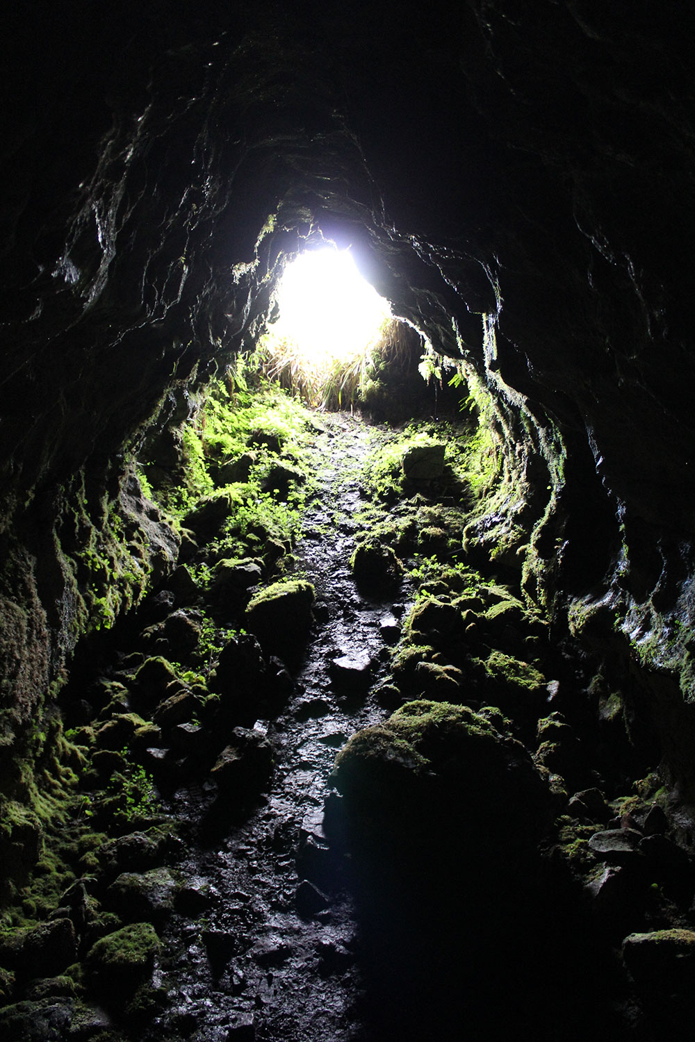
The twenty-seven caves in the north side of the summit would have been a major attraction, as would the magical valley, the Glen of Knocknarea on the south side of the hill. Large shell middens are found at Culleenamore, close to the Glen, on the shore under the west cliffs of Knocknarea. These shell mounds are thought to date from the Bronze age to the Medieval period.
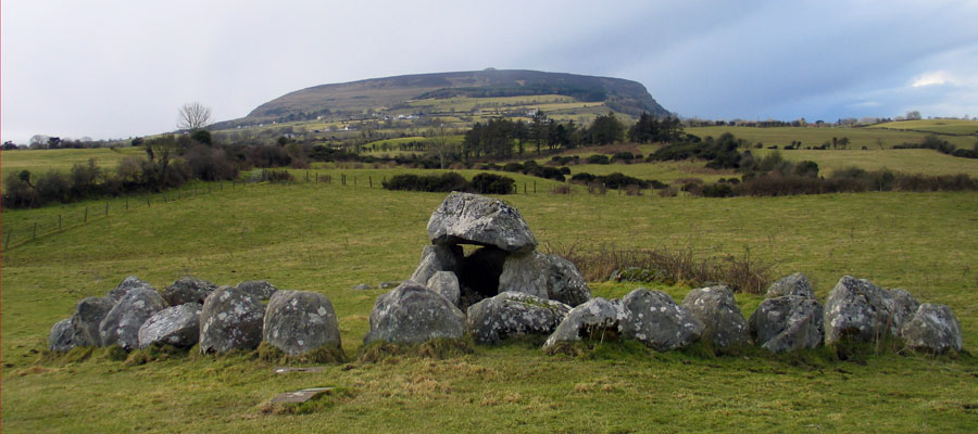
The flattish summit of the mountain is capped by the massive Queen Maeve's Cairn, which is one of the best known neolithic monument in Ireland along with the Poulnabrone dolmen in County Clare and Newgrange in County Meath. The stunning location of the huge cairn irresistably draws the eye to the summit of the mountain.
The ancient stone cairn looms over Sligo town like a flying-saucer frozen in motion. By placing the cairn where they did the neolithic farmers transformed the whole mountain into a monument. On days when the clouds dip down to touch the summit, the cairn disappears and the mountain looks much less spectacular.
Knocknarea is surrounded by geological fault-lines running through the limestone bedrock. In fact, the mountain has three major faults around it which form a rough equilateral triangle. The southern fault or base of the triangle is formed by the beautiful Glen of Knocknarea, a spectacular tree-filled fissure in the side of the mountain. An ancient track leads up from the Glen and around the west cliffs of the mountain, over Culleenamore, and up to Queen Maeve's cairn.
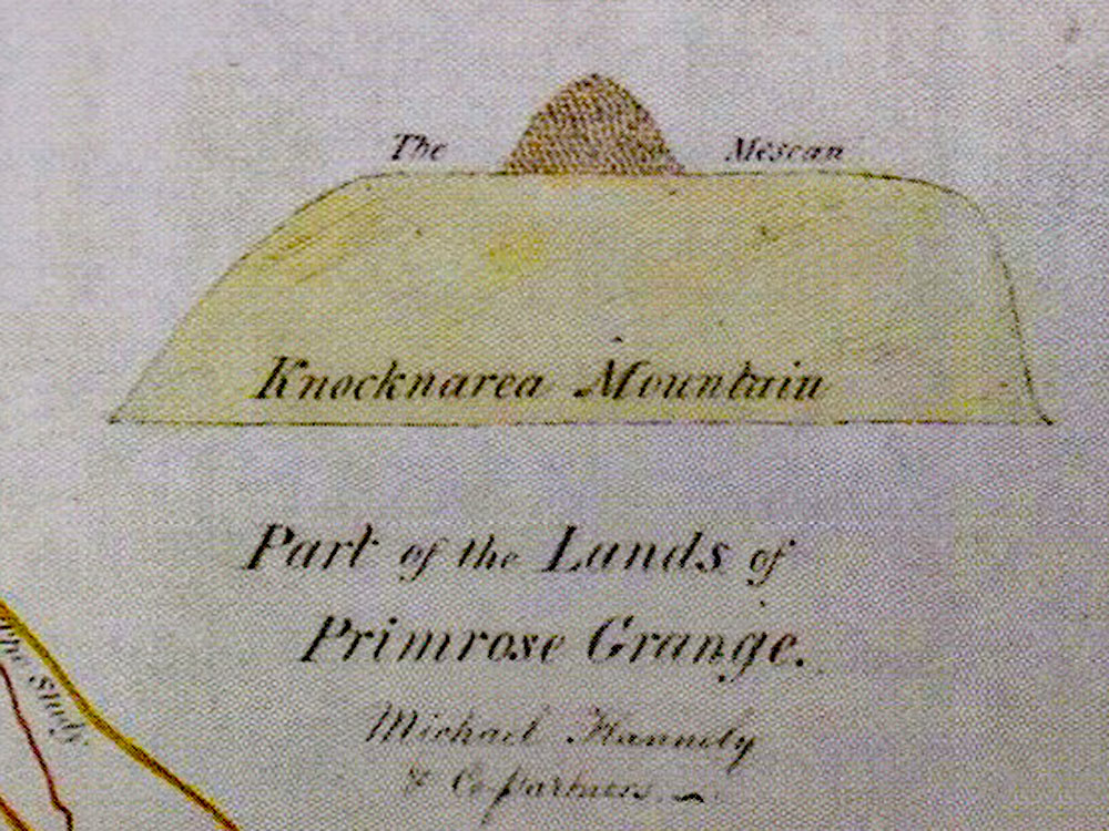
Another fascinating monument, the court-cairn at Primrose Grange close to the Glen, was excavated by Burenhult. Recent genetic research indicates a relationship between people buried in Primrose Grange and a man buried in Listoghil, the focal monument at Carrowmore.
The massive neolithic passage-grave known as Queen Maeve's cairn has never been excavated and was lucky to escape violation, when several of its satellite monuments and many of the sites at Carrowmore were investigated by Roger Walker, a local landlord who was a keen antiquarian and collector of artifacts. Walker had plans to open the great cairn in 1837 and again in 1844, but died without putting them into effect.