Like the other passage tomb clusters in Ireland, the Carrowkeel complex has a distinctive atmosphere and environmental setting. The landscape which the monuments appear to celebrate is not only unique in Ireland for its geology, but for the outstanding drama of its cliffs and glacial valleys. The complex is distinguished by its degree of preservation, which is remarkable in a European context. Significantly, no modern reconstruction work has been carried out there, as occurred at other megalithic complexes such as Locmariaquer in Brittany, or in the Boyne Valley.
A century of archaeology— historical excavation and modern research at the Carrowkeel passage tombs, County Sligo.
Carrowkeel, the most beautiful and mysterious collection of the Irish megalithic monuments, is part of an extensive landscape settled by early neolithic cattle-farmers from Brittany. At Carrowkeel, a remarkable series passage-graves were constructed in stages beginning around 3,500 BC, across the highest summits and ledges of the Bricklieve Mountains in County Sligo. The monuments, which served as the final resting places of specific people within the neolithic community, would also have functioned as territorial markers for an expanding colonisation of the region.
The main group of cairns at Carrowkeel. Cairn G with it's roofbox is to the foreground with Cairn H and Cairn K beyond.
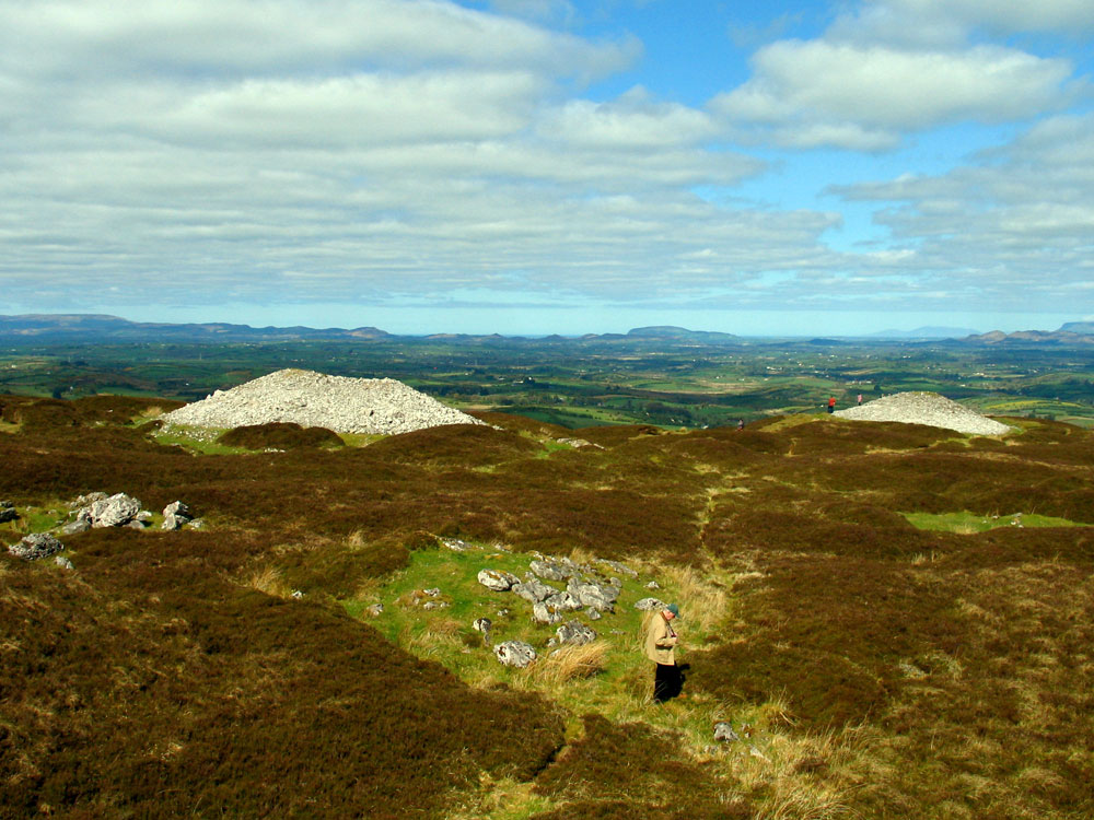
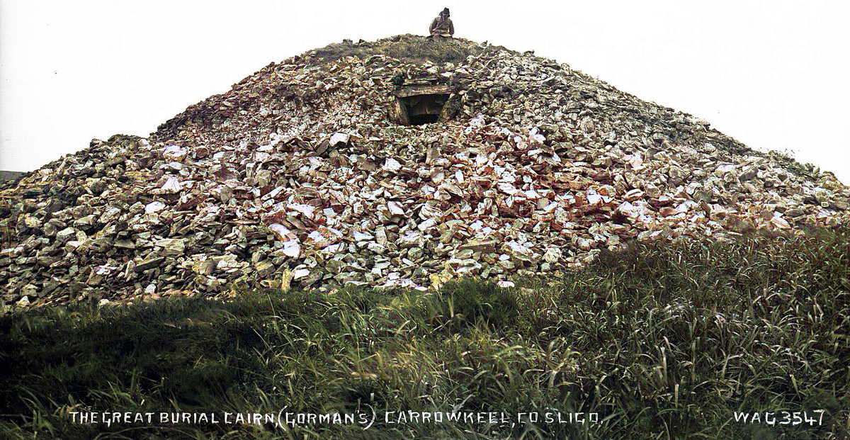
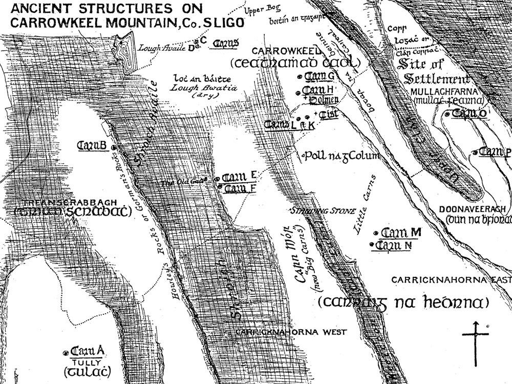
The cairns are situated on the limestone ridges high above the western shores of Lough Arrow, close to the village of Castlebaldwin. There are fourteen neolithic passage-graves in the townland of Carrowkeel, and several more monuments are found on the summits to the west. The highest monument is Kesh Cairn, known locally as the Pinnacle or Fionn MacCumhal's Chair, on the north end of the long flat summit of Kesh Mountain to the west. The largest of all the monuments is Heapstown cairn, located on the nortern shore of Lough Arrow on the banks of the River Uinshin.
The Carrowkeel cairns, the Bricklieve Mountains and Lough Arrow.
Neolithic Colonists.
This region around Lough Arrow became home to a large colony of early neolithic cattle-farmers who arrived from Brittany and settled on the north-west coast of Ireland in the years before 4,000 BC. The oldest neolithic monument in the region is the causewayed enclosure at Magheraboy, which can be dated to 4,150 BC. The oldest domestic cattle remains discovered in Ireland, which were found at Ferriter's Cove in County Kerry, dating to 4,350 BC, may well be from an early unsuccessful neolithic attempt to settle Sligo.
Close to Magheraboy is the massive early neolithic complex at Carrowmore, where a a huge ring of early passage-graves surrounds the focal monument at Listoghil. The Carrowmore and Carrowkeel landscapes are joined by the umbilical connection of the Uinshin river, which flows from Lough Arrow, past the enormous Heapstown cairn and on to Ballisodare Bay to the north-west.
The name "Bricklieve" translates as Breac Sliabh, Speckled
Mountain; the word Speckled can mean many things in old Irish including a magical portal or doorway. There are two other famous Speckled sites in County Sligo: the holed standing-stone at Tobernaveen near Carrowmore and the infamous Cursing Stones on the island of Inishmurray.
Doonaveeragh Mountain at Carrowkeel.
The Cairns
The Carrowkeel cairns are built in commanding positions at altitudes
between 240 and 360 meters above sea level on north-facing bog-covered limestone terraces. The monuments are neolithic passage-graves, with the chambers constructed from well-trimmed slabs of limestone. Cairns of locally-quarried limestone were used to cover the chambers, and occasionly chunks of erratic sandstone were used at stress-bearing points, for example in Cairn F. Several of the monuments showed evidence of white quartz, both internally in broken fragments and externally in chunks, but this has sadly long since been stolen by modern treasure-hunters.
The summit of Carrowkeel, Co Sligo. The view is towards Knocknarea in the northwest, 20 km away with the massive Queen Maeve's Cairn,
on it's summit.
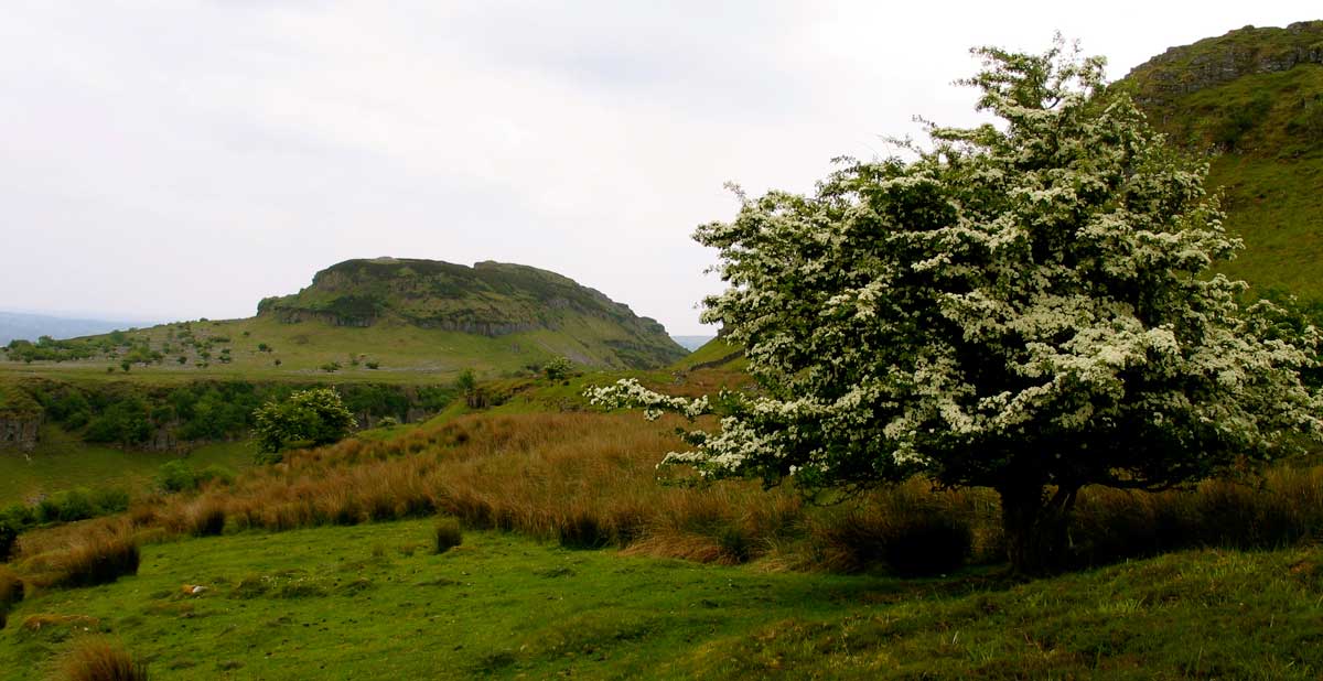
Twenty-one neolithic cairns are spread across from Doonaveragh Mountain
alongside Lough Arrow in the east, to the cairn known as The Pinnacle on the summit of Kesh Corann in the west. The limestone cairns are are visible from many miles around as small bumps on the ridges of the Mountains, particularly from other monuments around County Sligo. The main focus of the Carrowkeel monuments is directed to Knocknarea Mountain, 23 kilometers to the north-west.
If you are planning to visit Carrowkeel please treat these monuments with respect: do not climb on, or in any way damage the cairns. The internal chambers are fragile after standing for over five thousand years, and many have cracked supporting lintols.
Ancient Astronomy: the Carrowkeel Roofbox
In 1997 the present writer identified an early version of a neolithic "roof-box", a slot or opening like a letter-box, above the entrance to Cairn G. The only other example of a neolithic roof-box is the famous example excavated and re-constructed by Professor Michael J. O'Kelly during his contraversial reconstructions at Newgrange in the 1960's.
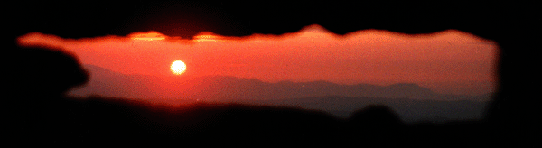
Sunset through the roofbox. This picture was taken about two weeks before midsummer in 1997. The hill of Doomore, the misdummer solstice marker, is to the right.
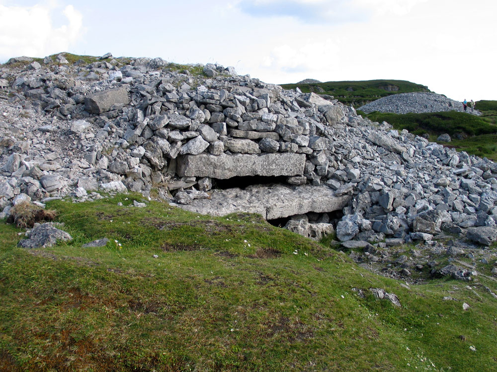
Cairn G is one of the better-preserved chambers, with a classic cruciform shape, a short passage and an original blocking stone. There are sill-stones seperating the passage and the three recesses from the central area. From the back of the chamber a strip of the horizon is framed by the opening above the doorway. Since the late 1990's observations of successive midsummer sunsets progressing along the Ox Mountains and illuminated the interior of the monument have been photographed by many visitors. The misdummer sunset drops behind the neolithic cairn at Doomore.
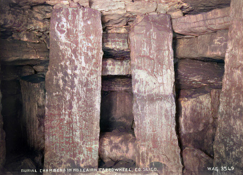
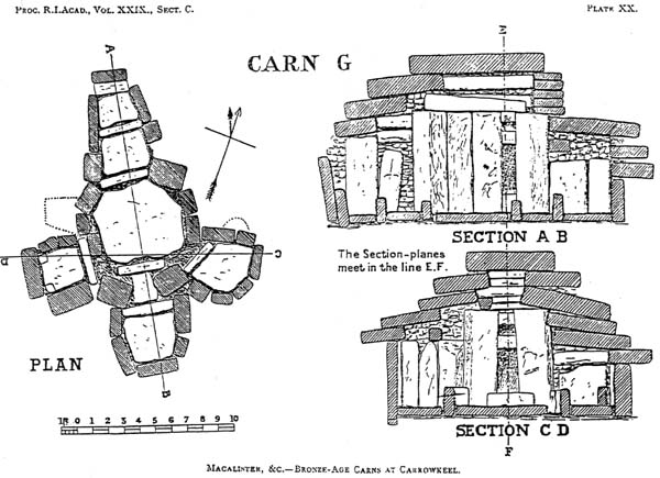
Plan, elevation and section of Cairn G from the 1911 excavation.
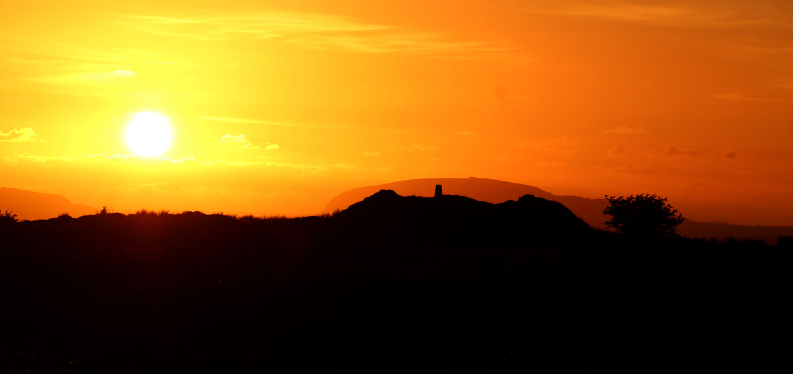
There are other notable connections to the sunsets at midsummer in the area. Photographer Leo Regan discovered that sunsets at midsummer observed from Cairn A appear to roll down the side of Kesh Corran Mountain before dropping into the gully at Carnanweelan. Midsummer sunsets viewed from the ruined neolithic cairn called Shee Lugh at the highest part of Moytura drop behind Knocknarea Mountain in a most spectacular fashion, in keeping with the mythological associations of the location in the Second Battle of Moytura.
Misdummer sunset dropping behind Knocknarea Mountain viewed from the neolithic cairn called Shee Lugh, the Seat of the Sun God in the mythological Second Battle of Moytura.
Excavations in 1911.
The carns were examined by R. L. Praeger in 1896, while he was engaged on botanical survey work; and as several of them appeared to be intact, and as the group promised to repay well the labour of opening them, the present investigation has after some years been undertaken.
The Carrowkeel cairns excaped notice and remained intact until the summer and autumn of 1911, when seven of the monuments were excavated in a rushed and unsympathetic manner by a team led by R. A. S. Macalister. The team included Professor Alexander Macalister, an osteologist and father of R. A. S. Macalister, E. C. R. Armstrong from the National Museum in Dublin, and botanist Robert L. Praegar.
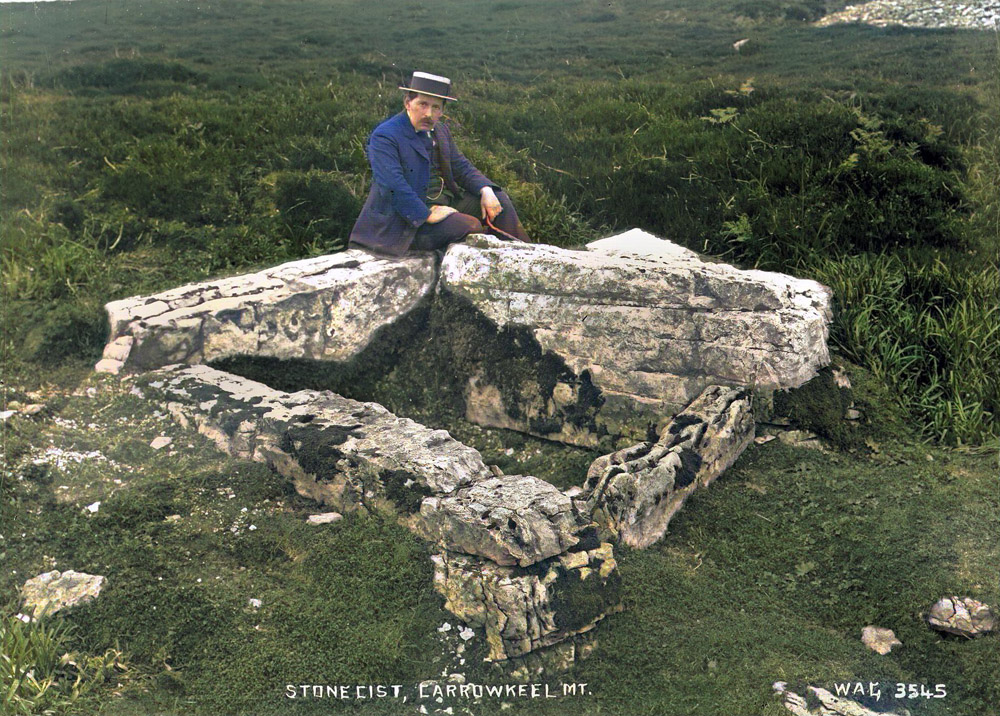
The team, along with some local men for labourers, opened seven monuments during three visits which lasted twelve days in total. Belfast photographer William A. Green accompanied the group on the second visit and took a valuable series of twenty-one photographs of the newly opened monuments, such as the image of Robert L. Praegar sitting on the cist close to Cairn K, above.
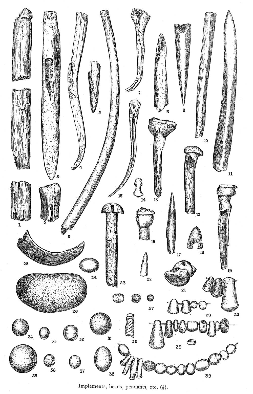
The remains of approximately thirty-two people were identified, in a mixture of unburnt and cremated bones, and a selection of artifacts including bone and antler pins, stone beads and pendants, and pottery were found mixed with the bones.
Artifacts from Macalister's excavations at Carrowkeel in 1911.
A kind of neolithic pottery associated with Irish passage-graves was first discovered in Carrowkeel in 1911 and has since become known as Carrowkeel Ware. It is a kind of coarse pottery decorated with a distcintive stab-and-drag pattern, and shards often show evidence of burning, suggesting they were placed on the funeral pyres.
Once for all we may here state that although we searched for sculptured ornament, such as is to be seen at Brugh na Boinne, with the most scrupulous care, not a single decorated stone came to light anywhere, either outside or inside the carns.
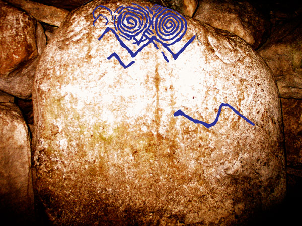
The first piece of engraved art to be found in Carrowkeel was discovered in 2009 by Robert Hensey, who noticed two faint spirals carved in the chamber of Cairn B. An account of the discovery titled Once Upon a Time in the West was published in 2012. These discoveries of megalithic art connect the sites at Lough Arrow and Carrowmore to Loughcrew and the Boyne Valley. As Robert Hensey puts it:
As a result of these new finds there is now megalithic art known from all four major passage tomb complexes. While there seems to be a tradition of making megalithic art at passage tombs in County Sligo, it would be wrong to expect large undiscovered quantities of art in the north-west. The authors carried out a two-week search as part of the Carrowkeel Passage Tomb Art Project at many other passage tombs in the Carrowkeel-Keashcorran complex and a number of other passage tombs in the region, and the second stone in cairn B was the only additional art found.
It is likely, however, that more art will be discovered in the west in time. The possible use of pigments to make colored motifs and designs might also explain the smaller quantities of carved art on passage tombs in the west. Evidence of the use of colour has recently been discovered on the parietal walls at Barnenez and Gavrinis passage tombs in Brittany, France, and at the Neolithic Ness of Brodgar site in the Orkney Islands. It may be that similar evidence will one day be found on the walls of passage tombs in Carrowkeel and on Neolithic monuments elsewhere in Ireland. But that, as they say, is another story.
Conclusion from Once Upon a Time in the West.
Neolithic art discovered in 2009 within Cairn B at Carrowkeel in County Sligo.
Ancient D. N. A. at Carrowkeel
The human remains were packed into boxes at Carrowkeel in 1911 and shipped to Cambridge University, where they were examined and analysed by Professor Alexander Macalister, who contributed his findings to the excavation report published in 1912. The human remains were placed into storage in the Duckworth Labroratory where they remained in obscurity until 2003 when archaeologist Alison Sheridan discovered them and recognised their significance.
The remains were the subject of an aDNA research project in 2017 which resulted in six complete human genomes from the Carrowkeel people.
This project was carried out by a team led by Doctors Thomas Kador and Lara Cassidy, in a multidisciplinary project that combined archaeology, osteoarchaeological examination of human remains and DNA analysis to gain new insights into Neolithic Ireland.
The remains were carbon dated, and a number of bones showed evidence of cut-marks, indicating that the bodies were dis-articulated after death. The published report is titled, Rites of Passage: Mortuary Practice, Population Dynamics,and Chronology at the Carrowkeel Passage Tomb Complex, Co. Sligo, Ireland.
More recent work by Lara Cassidy has demonstrated links between people buried in Carrowmore, Millin Bay, Newgrange, and both in the neolithic and the Bronze Age, Carrowkeel.
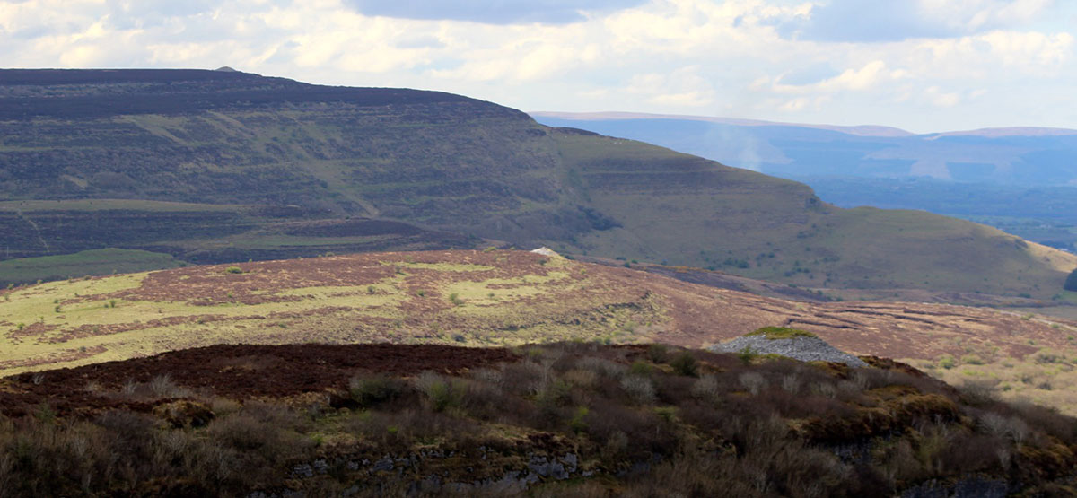
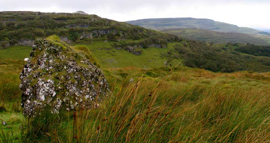
The landscape to the west of Carrowkeel.
The Neolithic Landscape
The Bricklieve Mountains are a series of parallel limestone ridges running
from north-west to south-east. This remarkable landscape was sculpted
by the retreating ice sheet of the most recent ice age, as they receeded to the
north-west towards Knocknarea and the sea.
Seen in aerial photographs and on maps,
the shape of the Bricklieve mountains is like a gigantic right-hand, palm-down,
with the four massive plateaus for fingers, and the steep, cliff-edged valleys in between.
Tully Mountain over to the west forms a thumb, then Treanscrabbagh, Carn Mor, Carrowkeel and Doonaveeragh ridges make up the four fingers fingers.
Over to the west, the landscape is equally spectacular with grass-covered cairn-topped
hills, steep valleys and Kesh Corann looming like a great sleeping beast in the distance. A local landscape myth tell how Kesh Mountain was formed from the body of the gaint sow, Cailceis, and that the smaller hills, Treanmor, Sheecor, Threen, Treanmacmurtagh and Carnanaweeleen on the east side are her piglets. The Bricklieve mountains area has many other types of monuments and settlements scattered about: ringforts, barrows, early churches, castles, and there are numerous caves in the area.
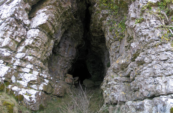
Enchanted Caves
During the neolithic caves were percieved as doorways or entrances to the Underworld, the World of the Dead. Many legends tend to gather at these liminal locations, and in Sligo caves are usually associated with the Cailleach, an Otherworldly figure of great power. In the Sligo area she is known as the Garavogue, and has her abode in the neolithic monument on the Ballygawley Mountains named after her. Three men who entered the School Cave in Carnanweeleen met her within Kesh Corran:
It is said that three men entered the cave They tied a long rope at the outside and carrying with them a lighted candle they entered the cave. The travelled on and on until they came to a lake where a little red woman was washing clothes. The candle was worn before they reached the lake so that they had nothing only the rope to guide them back.
National Schools Folklore Collection.
Seven caves are located near the Carrowkeel cairns, including the large swallow-hole called Poul na Gollum. The majority, a series twenty-one caves in total are found in the west side of Kesh Corran. Two unusual examples, the School Cave and the Thief's Hole are known on Carnanweelan, the spur on the north-east side of Kesh Mountain. The Thief's Hole is a swallow-hole within a few meters of the megalithic chamber on the top of the spur.
One of nineteen caves in the side of the mountain at Keash Corran to the west of Carrowkeel.
Three-hundred and twenty million years ago, all of this region was under tropical ocean, and so today many examples of fossilized sea-life can be found in the ancient rocks at Carrowkeel. During the Bronze age, probably about 2,000 BC when the cairns were already ancient, a thick layer of bog began to grow across the Bricklieve Mountain. Today the peat can be up to five meters deep in places, creeping up to cover the limestone karst like a thick, wet sponge, and giving the mountains a wild and rugged appearance. Great care is needed on Carrowkeel Mountain, as there are many hidden swallow-holes, grykes and gullies to twist the unwary ankle.
Many centuries after the cairns were built the Irish climate became much cooler and damper—much like the weather of today—and at that time the peat began to form and bogs grew across the Mountains. Stefan Bergh's excavations on the Mullaghafarna hhut-sites proved that during Carrowkeel's initial neolithic period the limestone hills were covered in grass. After the Bronze age climate change, the limestone rocks in the Bricklieve Mountains weathered and eroded massively, leaving a naked karst similar to the Burren in Co. Clare. It is hard for us today to imagine how different the landscape would have appeared to the neolithic farmers of 6,000 years ago.
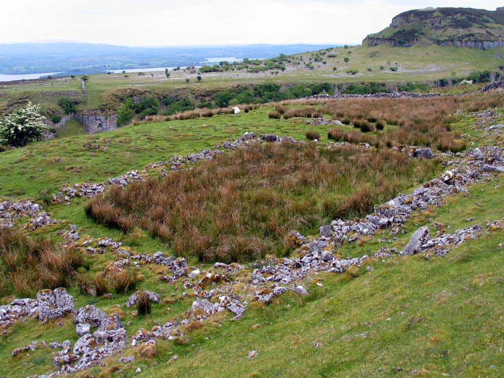
A medieval enclosure on the east side of Carrowkeel Mountain overlooks the neolithic settlement on the flat plateau of Doonaveeragh Mountain.
The Carrowkeel complex remained in use in the Bronze age,
and pottery from that period found of the chambers. In the late medieval
period, the native forces Red Hugh O'Donnell used Doonaveeragh plateau as a camp for
their army during the Nine Years War (1592 - 1601). There are many old empty
cottages around Carrowkeel, some of which were inhabited until the 1960's.
There is a fine example of a mountain cottage below Carrowkeel and across
from Doonaveeragh, where good examples of potato 'lazy beds' can still
be seen.
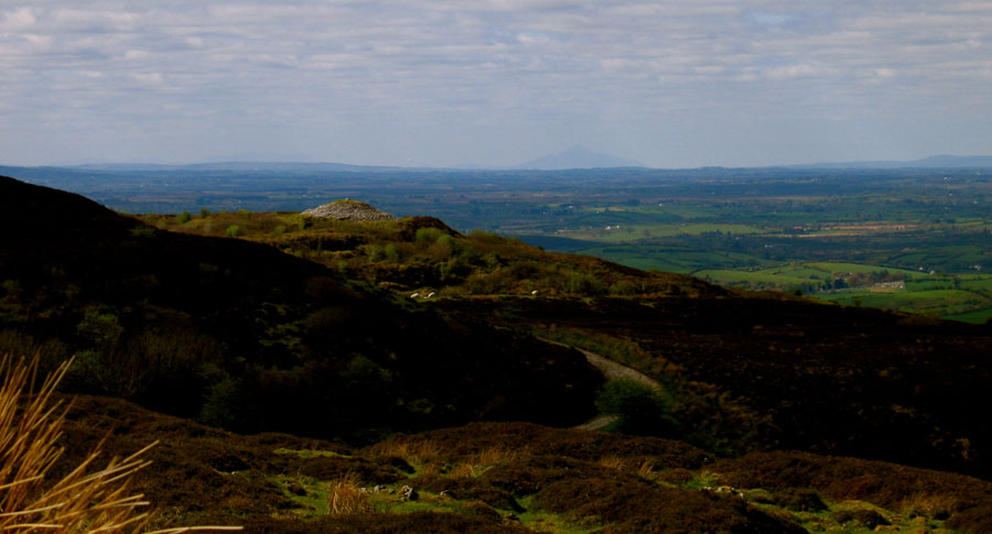
The view from Carrowkeel to the west. Croagh Patrick is visible 75 kilometers away on the horizon. At the Samhain and Imbolc quarter days the sun drops behind the Reek when viewed from the summit of Carrowkeel. A stone within the chamber of Cairn K marks the alignment.