Banner: Knocknarea at Sunset.
The Catstone
The All na Mireen—a huge fractured erratic chunk of limestone—is said to be the point where the Four Provinces of Ireland meet.

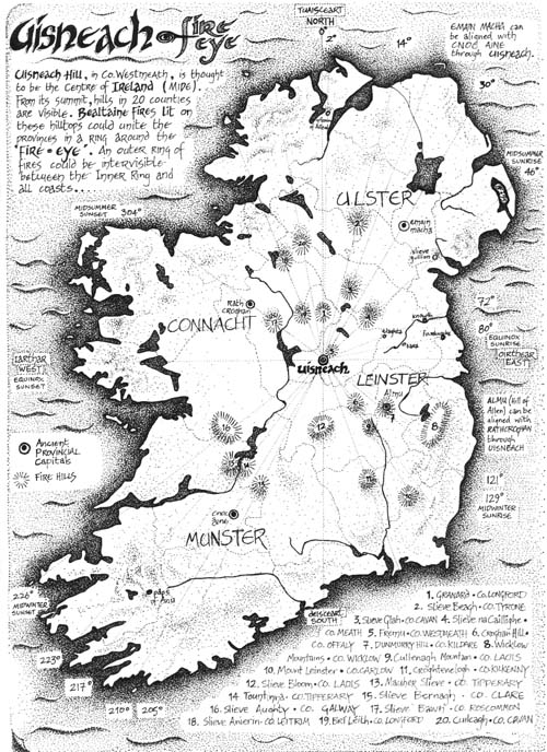
The Hill of Uisneach, the Centre of Ireland.

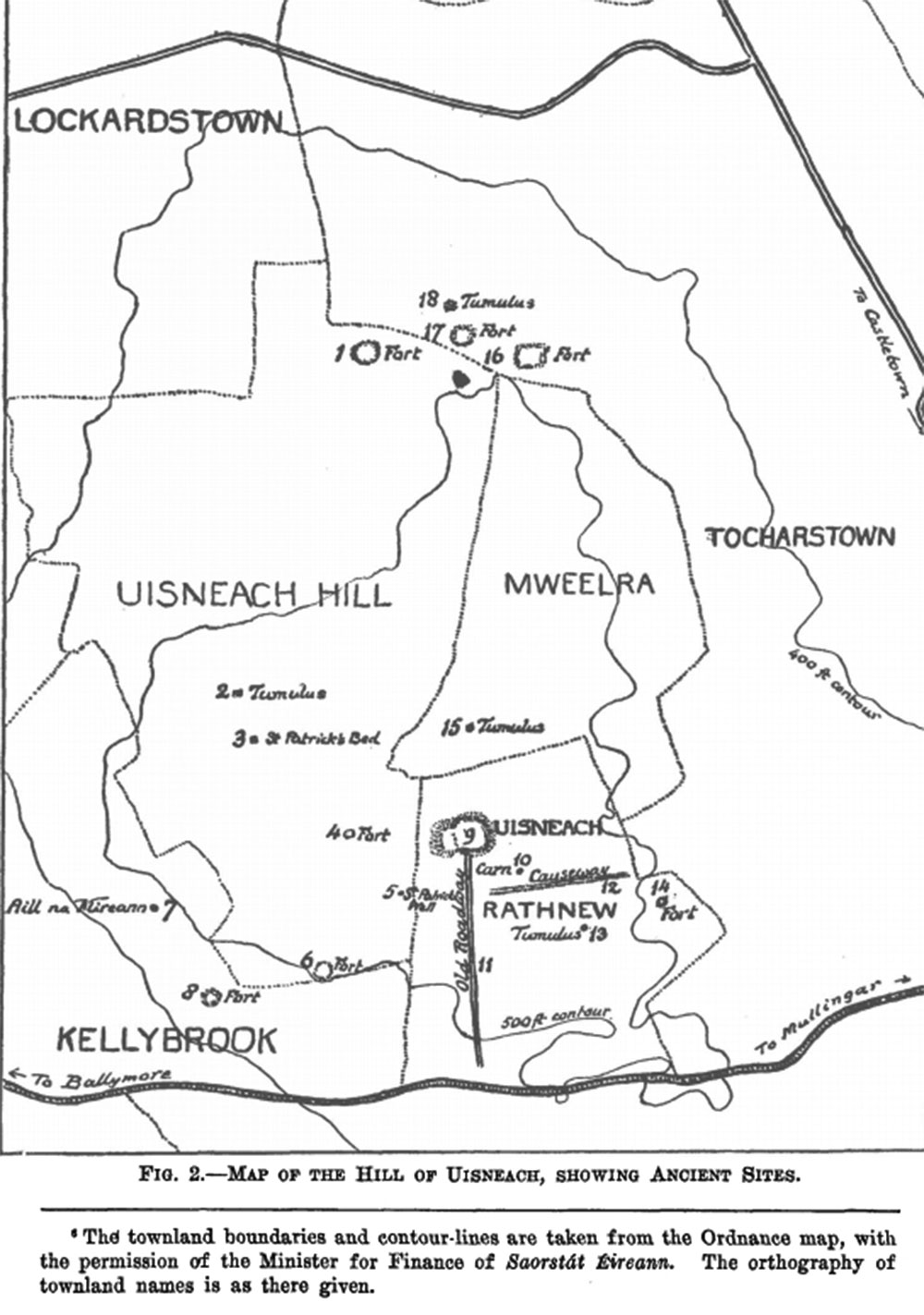
The Hill of Uisneach is the ancient centre of Ireland, located between Mullingar and Athlone in County West Meath. It has important links with the capital at Tara and the Beltaine bonfire ceremonies. There are at least twenty ancient monuments around the hill, the oldest of which may be a passage grave on the highest point, destroyed by sappers during the Ordinance Survey in the 1830's.

The Catstone in 1936.

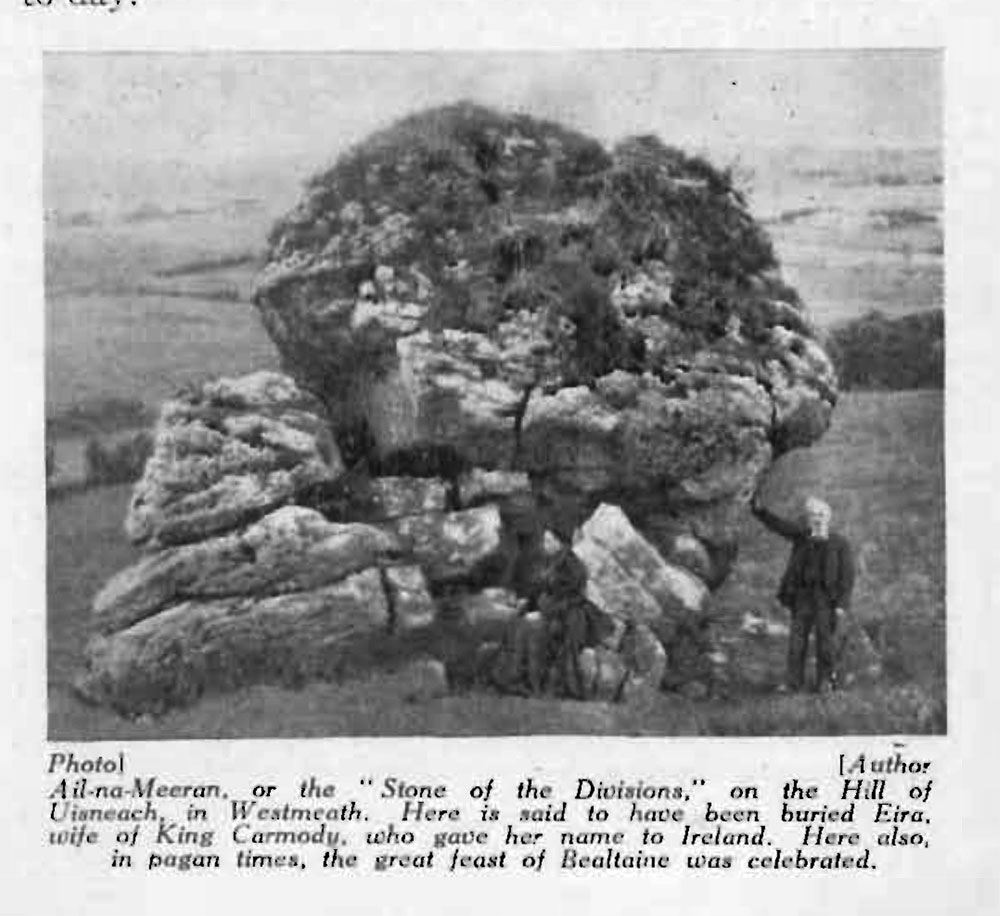
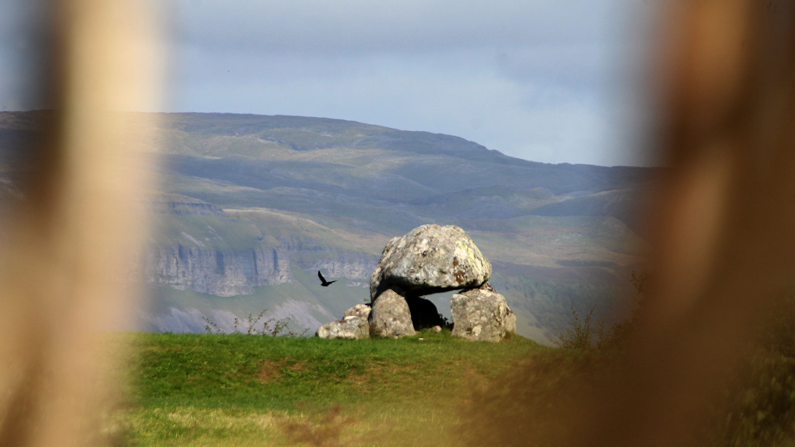
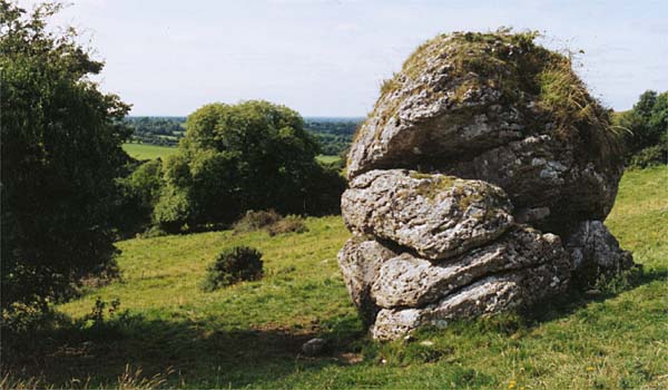
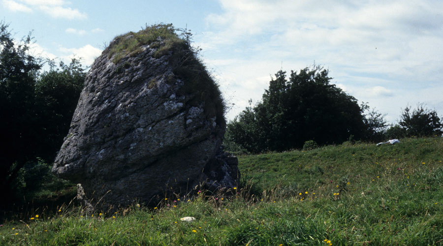
There is a large stone set up on the side of the Hill of Uisneach, which is known, according to tradition as The Stone of Divisions, Aill na Mireann in Irish. The more common name for this large craggy lump of limestone is The Catstone, as some have seen a squatting cat in its form. The Catstone is said to be placed exactly at the centre of Ireland, and the division and boundry lines of the four provinces are said to meet here at the stone.

Map of the monuments by Macalister in 1926.

John O'Donovan, visiting the Uisneach in 1837 during heavy rain, commented on the Catstone, saying that it:

is well worthy of the attention of antiquarians. It is at least twenty feet high and sixty feet in circumference at the base. It is unquestionably a natural rock, for no human power, either now or in the time of the giants, could have moved it; but art has been used in remodelling it. Four large blocks have been seperated from its south-west face, and erected into a splendid cromlech. Some might suppose that these pieces naturally fell from the side of this rock and placed themselves by chance in this position of a cromlech, but to my mind their position presents all the appearance of design. One can plainly see the places in the side of the rock from which the blocks fell by the operations of nature or were taken by human art, and can see how they might be replaced again as might pieces cut out of a round cheese or an apple; but it would puzzle one to account for the manner in which such massy pieces were detached in such apparently intended shapes.
Curragh frame
The Morrigan and the Phantom Stones at Carrowmore in County Sligo.

The Stone of Divisions

Michael Dames has explored the tradition at some length in his book, Mythical Ireland. Dames believes the Hill of Uisneach was the center of the Beltaine bonfire cult, and that a central fire on the hill would have been visible from a ring of satellite hills, all of which would be visible form another outer ring. This would imply that, as the old customs say, all the fires in Ireland were extinguished on May eve, and were re-lit from the central Uisneach fire on May Day.

Map by Brendan Farren, 1995, based on 'Mythical Ireland' by Michael Dames.

Michael Dames book points to other interesting questions, like the ancient four part division of the country. The four provinces, Connaught, Munster, Leinster and Ulster (not the modern political boundaries) all met at the Catstone which was at the center of the central fifth province, Meath of Midhe in Irish. The word 'province', in Irish literally means 'a fifth'.

The Stone of Divisions.

Further, he points out that the ancient capitals - Emhain Macha in Ulster, Alhmu in Leinster, Cnoc Aine in Munster and Rath Croghaun in Connaught - appear to be laid out and spaced in relation to the Hill of Uisneach. A line passing from Rath Croghaun to Uisneach ends up at the Hill of Allen (Almhu). Similarly, a line drawn from Emhain Macha passing through Uisneach arrives at Lough Gur and the Hill of Aine, which is thought to be the Munster capital.

A
  ruinous wedge monument beside the Drumcliff river in Co Sligo.
A ruinous wedge monument beside the Drumcliff river in Co Sligo.