Knocknashee, the Hill of the Fairies, is a beautiful table-top mountain in south west Sligo, which rises suddenly
from the drumlin plain to dominate the surrounding countryside. The distcintive profile of The Hill of the Fairies will be a familiar sight to anyone who passes up and down the N17 between Tubbercurry
and Collooney. The road twists between Knocknashee and Muckelty Hill, another neolithic site with a hilltop enclosure and cairn. The area around Knocknashee is thickly dotted with ringforts and prehistoric mounds and there are several ruined megalithic chambers in the area, all with commanding views to the mountain.
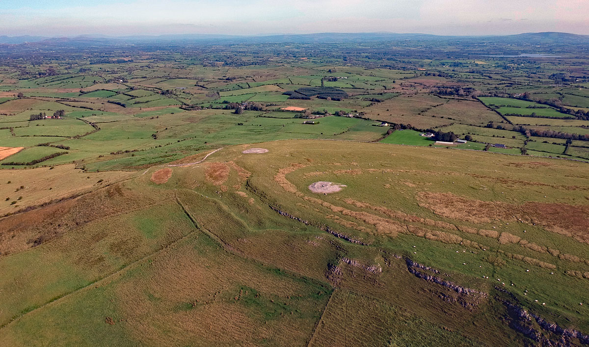
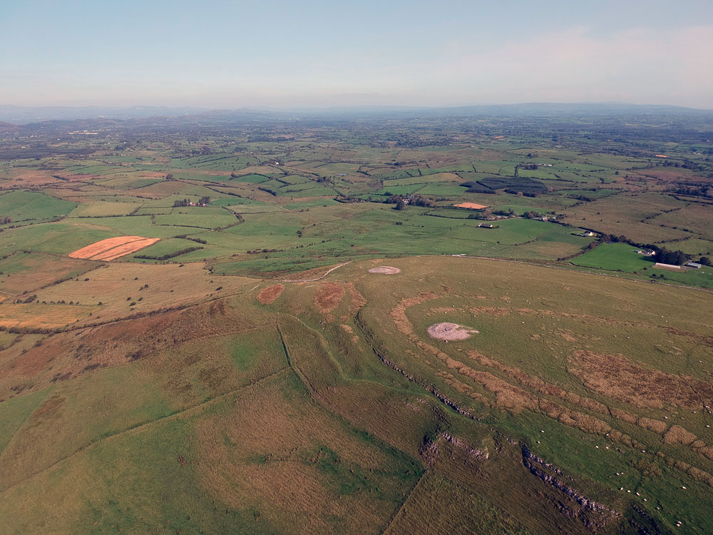
Two large neolithic passage-graves are located within a huge enclosure which encompasses the
flat summit of the mountain of Knocknashee. Both cairns are composed of quarried limestone, and are about twenty meters in diameter and perhaps some four meters high. The north cairn has not been opened in modern times.
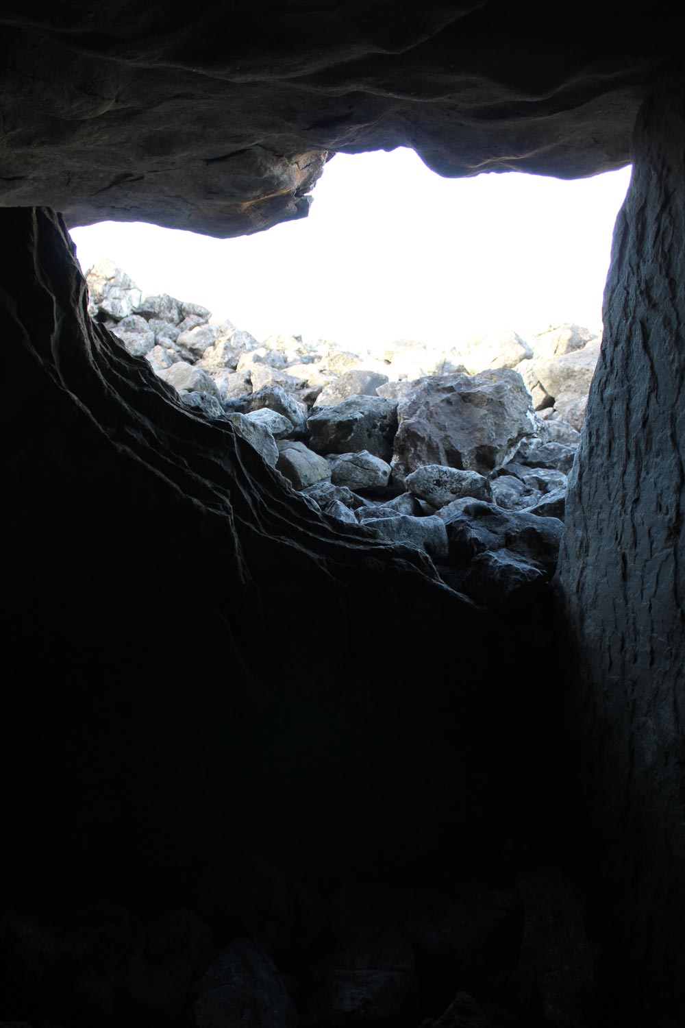
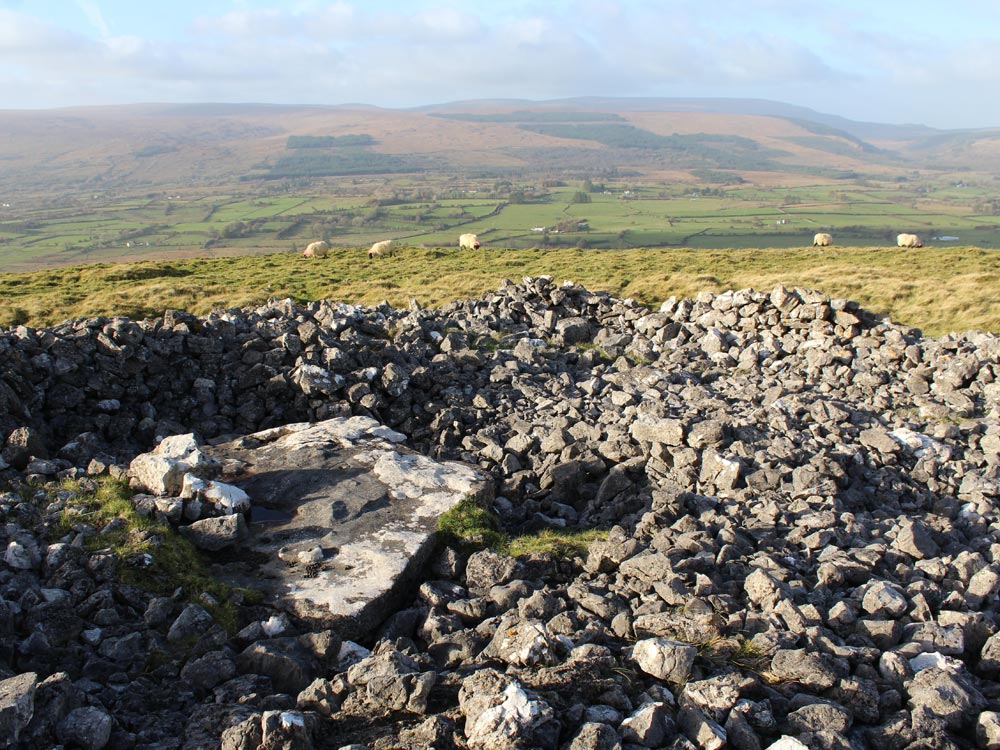
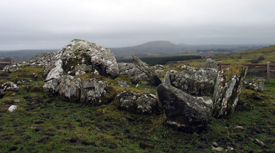
The south cairn has a chamber composed of large limestone slabs, which must have been opened in historical
times; the entry slab was broken to get into the chamber, as you can see from the image below.
The megalithic chamber on Knocknashee.
This open chamber resembles the large megalithic structure at Listoghil in Carrowmore, and also the monument just east of Cairn K at Carrowkeel. These may be the oldest form of passage-grave, with a platform or tertre, like those found at Carrowmore, with a large stone chamber, which was probably free-standing during its early phase. Recent research on continental megaliths suggests that the cairn coverings usually come later, during a second or third phase of elaborating the monument.
There are some scratchings on the west slab forming the chamber wall. They do not resemble megalithic art, but do have parallels at Knowth from the early Christian era. The floor of the chamber is flagged with one huge flat slab.
The south cairn had a concrete Ordinance Survey pillar for many years, which rather bizarrely was placed on the roof of the chamber, 300 meters above sea level. The marker was tumbled and removed from the cairn at some time in recent years, and the monument looks much better for it.
Close to the north end of flat-topped Knocknashee Mountain, commanding an extensive outlook and within a hillfort (SL032-013001). This is a circular, flat-topped cairn (diameter 28 meters; height c. 2.5 meters) at or about the centre of which a roofed chamber (Length 1.7 meters north - south; Width 1.15 meters east - west; Height 1.1 meters) is exposed. Single stones form the sides and ends of the chamber, a single slab serves as a floorstone and a single large slab roofs the structure. A piece has been broken from the top of the north end-stone and the resultant gap now permits access to the chamber.
A rough wall has been built along the eastern side of the flat top of the cairn. This possible passage tomb lies at the north limit of the possible Neolithic settlement (SL032-013004). Another possible passage tomb (SL032-013003) lies c. 120 meters to north-east.
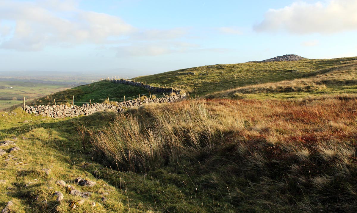
The neolithic north cairn on Knocknashee, with the ditch of the Bronze age hill-fort to the left.
Hut sites
There are about thirty circular structures thought to be the foundations of huts similar
to those found by Swedish researchers on Knocknarea, which is intervisible with Knocknashee.
They also resemble the large collection of huts at Doonaveeragh in Carrowkeel, some of which were dated to the Bronze age, and the huts on Turlough Mountain in the Burren. The diameters
of the examples on Knocknashee range from seven to ten meters, and several have doorways.
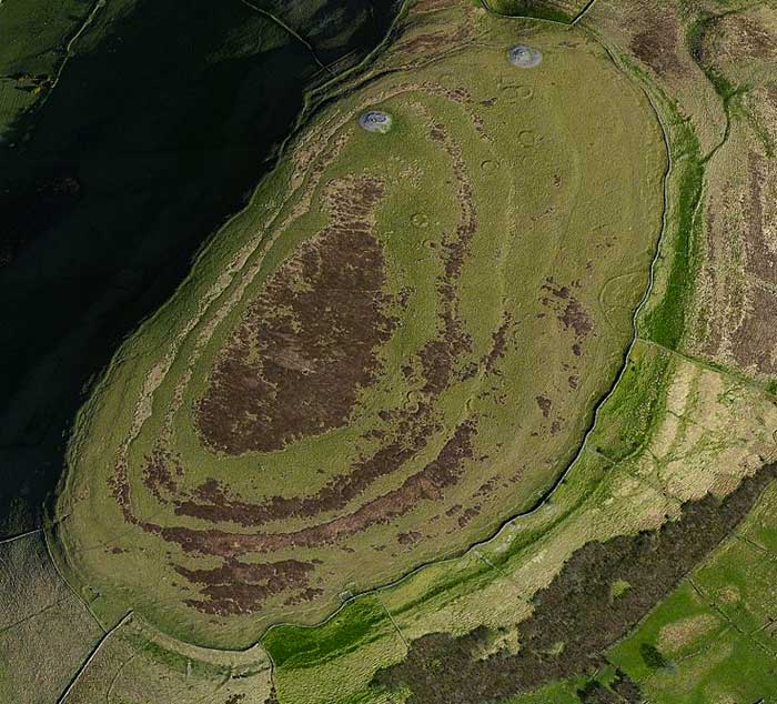
An aerial image of Knocknashee from Bing Maps, clearly showing neolithic cairns, hut circles and the massive upper bank of the hill-fort.
The hut foundations tend to cluster around the two cairns, as illustrated in the image above. The Knocknashee hut circles were investigated during very wet conditions over the summer of 2017; for more information about the excavations see their Facebook page.
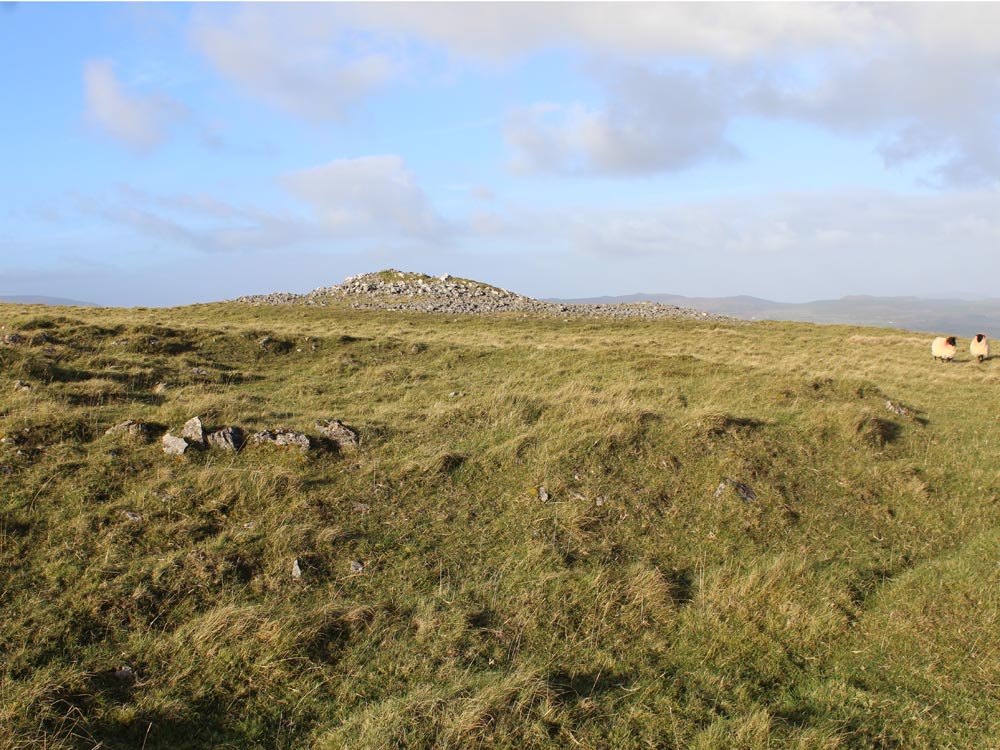
An example of the hut foundations on Knocknashee, with the north cairn in the distance.
National Monuments Service
On the plateau-like top of Knocknashee Hill and widely distributed over the grass and heather-covered terraces in the east half of a hillfort (SL032-013001). A complex of c. 30 huts in clusters of two, three and occasionally more, separated by distances of 2-15 meters; one instance of two conjoined huts was noted. The huts are often in north - south rows following the contours of the natural terracing. Although the degree of preservation of the huts varies, they are remarkably uniform in size and form.
A typical hut consists of a flat circular area (diameters 8-11 meters) defined by a stony wall (Width 1.6 meters; Height 0.3-0.5 meters). Most are entirely sod-covered but where the enclosing wall is exposed it appears to be composed of a jumble of angular limestone rubble. A number of the huts are surrounded by a fosse (Width 1.5-2 meters; Depth 0.3-0.5 meters) immediately outside the enclosing wall. However, in most cases, instead of a continuous fosse there are two or three discrete depressions outside the wall.
A clearly defined entrance gap is not always evident but where entrances were identified they usually occurred in the south-east quadrant. Condit, Gibbons and Timoney (1991, 61) noted that further evidence for individual settlement sites might be provided by the presence of scoops and hollows situated at the south and south-west within the hillfort. The complex is clearly visible in aerial photographs taken in 1968.
The view to the Ox Mountains to the north. The summit of Knocknashee is 300 meters above sea level and has amazing views of the surrounding landscape.
Knocknashee Hillfort
Knocknashee is also in fact, one of Ireland's largest and most impressive Bronze Age hill-forts, having
three huge ditches running around the hill, one at the top, middle and
bottom. Building neolithic chambered cairns on hill-tops within stone
enclosures in the west of Ireland seems to have been at least as common
as building monuments within enclosures in the Boyne Valley There is also a ring of splintered limestone chips running in a ring around one of the cairns, a feature also found at Carns
Hill west, Listoghil, Queen Maeve's
cairn and Knocknarea north.
There is another large cairn, quite possibly a passage-grave, within an enclosure on the summit of Muckelty Hill just a few kilometers south east of Knocknashee. For more about fairies and sites around Sligo click Here.
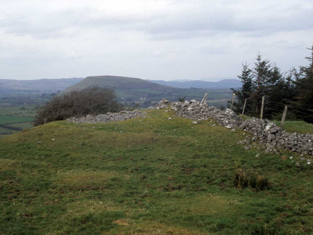
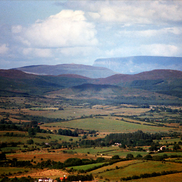
Looking due south to Knocknashee and Muckelty from the wedge at Cabragh on the slopes of the Ox Mountains above Coolaney.