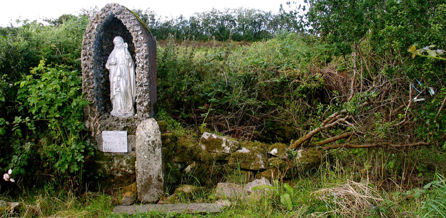
Saint Brigit's well at Cliffoney in County Sligo. This may have been an ancient church or hermitage, the well, one of five, is within a ruined ringfort. A cattle fair was held here 200 years ago The cross slab is an unusual engraving with a clockwise swastika in the top of the cross.
Cliffoney, County Sligo
Cliffoney is a small village in the north of Sligo, within the ancient kingdom of Carbury, close to the headland at Mullaghmore on the west and the fabulous Gleniff Horseshoe Valley to the east. The name Clia Fuinne means the Ford of the Wattles or Hurdles, from the ancient ford over the Cliffoney river at the north end of the village. This has always been a main routeway, along the coastal plain between Donegal and Sligo.
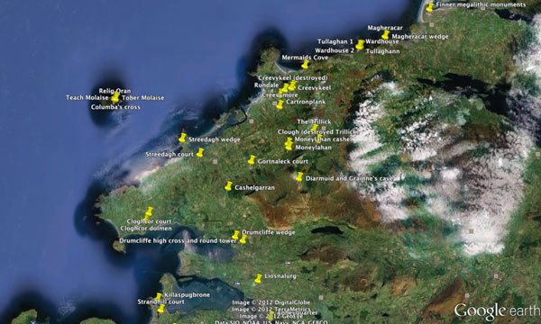
Google map of monuments near Cliffoney.
There are a number of megalithic mounments around the village in a line that closely follows the modern road. There are also a number of raths or ringforts in the same area, showing that this was an important crossing point in ancient times. St Brigit's well, in the photo above, was a popular site with passing pilgrims. The well is within a ploughed out ringfort, and was one of five wells within a few meters of each other.
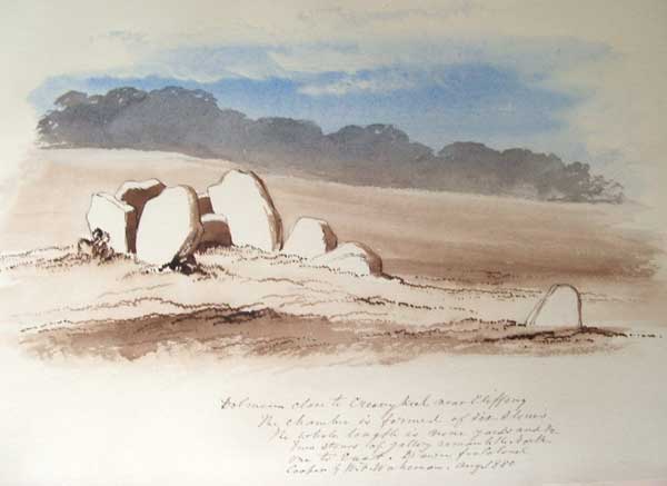
A megalithic chamber near Creeveykeel court cairn, illustrated by William Wakeman in 1880. The monument was removed completely around 1900 when a forge was built on the site. Wood-Martin saw a cup marked stone here which has vanished.
The megalithic monuments around Cliffoney are court cairns, a type of communal building with a large open area and an inner chamber. They generally date to around 4,000 BC. The restored court at Creeveykeel is one of the largest and finest in the country. It was excavated by the Harvard Archaeological Mission in 1935, one of the first scientific digs to take place in Ireland. There are the remains of three more courts in Cliffoney, while a fourth, illustrated by Wakeman in 1880, above, was destroyed around 1900. The monuments are found along a ridge of sandstone a small geological island in the surrounding limestone.
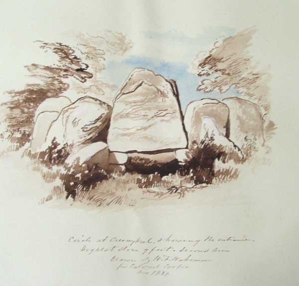
Wakeman' s 1880 illustration of the chamber at Creeveykeel. The imposing entry lintol was pushed over by three brothers around 1905, and was replaced horizontally in 1936.
William Wakeman
The artist William Wakeman was hired to travel around County Sligo and illustrate the monuments in the late 1870s. The results of his work are kept in two large sketchbooks in Sligo County Library. Wakeman drew three of the Cliffoney monuments including a rare view of Creevykeel with the entrance stone standing upright.
There were originally five megalithic monuments in Cliffoney, but very
little remains of any of the sites in comparison to Creeveykeel which was excavated and restored in the 1930s. Two of the megaliths are covered in thorn bushes and brambles, and few
stones can be seen today. The monument once located 300 meters north
of Creeveykeel seems to have been completely destroyed when a blacksmith built a forge there. All that remains is Wakeman's watercolour and a description by Wood-Martin, who saw a cup marked stone there.
Wakeman left a wonderful collection of images of the Sligo monuments and landscape. Thirty of these works can be viewed online; the entire collection, in two sketchbooks, one from around the county, the other from Inishmurray, can be viewed by appointment.
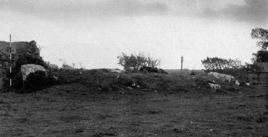
The megalith at Creeveymore, Cliffoney village, Co Sligo. Photo from the Megalithic Survey of Sligo, around 1960. The telegraph pole is by Cliffoney bridge.
Creeveymore
Creeveymore is the first site listed in the Megalithic Survey of County Sligo. Nowadays the site is invisible under blackthorn bushes and briars. The megalith is probably the gallery of a court, but is pretty ruined. It is sited overlooking the Cliffoney river at what must have been the fording place on the ancient route from Sligo to Donegal, just at the north end of Cliffoney village. The monument is quite ruined, nine stones remaining of a gallery just over 8 meters long and 2 meters wide, oriented and opening to the northeast. The cairn is long gone for other building projects, and only a low cairn surrounds the chamber.
The stones from the megalith were robbed in early Christian times: there is a massive oval platform ringfort right beside the megalith. Several huge stones can be seen in the souterrain at the north end, and there is a stone rampart running around the top. There is a hut foundation, probably dating to the same period, close to the ringfort overlooking the river and ford.
More stones were robbed in the 1820's to build Cliffoney bridge, only about 60 meters from the monument.
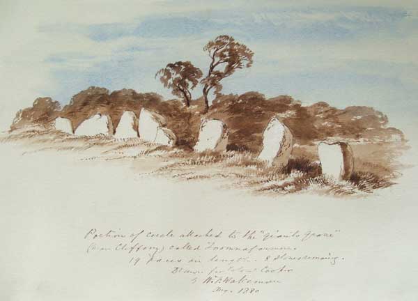
One of William Wakeman's fine 1880 watercolours of the megalith in Cartronplank called Toomnafoirmoire.
Cartronplank
A large monument, probably another court cairn still exists on a farm 1 kilometer east of Cliffoney crossroads. Interestingly enough, this crossroads, some 200 from the megalith, is the traditional village midsummer bonfire site. There are two wells, a mound and a fine rath close by.
A long gallery and massive end slab stand
in the farmyard, and sometimes used to store stakes and other fencing
materials. Wakeman illustrated the monument twice. He gives the name
Toomnaformire (The Grave of the Great Man), which appears to be a folk
memory of the Formorians, who are said to have had fortresses at nearby
Mullaghmore and Dernish; possibly this was a grave of Balor of the Evil Eye.
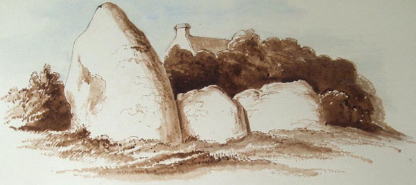
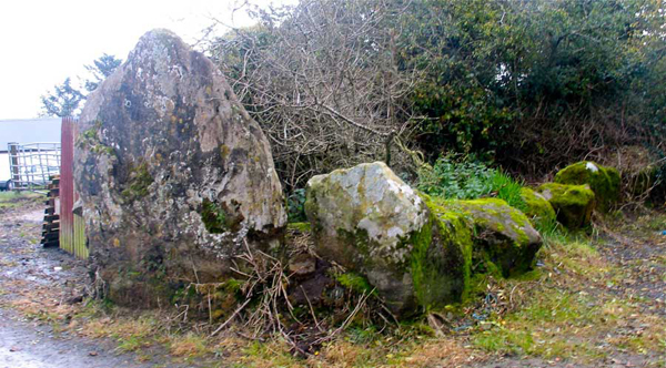
The large megalithic chamber in Cartonplank, now in a farmyard with apple trees growing out of it, Illustrated by Wakeman,
August 1880. The old name for this monument locally was Toomnaformoire.
The gallery at is Cartonplank is about 7.5 meters long by 2 - 2.5 meters wide, and is entered by a 'pair of well matched jambs'. The chamber was divided into two or three compartments, the end closed off by a massive triangular flag, 2.4 meters high. There are two stones remaining of the court on the south side. Some confusion has arisen in relation to Wakeman's illustrations of these monuments. Borlase, in his 1895 Dolmens of Ireland, mistook the Creevykeel painting reproduced near the top of the page as an image of Cartronplank.
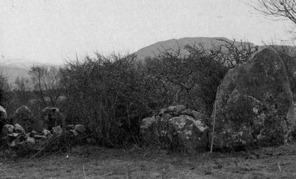
The megalith at Cartronplank, Cliffoney village, Co Sligo. Photo from the Megalithic Survey of Sligo, around 1960.
The megalithic building is just off the summit of Cliffoney hill, located about 200 meters west of the Cliffoney river, and is probably located on an ancient ford. The land drops away down to the shore at Cliffoney beach 1.5 km below. There are two wells to the south, both within 100 meters of the monument. There
are several notable ringforts close by, including a large, well preserved
example just 300 meters away on the summit of the hill, a large platform mound some 30 meters in diameter that commands wide views across the surrounding countryside.
The huge end slab from the megalithic chamber at Cartronplank.
There is a largely complete but much smaller court cairn on the west slope of a drumlin in
Bunduff, about 1.5 km to the west, but again the monument is very overgrown. Beside Mermaid's cove near the sea shore beyond Bunduff are some stones from the chamber of another megalithic structure. Because of the well matched entry jambs, this megalith is classified as a court cairn. It has a dramatic location close to the cliffs and rocks at Mermaids Cove.
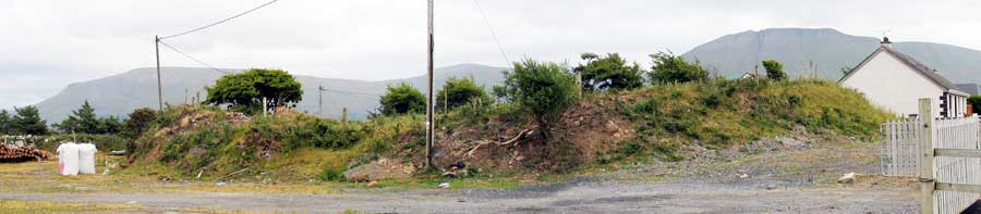
A large platform ringfort at the top of Chapel Hill in Cliffoney on the road to Ballintrillick. The fort is about 30 meters in diameter and is close to the megalithic chamber at Cartonplank and two wells.