
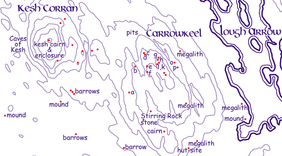
The Carrowkeel cairns
Within the townland of Carrowkeel there are fourteen hill top cairns and the largest neolithic village in Ireland. The megaliths of Carrowkeel are just a small number of the neolithic monuments across the Bricklieve Mountains and around Lough Arrow. There are numerous ring forts and enclosures and other monuments from later times in the surrounding countryside.There are a further twelve cairns in the surrounding townlands. Cairn K, the highest point of Carrowkeel at 321 meters, commands an impressive view across five counties.
The monuments, well-built artificial caves constructed from limestone slabs and covered by a mound of stones, contain passages and chambers of varying complexity, and although not all have been opened, they are of the same tradition and culture as the better known sites at Loughcrew and in the Boyne Valley.
 The people responsible for building these structures
originated along the coastal areas of Ireland, and the simplest form of megalith in Ireland, the boulder circles with dolmens were found all around the north coast. Carrowmore and the Cuil Irra sites 20 km to the northwest is the largest collection of monuments in the British
Isles and among the oldest in Western Europe. Simple dolmen circles, similar to those at Carrowmore, are also found up on the north eastcoasts of Ireland. The Carrowkeel people would have followed the river Uinshin in from Ballisodare bay to find the beautiful Lough Arrow region at the end of the river, a neolithic Eden. The people or culture built similar monuments in a chain stretching southeast Sligo, passes through Sheemor and Sheebeg, Corn Hill and Loughcrew before culminating with the great cairns of the Boyne Valley.
The people responsible for building these structures
originated along the coastal areas of Ireland, and the simplest form of megalith in Ireland, the boulder circles with dolmens were found all around the north coast. Carrowmore and the Cuil Irra sites 20 km to the northwest is the largest collection of monuments in the British
Isles and among the oldest in Western Europe. Simple dolmen circles, similar to those at Carrowmore, are also found up on the north eastcoasts of Ireland. The Carrowkeel people would have followed the river Uinshin in from Ballisodare bay to find the beautiful Lough Arrow region at the end of the river, a neolithic Eden. The people or culture built similar monuments in a chain stretching southeast Sligo, passes through Sheemor and Sheebeg, Corn Hill and Loughcrew before culminating with the great cairns of the Boyne Valley.
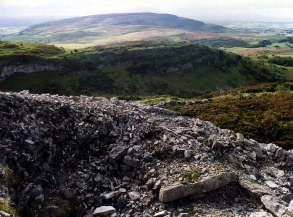
The view to Kesh from the chamber of Cairn F. Picture by Leo Regan.
The Carrowkeel sites were rediscovered by the naturalist Robert Lloyd Praeger around 1895, when he was surveying for alpine plants and orchids. A few extracts from his writings on the pages for Cairns F and G. He returned in 1911 and with R.A.S. Macalister and Armstrong and excavated the sites over three sessions, less than two weeks in total and left some of the cairns in the ruinous state of preservation we can see today. The cairns were given the letters they bear today during the excavations of 1911.
None of the cairns have names except C, the Leprachaun's House, and so are known by the letters given to them in 1911. While Moytura to the east and Kesh Corann to the west have a wealth of associated myths and legends, there is no mythology or folklore remembered about the cairns of Carrowkeel, nor are many of their old Irish names known except the ridges of Big Carns and Small Carns. The mountain itself may be the Sean Sliabh crossed by Lugh on his way to the Battle of Moytura.
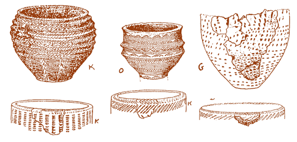
Some of the bronze age pottery and Carrowkeel Ware found in 1911. These pots indicate that the chambers could have been in use for many hundreds of years.
The information we
have about Carrowkeel at present comes of the report for the 1911 excavation, 'a tragic exercise in haste and lack of preparation' as Poynder said. The names of the townlands
in the area are probably not much older than the 16th century. and the majestically sited monuments themselves. The Bricklieve Mountains which also includes Kesh Corann is one of the most scenic
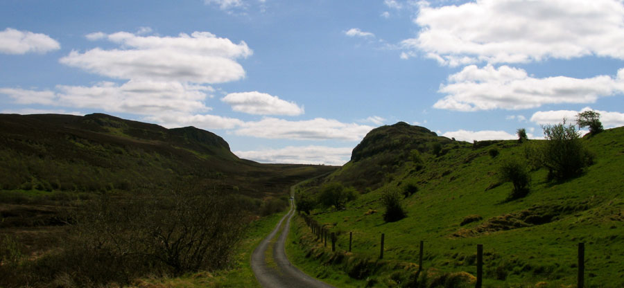
and unspoilt ancient areas in the west of Ireland.
 <
<
Take a virtual tour of five of the cairns on the excellent Voices from the Dawn Carrowkeel page.