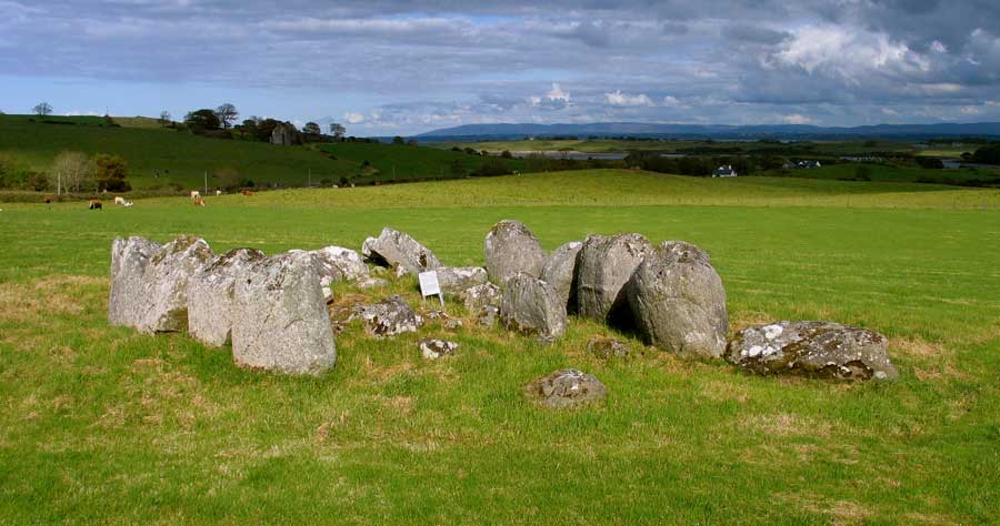
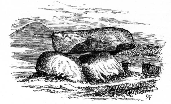
The Dolmen of the Four Maols.
On Sunday, June 4th 1998, I set off with my OS map to visit some of the fine Mayo monuments. First stop is shown above in an old illustration, is the Dolmen of the Four Maols, which is easy enough to find as it is signposted from Ballina Train Station. Rather than a dolmen, it looks to me like the remains of the end of another type of monument, possibly a court cairn, a very common type of structure in Mayo. The ground around the monument is pretty chopped up as cattle are watered right beside it. The dolmen looks as though someone tried to destroy it in the past, as several of the stones have what seem to be drill marks - there are six in the top left side of the capstone.
Ok, back on the road again. Next stop was marked megalithic tomb on the map, and is in a field right by the road. It turned out to be a probable court cairn - though it is hard to say. Two circles joined by some sort of structure in the middle. The picture above is looking into the south circle where a number of stones may be missing. There is a tractor road through the middle of the monument. The north circle is cut by the rough road/track which runs by/through the monument.
The stones were not especially big, and seemed to be a hard sandstone with plenty of quartz, quite possibly gneiss, as found in the Ox Mountains in Sligo. Off to the next stop 1 km up the road.
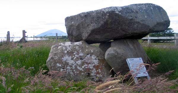
The Rathfran Wedge monument
Barely a kilometer up the road is this wedge monument. It is right beside the road, so access couldn't be easier. The stones used in the construction of this monument were pretty big - the boulders on either side are as tall as me - scraping six foot. This monument seems to be in pretty good condition - roofing of chamber and cairn stones are missing, but most of the other stones are in place. This one is facing west.
About 100 meters further up the road is another monument - but this time in ruins. Only a few stones remain, up on the ditch - and if it hadn't been marked on the map I'd have missed it.
Two stone circles, one large, one small, about 100 meters apart, on a low hill 50 meters above sea level. The smaller circle is slightly lower and to the southeast of the larger circle. This little monument is about 7 m in diameter, and has a raised platform type structure within it. I would say this is field clearance stones, as some of them looked to have been added recently. There are a couple of boulders lying about as shown above - but it is hard to tell what is going on - this is a silage field full of very long grass.
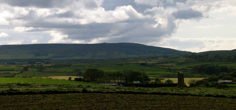
The larger circle has thirteen stones, three of those fallen, and measures about 15 meters in diameter. There is a great view from here - though you wouldn't know it from the picture. I could see in as far as Knocknarea and Benbulben to the east - 40 Km away. In the foreground is Killala Bay and the Atlantic Ocean. To the west is a large hill near the Céide Fields with two cairns and a large enclosure - next visit. South are the Mayo mountains.
Again, the rocks seemed to be a hard granite or sandstone with plenty of chunks of quartz.
Three km north of the stone circles I found this slim and graceful standing stone. It's near the summit of a hill, 62 meters above sea level, and commands a spectacular view of the surrounding countryside. Again, a great view in to Sligo, with Knocknarea standing out on the horizon. The stone, including base setting would be about eight feet tall.
On my way here I passed another ruined monument, which may have been a court or wedge monument - it was hard to tell. The picture seems to have vanished in the hard drive.
Another standing stone, though much taller, standing in Carrowtrasna on the south side of Lackan Strand. This stone is quite impressive, being 10 - 12 ft tall. It would have been visible to people out at sea in a boat, and may have been used as a guide or marker.
Still in the same area, south of Carrowtrasna and west of the Rathfran Circles, the Breastagh Stone is probably one of the better known Mayo standing stones. It is about 9 -10 feet tall, set back from the road in a field. The ogham script runs up both edges of the east face of the stone. I'll add a translation of the script when I find out what it says. Well worth a visit. As with the other monuments on these few pages, there is a good view of Shreeloga hill and cairns to the west of this monument.