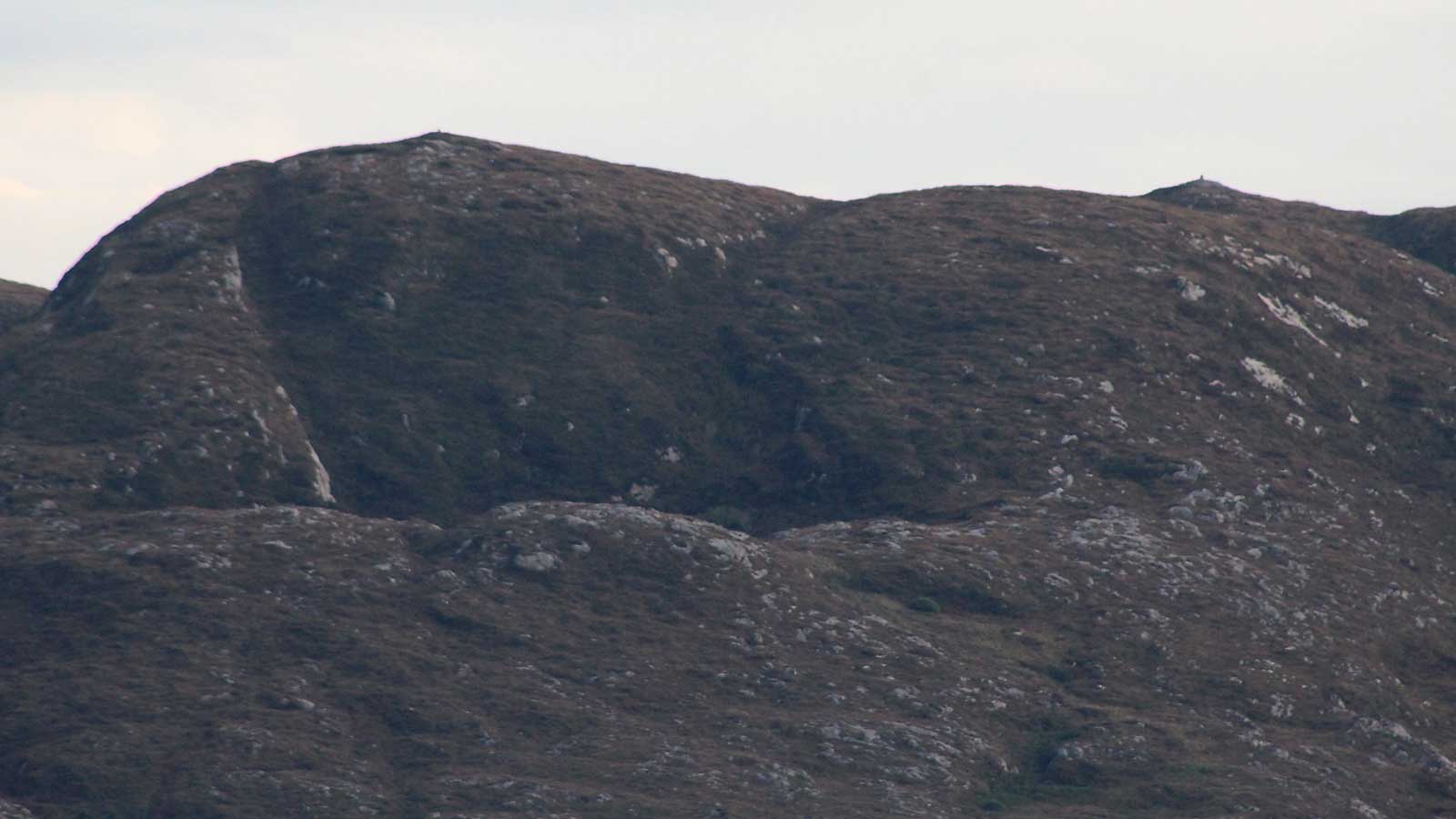
Looking south to the distcintive peaks of Sliabh Dá Ean from the flat summit of the west cairn on Carns Hill. From here the hills form the shape of a pregnant woman lying on her back.
The Ballygawley mountain passage-tombs
The Ballygawley mountains are part of the Ox mountain range, formed from an extremely hard and old kind of rock called gneiss. There are four monuments, most likely neolithic passage-graves, one on each of the highest points, and the magical bottomless Lake of the Two Geese. These striking summits mark the boundry between neolithic Cuil Iorra and the lands to the south. Though this boundry was established in the neolithic it is still in use today, marking the division between Carbury and Tirerril. I suspect it was part of the process of colonisation, when the neolithic farmers took over the Cuil Iorra peninsula, which is surrounded by water. The Ballygawley mountains act as the gateway barrier to the mainland, and were possibly marked to keep the mesolithic hunter-gatherers out.
The view from the Ballygawley passage-tombs to the Carrowmore megalithic complex. The reconstructed cairn at Listoghil, the central monument is clearly visible.
The mountains have an intimate connection with the monuments at Carns Hill, Carrowmore and Knocknarea, as many of the construction stones used to build the monuments are erratic boulders carried from these valleys by the retreating glaciers at the end of the last ice age. The local folklore tells how the great cailleach Garavogue, who had her home on the mountains, carried the rocks in her white apron to distribute them across the .
The summits, Sliabh Dargan, Sliabh Dá Eán, Aghamore Far and the Cailleach's House are each capped by a neolithic cairn.
Sliabh Dá Eán
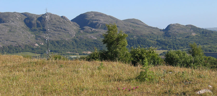
The cairn on the summit of Sliabh Dá Eán is about fifteen meters in diameter, and two meters high. The cairn is located on the highest peak of the four hills, at 275 meters above sea level, and is constructed with quarried local gneiss. There is no sign of kerbstones or a chamber, but the cairn surely covers some form of passage-grave. There is an obselete concrete Ordnance Survey pillar on the top of the monument.
Looking north across Cairn C, The Leprechaun's House, from Cairn E at Carrowkeel. The Ballygawley peaks and Benbulben form a distinctive horizon.
This area is rich with folklore and mythology. The cailleach, the neolithic landscape goddess named the Garavogue is said to have lived in the chambered cairn on the lowest, western-most peak. She befrended the mad king, Sweeney, and after transforming themselves into geese, they
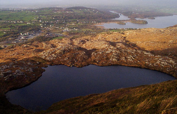
dived to the bottom of the small mountain-top lake, Loch Dá Gé,
the Lake of the Two Geese.
Lough
Dá Gé, the Lake of the Two Geese. Beyond is Lough Gill, the Garavogue
and Carns Hill.
This area of the Ballygawley mountains was used as a foresight by the local neolithic builders. The rising sun at the mid-winter solstice emerges from the mountain by the Cailleach's house when viewed from Listoghil at the centre of Carrowmore. The sunset in mid-winter drops into the Ox mountains between Knocknashee and Doomore cairn.
The sun rises in the valley between Aghamore and Sliabh Dá Eán,
and the recently discovered megalithic engraving at Listoghil may be a
representation of the distcintive peaks of Sliabh Dá Eán.
The
massive ten tonne capstone is tilted to six degrees above horizontal and oriented to the south-east towards the Ballygawley Mountains.
From Moytura, the extreme setting lunar
standstills, which only occur every 18.6 years, should set into the notch
between Sliabh Dá Eán and Sliabh Dárgan. The Moytura sunsets and
winter full moon sets drop behind Knocknarea
in a similar arrangement to that found in Cairn G at Carrowkeel.
In his book, Pi in the Sky, the late Michael Poynder discussed a large ley or energy
line crossing the country from Howth through the Hill of Tara, Loughcrew, Sheemor and the Ballygawley passage-graves, ending at Knocknarea. This chain of monuments was first noted by Gabrial Beranger in 1779, and more recently by the American researcher Martin Brennan.
Lough Da Gé, the enchanted bottomless lake viewed from the Carrowmore megalithic complex.
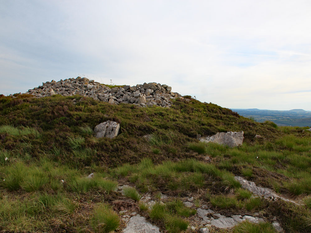
Aghamore Cairn
Aghamore Cairn located on the summit north of Slaibh Dá Eán
at 266 meters above sea level. The two monuments are seperated by a sheer valley,
some forty meters deep. This cairn is the smallest of the four in these mountains,
with a diameter of about ten meters. The stones used to construct the monument are gneiss, and
there is plenty of quartz in the local mountain rock.
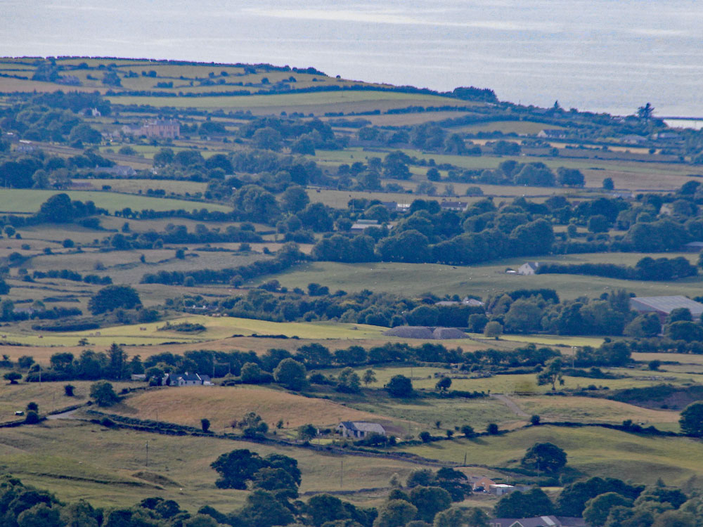
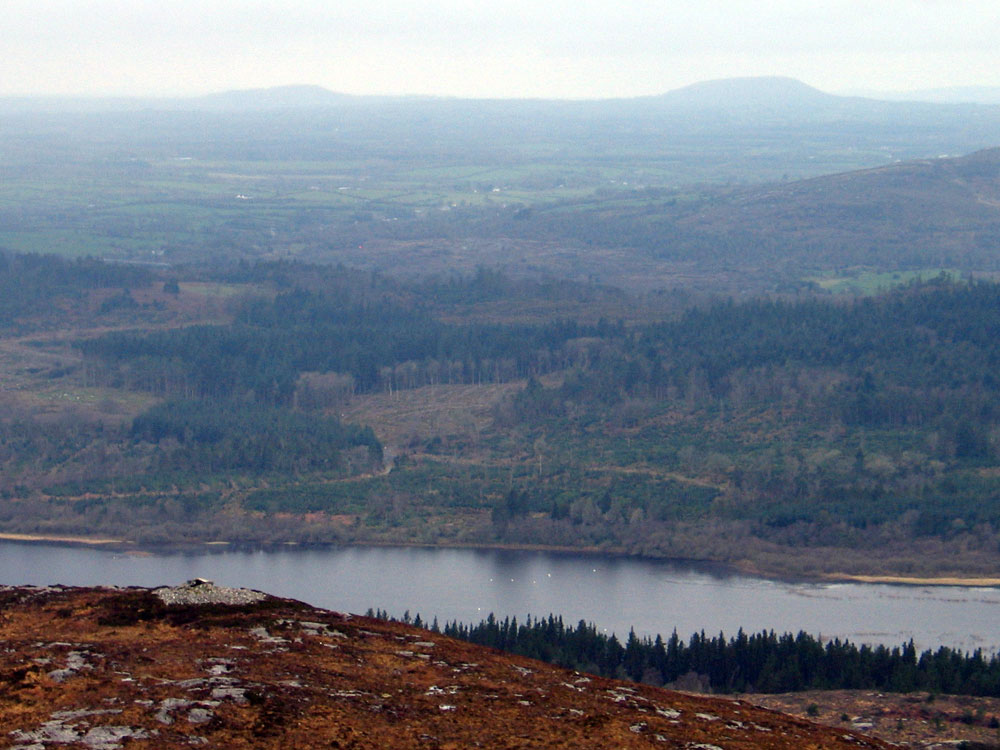
The view is quite stunning, especially to the north out across Lough Gill, and follow the river Garavogue as it flows past the huge monuments on Carns Hill to enter the sea. The beguiling mountain of Knocknarea looks quite beautiful from this vantage. To the south, Carrowkeel and Kesh Corran can be seen beyond Sliabh Dá Eán, and to the west, Knocknashee,
Muckelty Hill and Doomore
are all visible. Croghaun
peak is lost in the Ox Mountains.
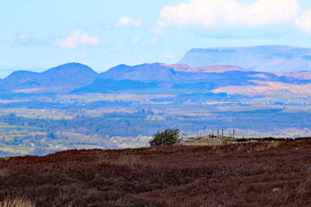
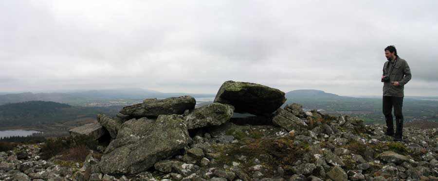
Slaibh Dárgan is perhaps the most visually impressive of the peaks, as it has
steep valleys, especially on the east, which are visible from a long way
off. The cairn is again located on the highest point, some 263 meters above
sea level, with fantastic views on all sides. The cairn on Slaibh Dárgan was distured at some stage, and has two large holes dug into the top. The diameter is about fifteen meters and the stones are local,
probably from the cliff-face just to the east.
The cairn on Sliabh Dargan looking southwest, where both Muckelty Hill and Knocknashee are clearly visible.
Slaibh Dá Eán is to the east
seperated by a forty meter deep valley. This valley is the notch visible from
Moytura, which probably marks the extreme midwinter moon setting position when viewed from Shee Lugh, the ruined passage-grave on the highest part of Moytura. Slaibh Dárgan also forms a deep notch valley with Aghamore cairn
to the north. Cailleach a Vera's House is located on the hill below to the west.
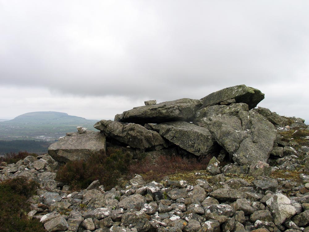
Cailleach a Vera's House
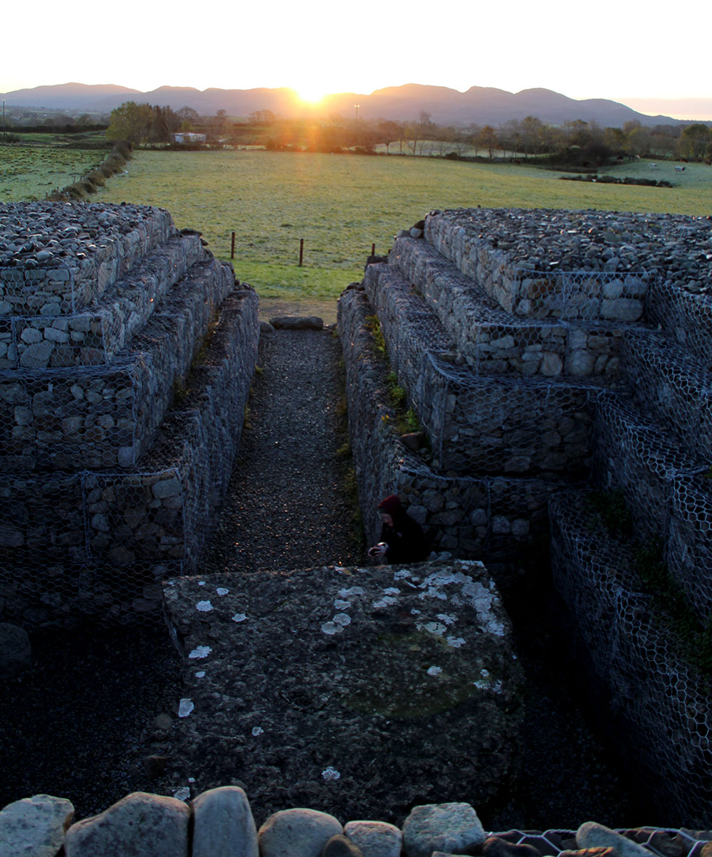
Cailleach a Vera's House is a fascinating neotithic monument, on a lower summit, about
215 meters above sea level. A passage and chamber remain within a cairn
of some sixteen meters in diameter. Some of the chamber stones have fallen
in, and the passage seems to have collapsed. The rectangular chamber can
be entered from a hole on the east side. The cairn is made from local
gneiss chunks, and there are a few lumps of quartz still mixed with the
stones.
The passage seems to be oriented to the south-southwest, to the region west of Carrickbanagher
where another possible passage-grave is located on the summit of Doon Hill. It seems to have a bearing to
the mid-summer extreme moonsets.
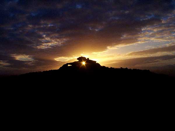
Sunset through the Cailleach's House.
The name Cailleach a Vera is derived from the Hag of Beara who is ultimately
derived from Buí, the wife of Lugh. Cailleachs or Hags are associated
with many cairns and sites, and in some of the tales are said to have
built the cairns by dropping stones from their aprons as they hopped across
the hills.
Neolithic passage-graves at Loughcrew,
Sliabh Gullion, Knowth,
and Carn Hill in Longford are all associated with the Cailleach, as are
the caves and cairn of Kesh Corran to the south. The local Cailleach in Sligo was Garavogue, after whom the Sligo river, which is the shortest in Ireland, is named. The local folklore has the Garavogue living on the mountain with the mad king Sweeney. The dark
mountain lake, Lough Dá Gé, is said to have got its name from the time when
Sweeney and the garavogue transformed themselves into geese and competed in a dive to seek the bottom of
the enchanted lake.
The megalithic chamber and cairn called Cailleach a Vera's House on a peak of Sliabh Dá Ean in the Ox Mountains in County Sligo. The monument was said to be the home of Garavogue, the local landscape goddess, the hag or witch who is said to have built the megaliths in the region.