Barnabrack stone circle
Let us now hie back to Ballisodare. The coastal shelf of County Sligo is, of course, everywhere limestone, but along the foot of the Ox Mountains this limestone shelf is studded over with millions of metamorphic boulders, torn or fallen from the towering mountain masses above, which being one of the very oldest rocks in Europe, break off in gigantic chunks, forming pillars and boulders of every shape and size, so that it resembles to a very remarkable degree the eastern Magh Tuiredh at Lough Arrow.
It resembles it in its wealth of boulders and also in the absence of cairns. It is indeed a veritable Plain of Towers, one townland being actually named "Tor Ard," or High Tower. The plain has stone circles, dolmens, single and grouped pillars, cashels, forts, giants' graves, and almost every variety of ancient monument, so that one possessed of a fertile imagination such as Wilde's should have no difficulty in finding a tomb for every hero both Firbolg and Tuatha de Danann that, we are told, fell in the mighty struggle.
The First Battle of Magh Turedh, Henry Morris, 1928.
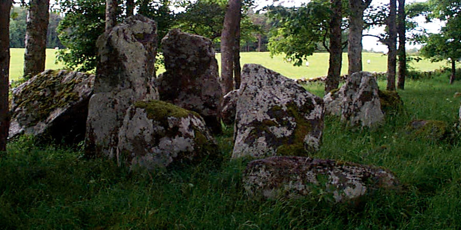
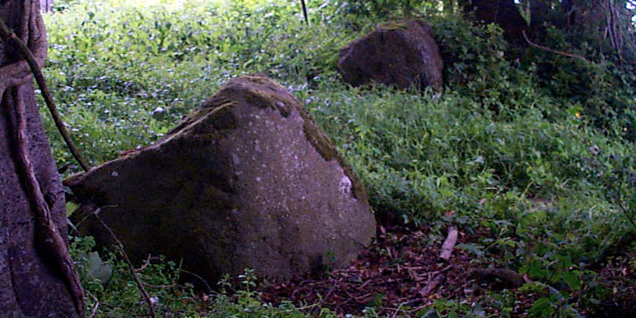
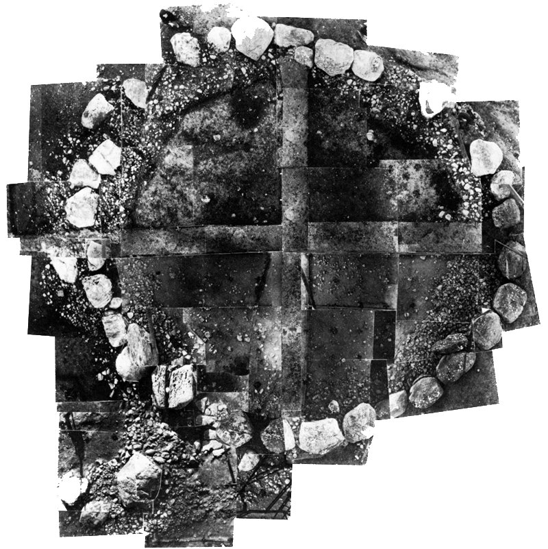
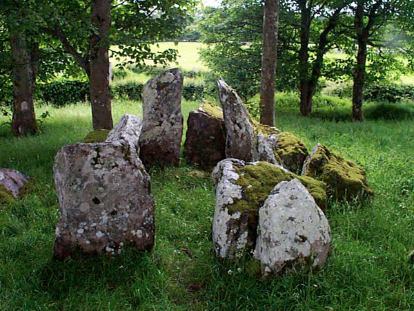
The Barnabrack stone circle seems to be on the preiphery or boundary of the great neolithic complex found on the Cuil Iorra Penninsula. The Barnabrack monument is a boulder circle similar in form to those found at Carrowmore, located on a low hill above Beltra. The circle may have been a tertre, an early form of passage-grave consisting of a free-standing burial chamber placed at the centre of a circular kerbed platform. Sometimes, the circle kerb is all that remains of the monument.
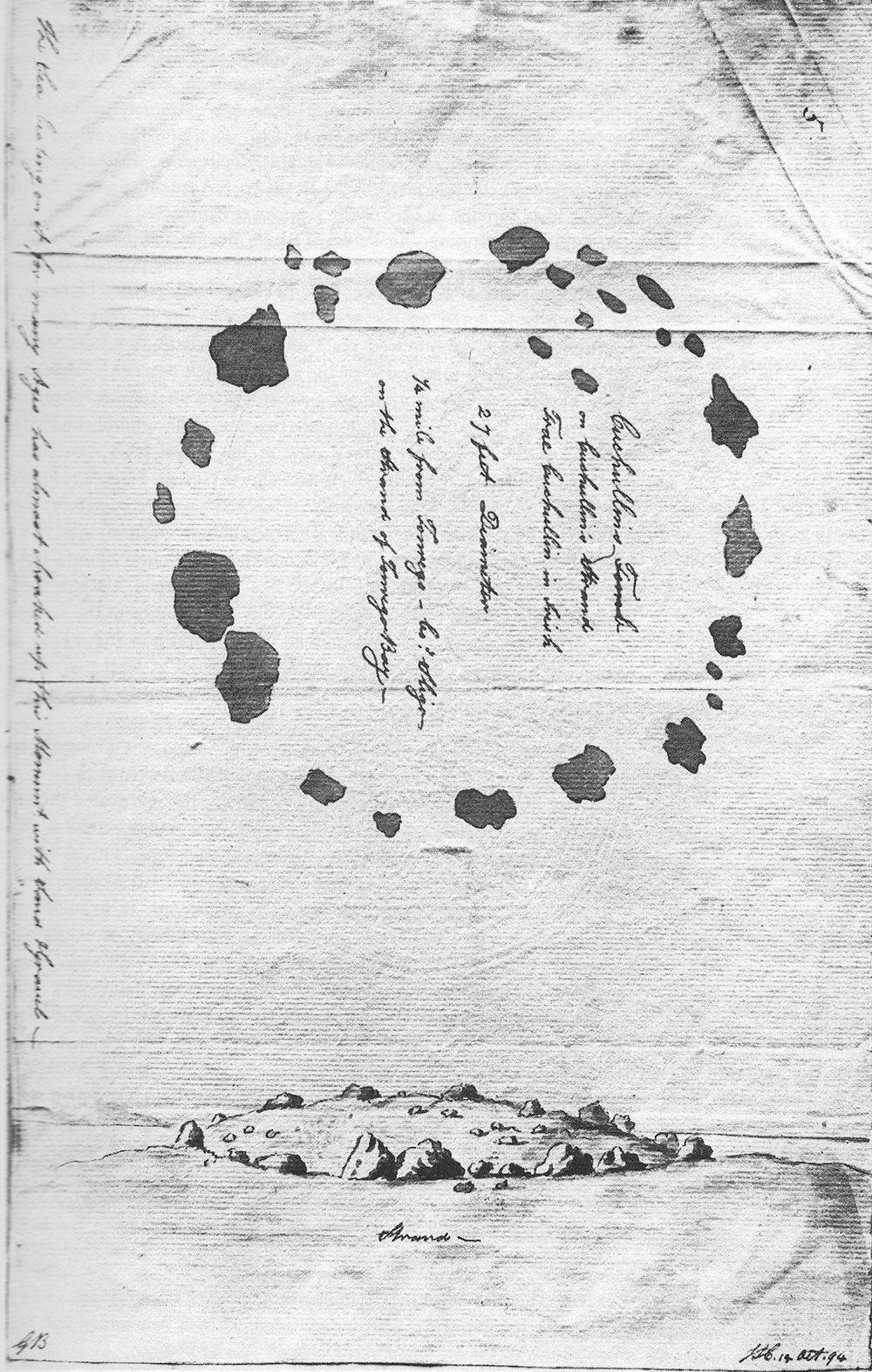
The monument, which is very overgrown, is bisected by a farm track which cuts through the middle. It is currently housing the owners trailer. About half of the boulder circle is still there, but Stefan Bergh who has surveyed the monument, says no central construction remains. The monument is probably the remains of a Carrowmore style passage-grave. Another monument of this kind, Eochy's Grave or Cuchullain's Tomb was located on the strand called Traigh Eothaile until it was destroyed during the construction of a weir crossing the Tanrego Intake.
For the benefit of those who might not be fully acquainted with Irish topography, it may be stated that the strand called Traigh Eothaile is mentioned very frequently in Irish history, and to all familiar with that history it is as well known as the strand of Malahide or Clontarf. It lay some three miles west of Ballisodare, and at low tide was about a square mile in extent. Up till 70 years ago the regular roads both east and west and north and south crossed this strand; but in 1858 a rampart was constructed which shut out the sea, so that this fine and famous strand is now a "dismal swamp" covered with rushes and other water-loving vegetation. In the construction of the rampart the monuments of King Eochaidh and his assailants were destroyed, the larger stones being used to build the rampart, and only a couple of little stones at present mark these ancient sepulchres.
The First Battle of Magh Turedh, Henry Morris, 1928.
Photograph © Göran Burenhult.
Barnabrack is on an ancient coastal routeway, and the area is associated with the famous First Battle of Magh Turedh. The area was known as Cuil Cnabh, the Quarter of Bones, and several of the monuments in the area are said to be the graves of slain warriors. Henry Morris has suggested that this is the location of the climactic end scenes from the battle between the Firbolg and the invading Tuatha de Danann.
Though it is positioned out alone away from the other monuments in the area, Barnabrack means the Speckled Gap and is located on a narrow strip of land between the mountains and the sea. Therefore it would be reasonable to presume that this was a trackway or route in and out of the lands to the west. There are several more of these monuments in the Enniscrone / Moy Estuary area.
One kilometer to the north of Barnabrack is the remains of the chamber of a court cairn located on the grounds of Tanrego House.