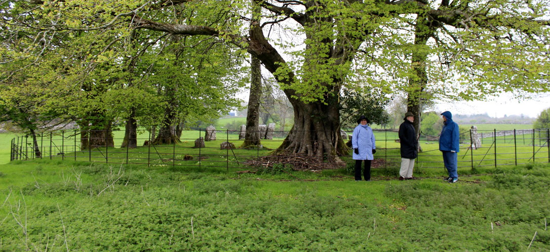
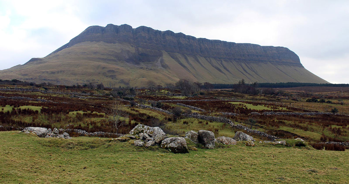
The Nymphsfield stone circle close to the village of Cong in County Mayo.
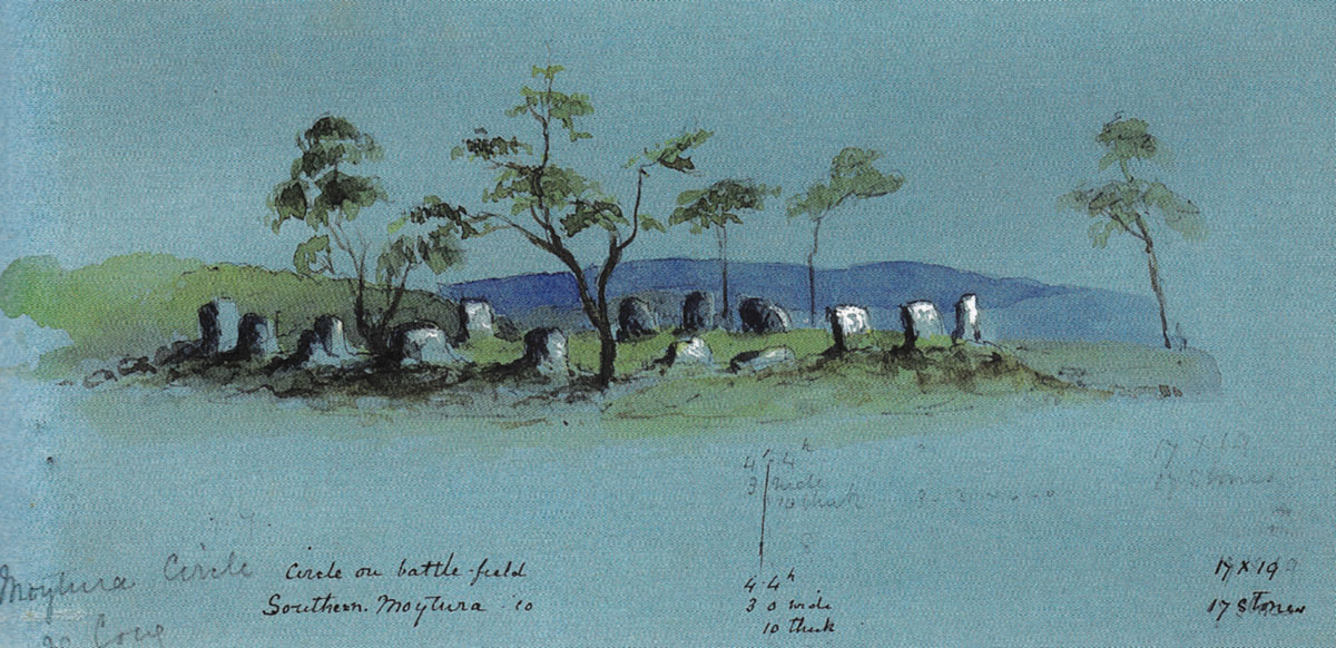
The First Battle of Magh Turedh
Henry Morris, Read 15th May, 1928.
There are few episodes in early Irish history better known than the two battles of Magh Tuireadh. Some modern writers, notably D'Arbois de Jubainville, maintain that there was but one such battle. "The most ancient tradition," says this writer, "that we find established in the two earliest catalogues of early Irish literature, and also in various tracts of the tenth century, knows of only one battle of Magh Turedh.... In the eleventh century it was held that there were two battles of Magh Turedh. Flann Manistrech, who died in 1056, is the earliest writer in which we find mention of the two battles."
The evidence for only one battle seems rather negative in character, resting apparently on the fact that the early writers speak of the battle of Moytura, as if they knew of only one. But these thent century refrences are few in number: de Jubainville knows only of three, and two of those are in verse, where possibly the exigencies of meter might account for a brief inexact definition of the battle meant. Assuming, therefore, that there were two battles, it will be remembered that the Tuatha de Danann were victors in both, conquering the Firbolgs in the first and the Formorians in the second.
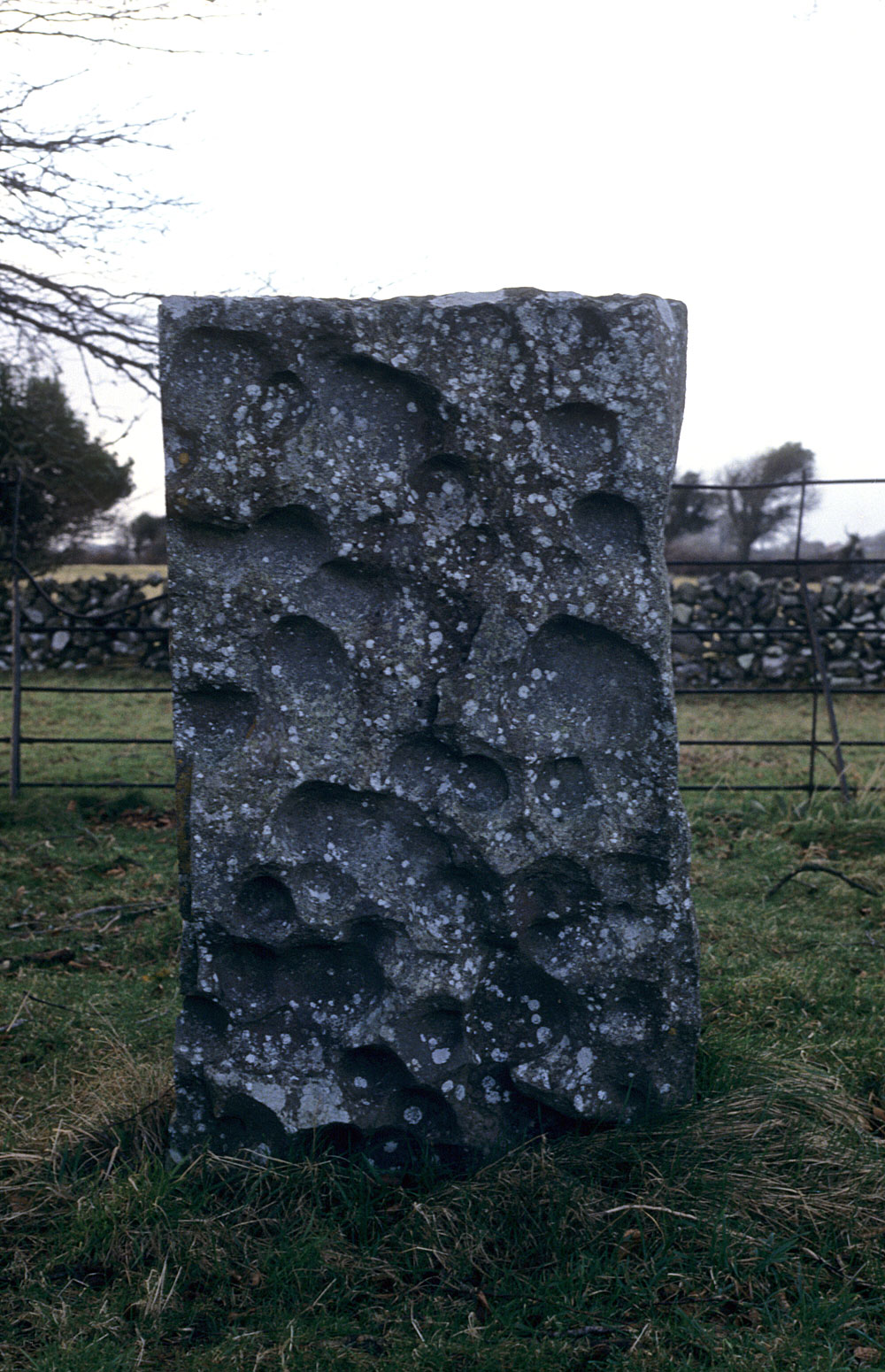
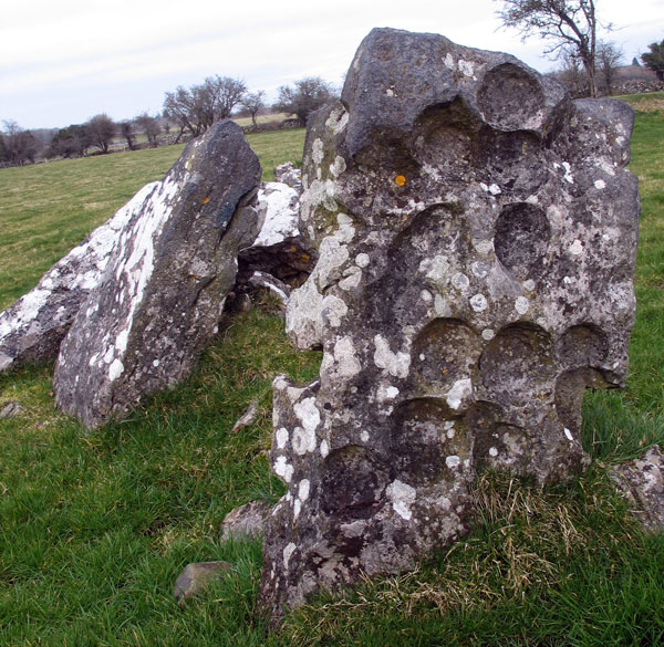
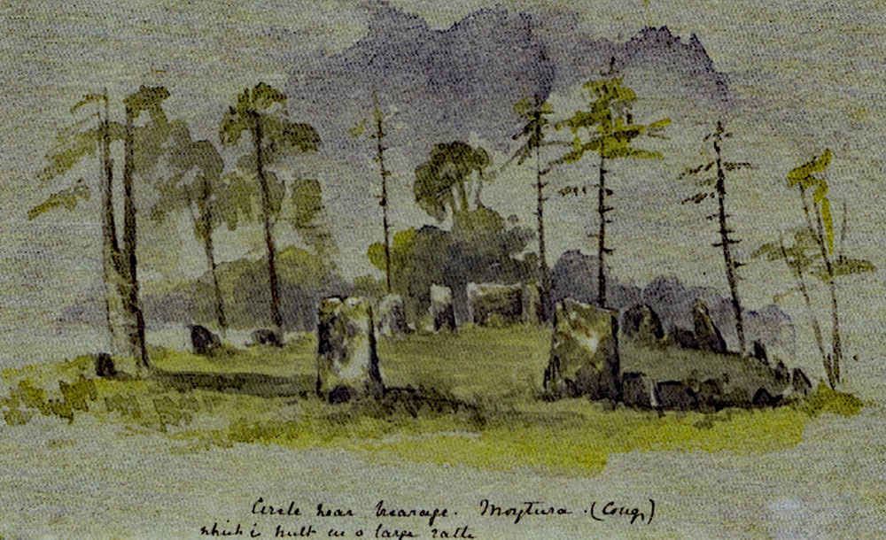
A circle stone at Nymphsfield close to Cong.
De Jubainville would regard the second as the real battle of Magh Turedh, and this idea has at least this much to recommend it that the site of the battle is traditionally remembered to the present day, and is sterotyped in the names of two adjoining townlands in County Sligo, these townlands being situated on a fine plateau that rises to the height of 700 feet on the eastern shores of Lough Arrow. The names are pronounced Mwee-turra ( Maigh Tuireadh ), east and west.
With regard to the first battle, nowhere does its site survive as a living topographical term at the present day. Nevertheless, you will find it marked very definitely on modern historical maps. In practice the second battle is placed in County Sligo or County Leitrim according to the knowledge or otherwise of the particular writer or map-maker, but invariably the first battle is located near Cong, in the extreme south of County Mayo. It is my object in this paper to investigate this location, to examine its credentials, and question the authority behind it.
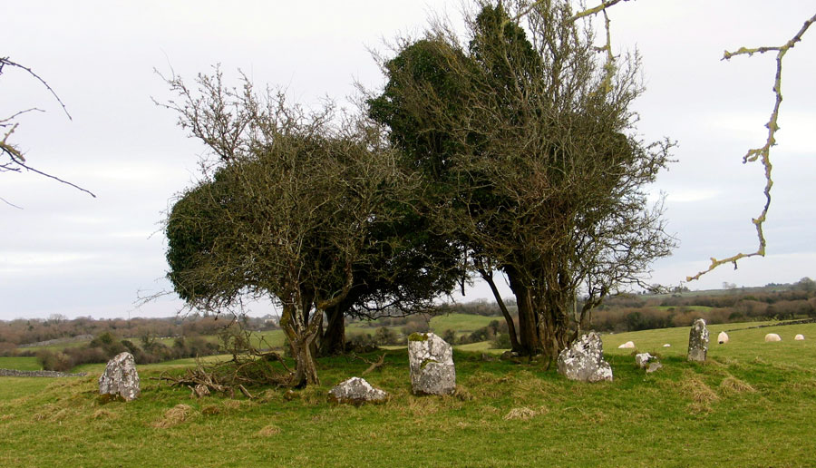
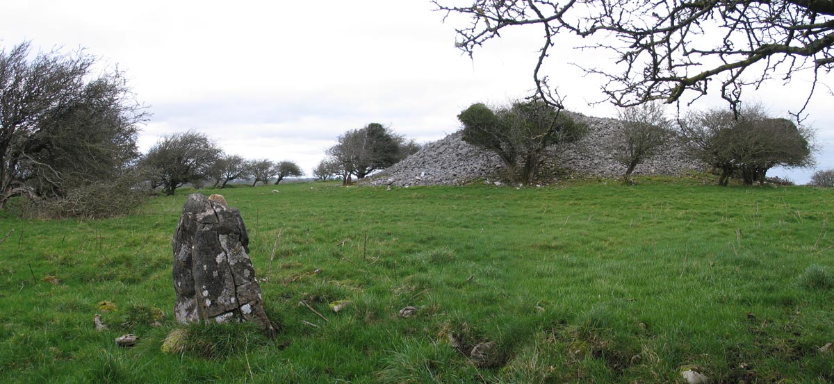
The smallest of the four stone circles at Nymphsfield near Cong, with its
atmospheric grove of thorn trees.
Authority
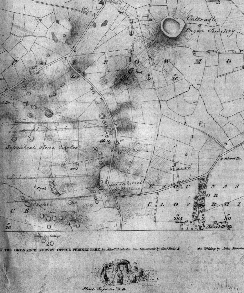
It will be conceded right off that since the beginning of the 17th century, if not indeed earlier still, this location has practically all authority behind it. The O'Clery's, both in the Annals and the Leabhar Gabhala, Keating in his History, and O'Flaherty in the Ogygia, all agree in placing it in "Conmacine Chuile Toladh of Connacht." O'Flaherty is even more explicit: he says this decisive battle was "fought at Moytura in Partry, near the lake of Conmacine Cuil Toladh." Furthermore, Michael O'Clery and others call it the battle of "Maigh Tuiread of Cong." To the eastward of the well-known village of Cong lies a plain studded over with cairns and other prehistoric monuments. O'Donovan identified this plain as the battlefield of Moytura South: Sir William Wilde, in 1872, with his facile pen cast over it the glamour of romance, and now some of the inhabitants of this plain name their houses after the battlefield, and it is part of the creed of every school child that the battle of Moytura South was fought near Cong.
Before challenging all this it may be as well to quote O'Curry's short account of the battle. He tells us that the Tuatha de Danann, after spending seven years in Scotland, landed on the north-east coast of Ireland. But in another place he contradicts this, and says that the Tuatha de Danann "entered the island on the north-west." The old MS says they landed "at wide Tracht Mugha in Ulster." This name has not survived; but Fr. Hogan believed it in the modern County Donegal. It is noteworthy also that when the Formorians came for the second battle of Moytura they landed at Ballisodare in County Sligo. To resume O'Curry's narration, the Tuatha de Danann made their way into Maigh Rein, near the modern town of Drumshanbo, in County Leitrim. Later they retired further "to the south and west and took up a strong position on Mount Belgadan at the west end of Maigh Nia, which is now called Maigh Tuireadh, near the village of Cong."
A copy of Gabrial Beranger's 1779 illustration of the burial mound of King Eochaidh, a monument that appears to be an early form of passage-grave like those at Carrowmore across the Bay.
O'Curry, it may be remarked, had no warrent for stating that Maigh Nia "is now called Maigh Tuireadh," if he meant to imply that this is its modern accepted name; nor is there any evidence other than the assertations of historians, that it was its accepted name at any time. Again, his ststement that the Tuatha de Danann marched "south and west" is not warranted. They should, of course, have marched that way from Maigh Rein if Lough Corrib was their objective.But the old MS. which was O'Curry's sole authority says:— "The Tuatha de Danann said to each other: 'Let us not stay here ( in Magh Rein ) but go to the west of Ireland, to some strong place.'... So the host travelled westwards across plains and inlets ( inberaib ) til they came to Magh Nia." [ The italics are mine. ]
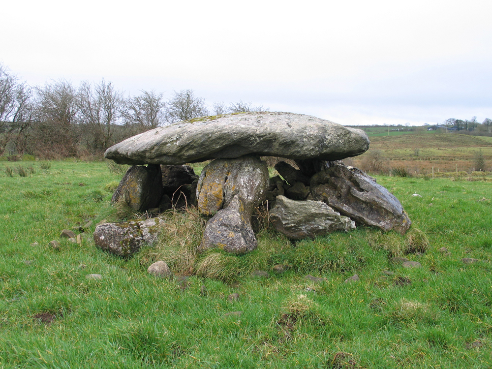
A passage-grave at Ardnaglass to the north of Benbulben in County Sligo.
The First Battle Begins
The battle began on Midsummer Day: the Firbolgs were defeated with great slaughter, and their king ( who left the battle-field with a body-guard of a hundred brave men, in search of water to allay his burning thirst ) was followed by 150 men, led by the three sons of Nemedh, who persued him all the way to the strand called Traigh Eothaile. Here fierce combat ensued in which King Eochaidh fell, as well as the three sons of Nemedh. The latter were buried on the west end on the strand at a place since called Leaca Mhic Nemedh, or "the gravestones of the sons of Nemedh," and King Eochaidh was buried in the strand where he fell, and a great heap of stones, known to O'Curry's day as the Carn of the Traigh Eothaile, and which was formerly accounted one of the wonders of Erin, was raised over him by the victors. Such is O'Curry's account, in his Manuscript Materials.
For the benefit of those who might not be fully acquainted with Irish topography, it may be stated that the strand called Traigh Eothaile is mentioned very frequently in Irish history, and to all familiar with that history it is as well known as the strand of Malahide or Clontarf. It lay some three miles west of Ballisodare, and at low tide was about a square mile in extent. Up till 70 years ago the regular roads both east and west and north and south crossed this strand; but in 1858 a rampart was constructed which shut out the sea, so that this fine and famous strand is now a "dismal swamp" covered with rushes and other water-loving vegetation. In the construction of the rampart the monuments of King Eochaidh and his assailants were destroyed, the larger stones being used to build the rampart, and only a couple of little stones at present mark these ancient sepulchres.
Stone circle at Cong.
Now, it is 55 miles as the crow flies from Cong to Traigh Eothaile, and the first thing that will strike anyone on reading this account of the battle is the absolute silliness of a story that a man, even in midsummer, had to travel 55 miles in Ireland to get a drink of water! This crude anomaly, it was felt, needed an explanation, so ( quoting Wilde ): "The MS. relates that the druids of the Tuatha de Danann, hearing of the extremity in which Eochaidh was placed, magically concealed all the wells, rivers and fountains;" and then Wilde adds his own explanation— "probably a mist surrounded them." Such are the respective explanations of these two writers, one supernatural, and the other natural, and both highly improbable and convincing.
It is my experience in studying our historical and quasi-historical legends, and in the best of all ways, namely by going over the actual ground where they are alleged to have happened, that whenever you are on sure ground there is a remarkable appropriateness between the episodes and incidents of the tales and their topographical setting. The story told, whether actual happenings, or a conflation of legends, or conscious invention, suits the geography and the terrain. Hence a very improbable story such as this at once raises suspicion. Our later 17th century historians clearly felt so shy about it that they suppressed it. Michael O'Clery in the Leabhar Gabhala says:— "They were a long time fighting that battle, so that it was won at last against the Firbolg, and the rout was pressed northward and 1,100 of them were slaughtered from Magh Tuireadh till they reached the strand of Traigh Eothaile."
How much more naturally this reads; not a word about Eochaidh's flight for a drink, while his hapless followers maintained a forlorn combat 55 miles in his rear. But withal 1,100 cut down in 55 miles was slow work for such expert slaughterers as the Tuatha de Danann; it was only 20 per mile. So Keating improves on this by telling us that "Eochaidh was slain and 100,000 of his people cut off from Magh Tuireadh to Traigh Eothaile." I do not accuse Keating of inventing these figures: they may have been given by some earlier writer; but they are necessary in order to give any show of reality to the story.
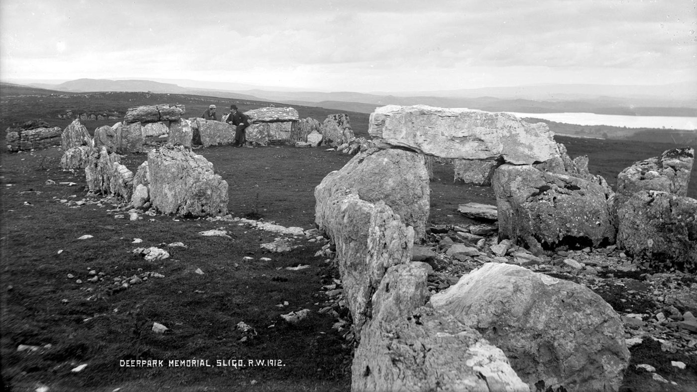
The huge court cairn at Deerpark in County Sligo photographed by Robert Welch.
Historical Basis
The historical basis for this account of the battle, as far at any rate as modern historinas are concerned, is a tract in the Trinity College MS. H. 2. 17, a collection of tracts in different styles and by different scribes, written on vellum. That on the battle of Moytura begins on page 90 and continues for nine pages in a small, cramped, rather poor hand—poor as compared with the fine, bold, regular script characteristic of most Irish MSS. The pages are now dark with age and ill usage, and a good part of the first page is quite illegible. The tract has been published with an English translation and Notes in Eriu by J. Frazer.
The colophon states that it was written "in the plain of Eithne, by Cormac O'Cuirnin for his companion Sean O'Glaimhin," though as the editor points out, the handwriting shows it to have been written by two different scribes. The O'Cuirnin's were a literary family of great repute. For three centuries they continued as hereditary ollamhs and historians to the O'Rourkes of West Breifne, or County Leitrim, and they exploited the name and fame of St. Mogue in the interests of Rossinver and Drumlane, as against the rival pretensions of the successors of St. Caillin of Fenagh. One of the many losses our national literature sustained was the burning of the library of the O'Cuirnins in 1416 on Inis Mor, now Church island, Lough Gill, County Sligo.
An unusual megalith close to Knocknashee in County Sligo.
The Four Masters notice the obits of nineteen O'Cuirnins, amongst them, in 1475, that of "Cormac O'Cuirnin, Perceptor of the Learned of Ireland." It is highly probable that this Cormac is the writer, if not indeed the author, of the Moytura tract. O'Donovan guesses it to have been at the time of Elizabeth, but the compiler of the Trinity College Catalogue assigns it to the 15th century, which agrees with Cormac O'Cuirnin's period. Frazer expresses no opinion as to the date, but points out that it contains some late, and some very early linguistic forms, thus showing that it is "the result of several revisions of a text which may in parts go back tothe early Middle Irish period."
The account of the Tuatha de Danann invasion and of the subsequent battle is told in great detail, the writer professing to give the very words and speeches and feelings of the actors. It goes without saying that all this detail is modern invention, a fanciful elaboration of a brief, concise, matter-of-fact account in some early Irish manuscript. Cormac O'Cuirnin, the Perceptor of the Learned of Ireland was just the person to attempt an elaboration of this kind, and bring it up to date by arraying his heroes in mail and helmets. O'Donovan wonders he did not introduce guns.
But two questions may now be asked:—
1. Had the author the plain of Cong in his mind when writing this tale?
2. And if so, how far had he the authority of his exemplar for this?
To give a negative answer to the first question might be somewhat rash, though on the other hand, an affirmative one would require some proving. He mentions about two dozen places or objects on the battlefield. O'Donovan makes a guarded attempt at identifying a few of these, but Wilde in his Lough Corrib boldly identifies one half of them. To do this he drags the battle, which it should be observed lasted four days, backwards and forwards to where the monuments are, so that he fixes on the map not alone the scenes of the battle, but of its various episodes, with a precision which is altogether lacking in our knowledge of modern battles like Clontarf, Faughart, or Benburb.
Eochy's Grave, the ruined passage-grave on the strand at Tanrego in County Sligo, looking south to the cairn on the summit of Doomore.
His most glaring piece of self-deception, however, is his treatment of Eochaidh's flight, death and burial. He actually prints the translation of the MS. account telling of the King's death and burial at Traigh Eothaile, and though he must have known well the position of Traigh Eothaile, he cooly ignores this; and tells us that Eochaidh fled to the shore of Lough Mask, where he gets conveniently killed and buried at "the great cairn on the grassy hill of Killower overlooking Lough Mask, from which it is about a mile distant!" The MS. story said he was buried on the strand, but this is only a trifle when you have a great cairn to account for. Of the two dozen names mentioned by O'Cuirnin, Wilde could only find one surviving, and that one apparently accidental.
But the fundamental objection against using these monuments as proof of the battle's having occurred there is that these monuments—the cairns especially—are Bronze Age monuments according to the teaching of modern archaeology; and whatever historic basis the battle of Moytura may have must be sought after in the Iron Age. It may be doubted that even the name, much less a detailed account, of a single Bronze Age battle has come down to us.
Leaving the monuments, let us come to the mountain. O'Cuirnin calls it Duibslebe ( Black Mountain ), or Sliab Belgadain. Neither name now survives, the name of the mountain, according to modern maps being Benlevi. Whether or not this is a corruption of Duibslebe is a moot point, but it may be remarked that Duibslebe appears to have been already superseded by Belgadan when O'Cuirnin wrote. Hence there is a great lack of evidence that the plain of Cong is the one O'Cuirnin described. Yet for a priori reason it seems quite possible that it was. He calls it "the Battle of Magh Tuireadh Cunga," that is "of Cong." At the time O'Cuirnin wrote there was only one well known "Cong" in Ireland—viz., that at the head of Lough Corrib. No other Cong was generally known, and Cong of Lough Corrib had become rich and famous, a "royal abbey," to which the last of our Ard Righs had retired to die.
Hence my reply to the first question posed above that it is quite possible O'Cuirnin had the plain of Cong in his mind in writing this tale.
Coming now to the second question, I believe the original record of the battle of Moytura did not refer to the plain at Lough Corrib, but to another Cong to which I now propose to introduce the reader. A year before Wilde wrote his Lough Corrib, that astute scholor and painstaking editor, the late W. M. Hennessy, published in his introduction to the Annals of Lough Cé an Irish passage with a translation, which, as he carefully points out, "is of peculiar interest, as it indicates a different locality as the site of the battle of Magh Tuireadh Cunga from that which has generally been recognised as the scene of the overthrow of the Firbolg dynasty." This citation, he tells us, is from "a MS. completed in 1416 in the present County Sligo by Giolla Iosa Mór Mac Firbisigh, one of the most eminent antiquaries of his time, who probably quoted the story from some ancient authority."
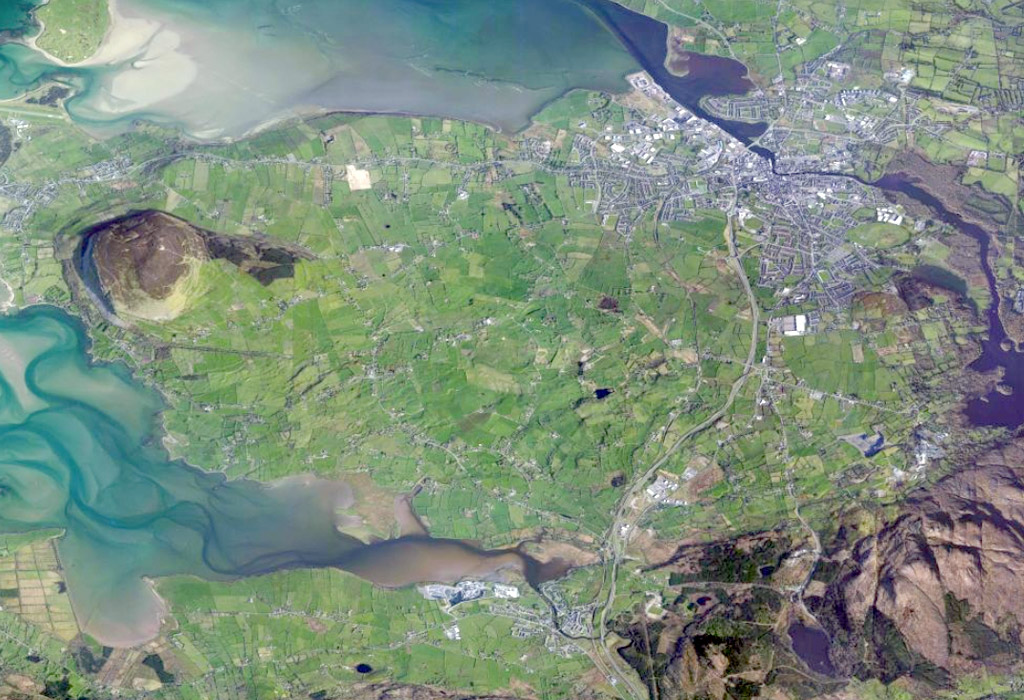
The proposed location of the first battle of Moytura at Ballisodare in County Sligo, according to this article. Knocknarea, Carrowmore and Carns Hill are all close to the site; image from Bing maps.
Translations
Hennessy's translation is as follows:—
When the battle of Magh Tuiredh Cunga was given between Eochaidh Mac Eirc and Nuadha, King of the Tuatha de Dananns, Nuadha's druid, Cé, went to see the slaughter, whereupon he rushed in madness and red lunacy towards the south-east (siarr-des), and he ceased not from the madness until he found a heap of stones on the plain, where a deep sleep fell upon him, and the lake burst up around him, so that he was drowned, and therefore it is from him the lake is ( named ) i.e., Loch Cé.
It is self-evident that a man travelling south-east from Cong would never reach Loch Cé.
As was usual with our native historians, Mac Firbisigh then quotes a poem in conformation of what he has written. The following lines occur in the poem, referring, of course, to the druid:—
He came from the hot Magh Tuiredh,
After being wounded by fierce weapons,
Until he sat on the carn of Corr-Sliabh.
This was a very conspicuous cairn, crowning the summit of the Curlews, a little to the east of the modern road crossing the mountain. The cairn itself has been partially cleared away, but its site is still clearly marked, and the name of the cairn is yet vividly remembered locally—viz., Sidh Gabhra; Sidh being a common name for cairns and tumuli in Connacht. This spot commands a splendid view of Loch Cé and Magh Luirg an Daghda, or "the Plains of Boyle."
The roof-box at Cairn G in Carrowkeel, an early model for the famous and contraversial example at Newgrange.
In the Edinburgh copy of the Dindsenchus published by Stokes the same story is told:—"Cé, the wizard of Nuada, having been wounded in the battle of Magh Tuiredh, went to Corrslebhi ( co rainic carn Coirrslebhi ), and then he went to Magh Airni where the lake is, and there Cé fell, and at his burial the lake burst forth, whence is Loch Cé, 'Cé's Lake.'" Another versiion also given by Stokes from MS. H. 3. 3. (66b) defines the battle as the second of Formorian one, and says the druid fled sier-des from the battle which Stokes has wrongly translated "south-west." But sier, I suggest, is not a variant spelling of siar, west, it is the north-western dialectic form of sior, east, which is yet heard all over Donegal. From this it appears Cé first sat on the Cairn of the Curlews ( Sidh Gabhra ) "and he saw the smooth and flowerful plain. Fain was he to reach that plain that he saw. On he went in that wise to the very centre of the plain... where he perished." It appears there was at the centre of the plain another cairn.
The Book of Leinster version, as given in Provost Gwynn's fine work, is almost identical with that in the Book of Lecan as quoted by Hennessy, except that the latter has one verse not found in the former, and the former two verses not in the latter. All three are required to make the story complete. But the learned editor of the Metrical Dindsenchus has confused the issue somewhat by translating carn chuirr shleibe as "the cairn of the mountain-peak," instead of the cairn of the Curlew mountain; and, accepting unquestioningly the modern location of the battle of Moytura Cunga, he appends a long note explaining that it is "plainly an error" to think, as the prose Dindsenchus clearly implies, that the story referrs to the first battle of Moytura. The whole note, in my opinion, is misleading, for, while throwing overboard the topographical authority of the Dindsenchus, it does not explain away the discrepancy, as a fugitive at Lough Arrow should travel south, not south-east, to reach Loch Cé.
Through the existing recension of the Dindsenchus, as Stokes has pointed out, it is not earlier than the 12th century, it represents a much earlier stratum of Irish pagan tradition, and often provides a useful check on more modern historical compilations.
In the 57 years that have elapsed since Hennessy edited the Annals of Loch Cé, the only writer, as far as I am aware, who has taken up Hennessy's hint, and made use of his citation from the Book of Lecan, is the late Colonel Wood-Martin from Sligo. He was, however, rather impetuous in his adoption of the idea, for in his Rude Stone Monuments of Ireland, published originally in the Journal of this Society, and later ( 1888 ) in book form with some chapters added, he suggests that the battle was at Cunghill in County Sligo. But Cunghill has nothing to do with "Cunga" of the battlefield: the correct Irish form of the former is "Conacail."
Wood-Martin, however, was a diligent investigator, and before the publication of his History of Sligo in 1889 he discovered in the British Museum a MS. "Rentals of the Estates of Landed Proprietors of the County Sligo in the years 1633-36," and in this detailed description of these estates occurs inter alia the following:—
"Barony of Leyney, Parish of Ballisodare, estate of Owen Duffe Mac Brehane.
Cong 1/2 quarter. In parte it is good arable land and somewhat heathy rockey ground, in another part it hath good turffe, noe meddowe, it will grase 40 cowes, and it is worth £10 per annum," etc.
Wood-Martin saw at once the value of his discovery.
"This discovery," he writes, "leaves little doubt that the two contests of Moytirra really took place within the bounds of the present County Sligo—neither of them having occurred in Mayo."
This, however, to my mind, is too summary a disposal of the matter, in view of all the authority that has in three or four centuries accumulated on the other side. Wood-Martin, with his minute local knowledge, places the half-quarter of Cong in the district of "Coillte Leyney," but without giving any authority, for the MS., as quoted by him, merely locates it within the parish of Ballisodare. This parish lies like a saddle astride the Ox Mountains, and the district of Coillte Luighne is that portion of it which lies on the northern slope of the mountains, and farthest west from the village of Ballisodare. The name—Coillte Leyney—is still well known to the local people, and is sometimes even used as a postal address, though not now officially recognised. It is said to embrace the three townlands Lugnadiffa ( Lag na Daibhche ), Mullaghnashee ( Mullach na Sidhe ) and Crockacullion ( Cnoc a' Chulinn ); but I believe it was anciently more extensive, as the next townland to the west is Larkhill, which appears to "Lar-choill," or "Middle Wood." This is the only part of the Barony of Luighne that extends north of the Ox Mountains.
George Petrie's draft map of Carrowmore from 1837.
All my own positive investigations go to confirm Wood-Martin's positive statement that "Cong" was located here. In the first place, the name describes the terrain here. "Cong" is derived by O'Donovan from Cumhang, narrow, and by Joyce from Cuing, a yoke—that is, something narrow joining two larger portions together. At Cong of County Mayo it is the narrow neck of land joining the districts east and west of the great lakes. Here in County Sligo it is the narrow land between the mountains and the sea. From near Foxford the long ridge of the Ox Mountains steadliy approaches nearer and nearer to the coast, until at Lugnadiffa and Mullinashee the slopes from the foothils come down right to the edge of the old strand of Traigh Eothaile; then the mountains eastward of this recede again a mile or more from the coast. The sidh which gave the name to Mullagh na Sidhe is shown high up on the mountain slope, and on a plateau there was, till about the famine period, a village of 18 houses, and some of the present people of the district believe that the name Mullaghnashee was originally confined to this mountain village, and did not include the lowland as it does a present.
Here is where Cong should be. "Cong of Saint Fechin" is a combination that is frequently found in our histories, and I have shown, I hope satisfactorily, in a paper published elsewhere, that this was the site of "his own monastery of Cong" referred to by Colgan in his second Life of Saint Fechin, and not the Lough Corrib Cong. Neither name nor monastery now survives. However, there is in Mullaghnashee a rath or cashel 25 yards in diameter, where unbaptised children used until recently be buried. It is still called Lios na bPaiste or "the Children's Fort," though the district has long since ceased to be Irish speaking.
The character claaed Melisandre, the Red Woman from Game of Thrones, is based on a version of the cailleach Garavogue who appears in the legend called The Red Woman or The Shining Beast.
Now the favorite place for the internment of such children is a disused Christian cemetery. And many of the early churches were built inside raths or cashels, such as those at Killespogbrone, Inishmurray, and many others. In a neighbouring townland is "Saint Fechin's Holy Well," where stations are still made in memory of the saint. Hence there is a strong presumptive reason for holding that this is the site of Saint Fechin's "own monastery of Cong," and that this is the Cong which, in its genitive form, occurs in the name "Magh Tuireadh Cunga."
The smallest of the four stone circles at Nymphsfield close to Cong.
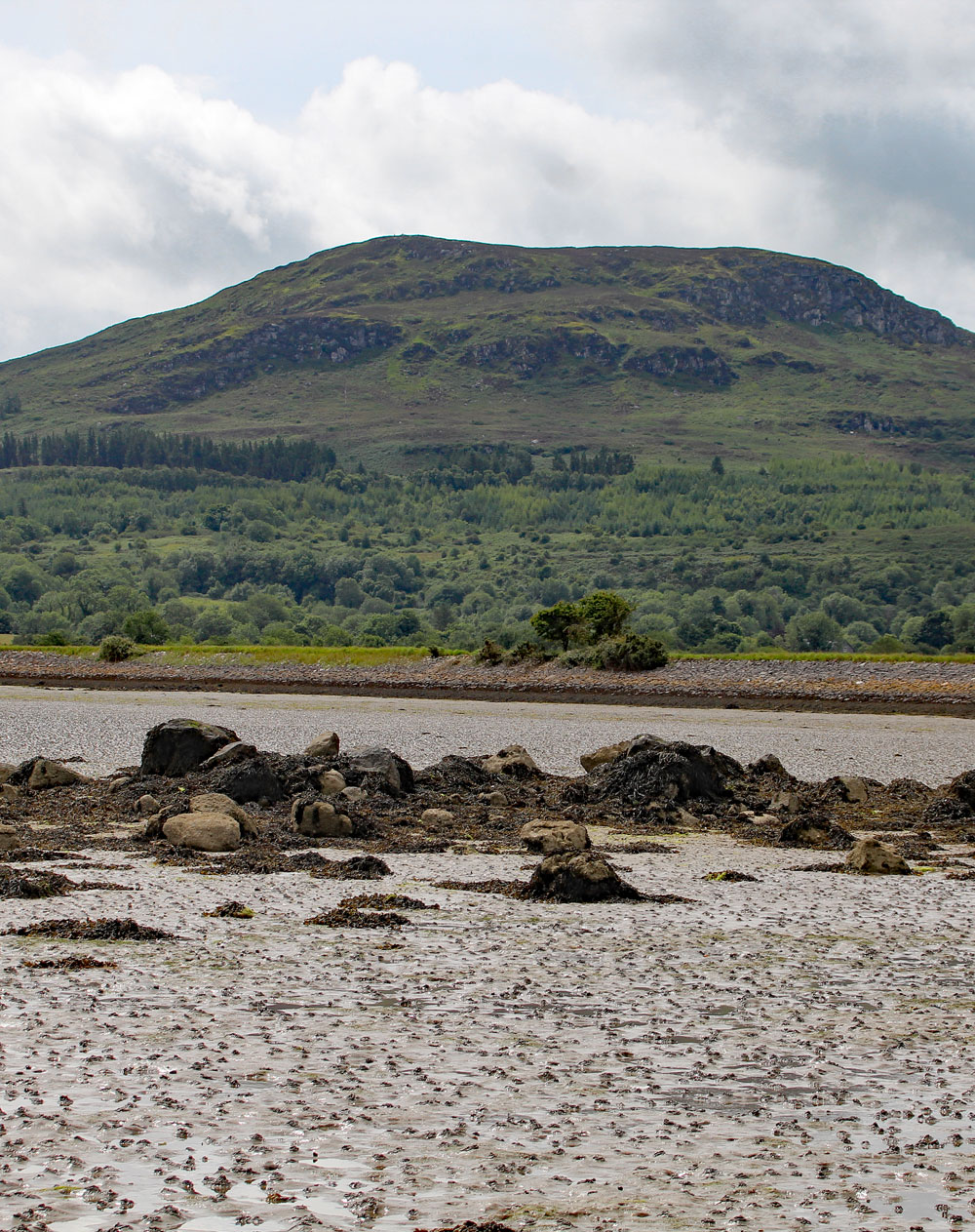
Traigh Eothaile at Tanrego
Now let us see how easily this location fits the story of the old battle. The battles of ancient times were, in the light of modern warfare, small affairs and required relatively small theatres, though Sir William Wilde provided at Cong, County Mayo, a battlefield as extensive, l believe, as that of Waterloo. However, at Ballisodare there is a theatre sufficiently large for such a battle as that of Magh Tuireadh. In the townlands of Mullinashee, Crockacullion and those immediately to the west there is sufficient lowland to deserve the Irish name "Magh," a plain.
Here, I suggest, the battle was fought, or perhaps it is safer to say that it is here such native and local historians as the Mac Firbises understood it to have been fought. When overcome by thirst, King Eochaidh had not far to run. His sepulchre is only a mile from the centre of the suggested battle. The direction of Loch Cé is almost exactly south-east from this place, which is the direction in which the Dindsenchus tells us the frenzied druid ran.
At the suggested battlefield in Coillte Luighne there is a gap in the mountains through which a modern road runs, and the placenames show that there was an ancient road here, which after passing through the gap faced south-eastwards, and determined very probably the direction of the druid's flight. And his race would only be about 18 miles in a direct line, as against the 50 miles from Lough Corrib. In reaching the plain where is now Loch Cé he first had to pass over the Curlews, and go right past the Sidh Gabhra or "Carn of Corr-sliabh," as the Dindsenchus describes it. In coming from Lough Corrib he would not touch the Curlews at all in going to the site of Loch Cé.
The Dindsenchus refrences cannot be set aside lightly. Even in their latest redactions they are two or three centuries earlier than O'Cuirnin's narrative. One of them defines the battle as that of "Cong" and therefore excludes the second battle, and they all tell us the druid fled either south-east from the battle, or else across the Curlews to reach Loch Cé. In fact, the whole conception of the story requires that the battlefield should be somewhere reasonably near.
The version in H. 3. 3. looks as if made by some redactor or scribe who knew the district, and knew that the story could not apply to the battle of Cong at Lough Corrib. Hence he tried to make it suit the battlefield at Lough Arrow, but his version has all the marks of patch-work. For instance, there would be no need for his druid to touch the Curlews in going from the Lough Arrow battlefield to the Loch Cé plain, whereas coming from Coillte Luighne the crossing of the Curlews was unavoidable. I regard this crossing of the Curlews as more conclusive evidence even than the south-eastern direction of the flight mentioned by Mac Firbisigh.
Even O'Cuirnin tells us that the Tuatha de Danann moved west from Magh Rein. Well, Coillte Leyney is west by north from the plain in County Leitrim where they were encamped. And that to reach Magh Nia, he tells us, they had to pass over inbhears—that is, river mouths or sea inlets. There are no inlets to be crossed between Magh Rein and Lough Corrib. But to get west from Magh Rein to Ballisodare a direct passage is impossible even to-day, owing to the 12-mile ridge of the Arigna mountains.
South of this was equally impossible owing to the Shannon and its lakes. So the only feasible was to retrace their steps by Drumkeeran, Manorhamilton and Glencar until they struck the great coast raod at Drumcliffe, which was then, and is now, the great highway for entering Connacht from the north. Now, it is noteworthy that the old road, which was in use till the 17th century, crossed three inbhears or river-mouths in going from Drumcliffe to Coillte Luighne! namely those of Drumcliffe, Sligo and Ballisodare.
So that if, as I have conceded as possible, O'Cuirnin had the plain of Lough Corrib in his mind, he must have copied down this passage from his exemplar without adverting to the fact its inappropriateness. The other alternative is that he copied or wrote it deliberately, fully conscious of its applicability to the Cong in Coillte Luighne.
But this does not exhaust all the evidence bearing on the district.
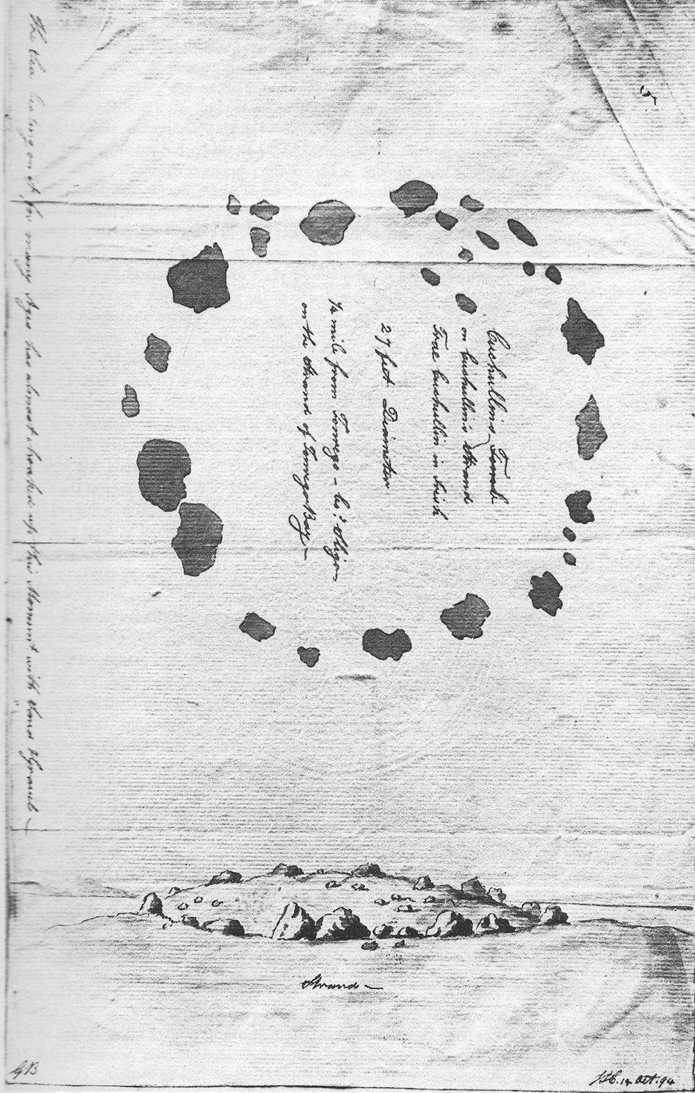
O'Donovan writing to his assistant O'Connor, on the 27th September 1836, quotes a brief alternative account of the battle from Lord Roden's copy of Dubhaltach Mac Firbisigh's MS., of which the following is the conclusion:—
King Eochaidh himself was killed, and was buried in Cuil Chnamh over Traigh Eothaile, in the east of Tir Fhiacrach, where lies Lough Lughna, west of Coillte Firtri, as this verse records:—
Cuil Cnamh, the land where lies
Eochaidh Mac Eirc Mic Rionnal:
The name will live for ever
From the bones of Eochaidh of Red weapons.
"This shows that the name of Cuil Cnamh was so well established at the time this little verse was composed that the poet thought that posterity would never forget it. Is he borne out in his prediction?"
O'Donovan also cited from the Four Masters:—
1468 —"He seized on great spoils in the east of Tir Fhiacrach of Cuil Cnamh and Coillte Luighne."
1476 —"O'Donnell advanced to Cuil Cnamha, and Mac William to Coillte Luighne."
O'Connor replied that the old people said: "That Dromard was originally called Cuil Cnamh," and that "In the townland of Barnabrack in Dromard parish, there is a small lake about four perches broad, which is called Lochan Cuil Cnamh from a burying place which the people suppose must have been formerly near it." This little lake is still there, and there is a tradition at the present day that vast quantities of bones were found in its vicinity.
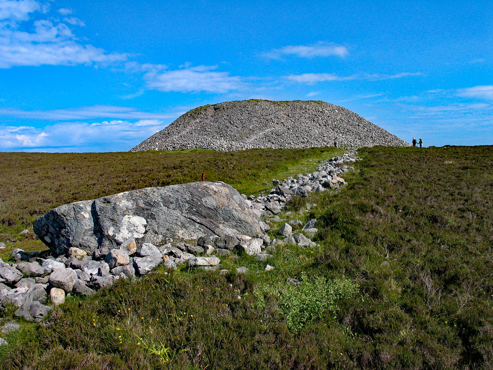
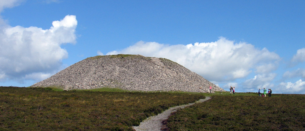
Queen Maeve's cairn, the massive unopened neolithic passage-grave on the summit of Knocknarea, is sadly suffering badly from the effects of people climbing all over it.
Traigh Eothaile at Tanrego
Tir Fhiacrach is the name of the territory, now a barony, between the Ox Mountains and the sea, from the west of Ballysodare parish to the mouth of the river Moy. The Mac Firbisigh lived in Tir Fhiacrach.
Coillte Firtri is simply an alias for Coillte Luighne, for the Tain Bo Flidais calls the territory of Luighne "Crich Lughna Mic Fir Tri."
There are both a townland and a parish of Dromard, and O'Connor does not make it clear which of them was equated with Cuil Cnamh, but O'Donovan understood it to be the parish, as he tells in a note under the year 1468 in the Annals; for he says:— "It appears from the writings of the Mac Firbisighs that Cuil Cnamh was also called 'the district of the strand,' and extended from the stream of Borrach to strand of Traigh Eothaile at Tanrego."
Thus the modern tradition, the name, and its historic location, as well as the lake, all point to a district close to the strand of Traigh Eothaile having been named "the Corner of Bones," evidently the result of some ancient slaughter. And this is exactly where Mac Firbisigh's MS. tells us that Eochaidh was buried "in Cuil Cnamh, over Traigh Eothaile, in the east of Tir Fhiacrach."
Now here is evidently a different version of the first battle of Moytura, yet however they differ we still find King Eochaidh buried in the same district, a point surely of no small importance. There were also two different versions as to the fate of the Firbolg after the battle, but into this it is not necessary to enter.
However, the final passage in O'Cuirnin tells us that the "Tuatha de Danann made Bres their King, and he was high-King for seven years. He died after taking a drink while hunting in Sliab Gam." Now Sliabh Gam is the Ox Mountains, so it looks extremely probable that the whole story of the Tuatha de Danann invasion of the Firbolg was originally a local one, and all located around the Sligo district, before the synchronising historians got hold of it and made it a broadly national episode.
A few words in conclusion about the name. Irish was a precise language, and Irish words had precise meanings, much more so than in popular English of to-day. A conical heap of stones, whether sepulchral or not, was called a Carn. When it was supposed to be the abode of the Fairies or other supernatural beings it was generally called a Sidh ( pronounced "shee" ). If coated or covered with earth it might be called a "Dumha." But it was never called a "Tur" or "Tor." That name was reserved for a pillar, a tower, a towering rock, or a gigantic boulder. We see it in Torach, "the towery ( island )," from its many perpendicular tower-like rocks. We see it in the traditional "Magh Tuireadh," or "Plain of Towers," east of Lough Arrow.
Here there is not a single cairn on the whole plateau, but it is studded over with gigantic glacial boulders, many of them standing on end as if set up by human hands, the largest being the "Eglone Pillar," 19 feet high and calculated at 100 tons in weight. It is even yet a plateau of tors and towers, and must have been much more so before the reclamation of centuries removed all the smaller pillars and boulders. The nearest cairn is down in the lowland at Heapstown, two miles away, and there is no warrent whatever, except our own imagination, for connecting this huge cairn with the "Plain of the Towers."
Let us go back now to Wilde's battlefield at Cong, and what do we find? A rolling plain, with nice green fields for the most part, and interminable lines of fences constructed of small stones, rarely larger than a cooking pot. The only objects that catch the antiquarian eye are the cairns, of which there is a number, the largest being that in Ballymacgibbon, but of tors, towers, or pillars there are none.
A watercolour by an unknown artist depicting the first of the four stone circles at Glebe or Nymphsfield close to Cong. The illustration was probably painted in the 1880's or 1890's.
I submit with all confidence that in precise Irish writing this plain could never have been called a "Plain of Towers." O'Curnin, as if conscious of this, supplies an explanation on a par with the unreal character of so much of his narrative. "The Tuatha de Danann," he tells us, "saw the Firbolg approaching them in that fashion across the plain from the east. 'With how much pomp,' they said 'do these battle props ( turthi catha ) enter the plain, and draw towards us,' so that it was then that the plain got its name Magh Tured, the Plain of Props." But we may be certain that it was not thus Magh Tuiredh at Arrow got its name, but from actual pillars, many of which we can still see, and analogy requires similar conditions in the case of the other Magh Tuiredh.
Let us now hie back to Ballisodare. The coastal shelf of County Sligo is, of course, everywhere limestone, but along the foot of the Ox Mountains this limestone shelf is studded over with millions of metamorphic boulders, torn or fallen from the towering mountain masses above,
which being one of the very oldest rocks in Europe, break off in gigantic chunks, forming pillars and boulders of every shape and size, so that it resembles to a very remarkable degree the eastern Magh Tuiredh at Lough Arrow. It resembles it in its wealth of boulders and also in the absence of cairns. It is indeed a veritable Plain of Towers, one townland being actually named "Tor Ard," or High Tower. The plain has stone circles, dolmens, single and grouped pillars, cashels, forts, giants' graves, and almost every variety of ancient monument, so that one possessed of a fertile imagination such as Wilde's should have no difficulty in finding a tomb for every hero both Firbolg and Tuatha de Danann that, we are told, fell in the mighty struggle.
Other evidences of occupation by a large population are seen at Tanrego, where several acres are covered by shells, chiefly oyster-shells, the beds in some places reaching a depth of 3 1/2 feet.
Such is the place where, following in the steps in Colonel Wood-Martin, I submit the first battle of Moytura was fought.
It suits the march of the Tuatha de Danann from Magh Rein; it suits the flight of the druid; it is in natural proximity to the grave of the defeated king; it answers to the description of the place as implied in the name of the battlefield; and it provides a strong defensive position for an invading force, apprehensive of attack by a native army in possibly superior numbers.
In not one of these important particulars does the County Mayo site conform to the requirements of the case.
The mistake arose, as I have shown, because our historical writers confounded the greater with the lesser Cong. This confusion was rendered possible by the break in the literary and historical tradition due to the Norse invasions, with the consequent break up and dispersal of schools, and the destruction of manuscripts. Yet all late writers dealing with this battle felt constrained to do violence to some part or another of the narrative in an effort to adjust the inadjustable. But with the Ballisodare site no violence is needed.
Every detail finds its requisite topographical setting, and fits into it with such easy naturalness as to scarce leave room for doubt that here indeed is the historic battlefield.
The First Battle of Magh Turedh by Henry Morris,
published in The Journal of the Royal Society of Antiquaries of Ireland,
Sixth Series, Vol. 18, No. 2
December 31, 1928.