Banner: Knocknarea at Sunset.
Aerial view of Newgrange showing the cursus, right foreground. The east side of the mound is under excavation.

The Newgrange cursus and the theatre of ritual

by Tom Condit.

Processions and processional routes are, even in modern times, part and parcel of religious festivals and events. Tom Condit describes how cursus monuments, formally laid-out ritual routeways controlling direction and views of the surrounding visual landscape, indicate that such processions also took place in the Late Neolithic period in Brú na Bóinne.

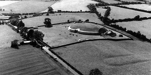
'Cursus' is the name applied to monuments, frequently identified as part of prehistoric ritual complexes, which consist of a pair of parallel banks and ditches defining a path or a routeway. The ends of cursus monuments are generally defined by rectilinear or U-shaped terminals Although it is one of the least visible monuments in the Brú na Bóinne complex the Newgrange cursus is one of the most exciting remnants of prehistoric ritual.

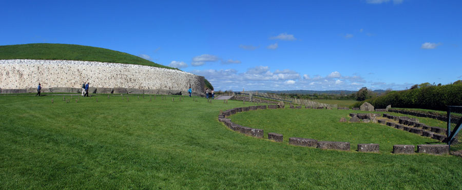
That Brú na Bóinne was not just a place for the interment of the dead is amply demonstrated by the presence of monuments dating to the Late Neolithic/Early Bronze Age, such as the henge monuments, the timber circles and, in particular, the Newgrange cursus. Such monuments tell us, from their shape and design, that they were used for gatherings.

In many instances archaeological evidence for the nature of the ceremonies that took place within the sites does not survive. However, the inward-looking amphitheatre effect of the earthen henges and the circularity of the timber circles suggest that gatherings and religious events took place in the interior of these sites.

An early illustration of Newgrange from Ledwich, 1790.

The cursus is slightly different in that it marks the route of a ritual procession through the landscape, revealing discrete sections of the landscape itself and highlighting monuments and other ritual sites. It would appear that such routes were designed with all the visual contrivances employed in modern architecture and design.

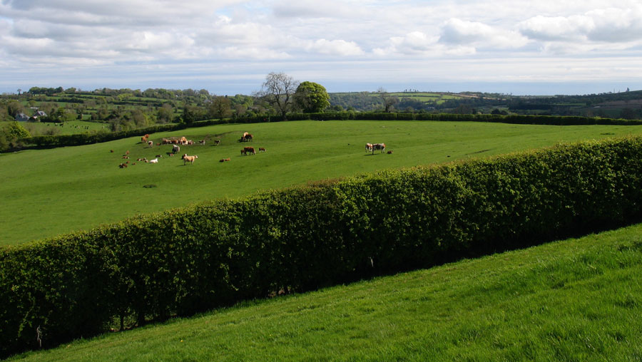
The Newgrange cursus, located c. l00m east of the great passage tomb on a north-south axis, consists of two parallel banks 20m apart, the southern end closed off by a U-shaped terminal.

Around l00m of the cursus survives - perhaps only a fragment of its original extent. There is no doubt that in its original state it would have been considerably longer. Its former extent may be fossilised in the orientation of modern field fences and boundaries on the north.

Where it survives, the cursus is sited on land sloping upwards on the Newgrange ridge. It would appear that considerable prehistoric activity took place at this location.

Vertical aerial photograph of cursus, and mounds and enclosures on floodplain of river.

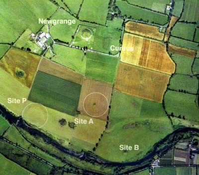
The cursus emanates from a now-dried-up pond formed by a small stream which runs east-west to the north of the Newgrange ridge. It seems likely that the cursus would originally have traversed the pond. The use of water in streams and ponds is likely to have had religious significance in the Late Neolithic period.

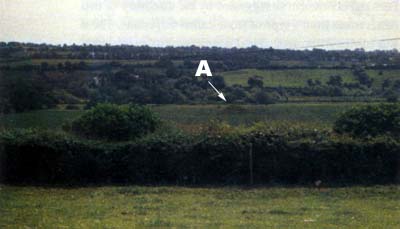
As one walks along the cursus, the horizon of the ridge dominates the view, with the profile of the Newgrange passage tomb clearly visible to the west. About halfway up the slope the horizon formed by the summit of the ridge is clearly visible.

The
          cursus at Newgrage photographed from the east side of the mound.
The cursus at Newgrage photographed from the east side of the mound. The main group of cattle are clustered between the banks of the cursus.

The View Across the Boyne

On the approach to the summit the southern bank of the River Boyne is revealed to the east. Then the grass-covered escarpment south of the river is revealed. The terminal of the cursus is located slightly south of the summit of the ridge and it is from here that the floodplain of the river can be seen, with the water of the river glistening in the background. A sensation of anticipation is created by the changing horizon as progress is made along the course of the cursus.

From this point also the most prominent ritual monuments on the river floodplain can be seen, for directly south of the cursus terminal is a small mound, presumed to be a passage tomb, located at the centre of a now-ploughed-down henge monument referred to as Site A.

Beyond this to the east is another larger mound, Site B, sited on the floodplain beside the river, while to the west is another henge, Site P, again ploughed down and barely visible, located on the river bank beside the ford at Roughgrange.

View of Site A, mound and enclosure from the cursus terminal.

The mounds would not be significantly lower than they were in antiquity, but the henges are now only shadows of their former selves, having been ploughed down through centuries of cultivation.

To date none of these sites have been excavated, but it is interesting to speculate that they were laid out deliberately to provide the view to be created from the terminal of the cursus. It is interesting to note that the distance from the cursus terminal to the mound at Site A, c. 470m, is roughly the same as that from Site A to Sites B and P respectively.

Mrs. Hickey at Newgrange.
Mrs. Anne Hickey, who was caretaker at Newgrange for sixty years visits during Michael O'Kelly's excavations in 1964.

This unusual arrangement of monuments, when seen from the cursus, would appear as a henge to the right, a mound to the left, and a combination of mound and henge directly ahead at the centre. In the mind's eye the archaeologist visualises the appearance of this view when the monuments were in their original condition, subtracting the modern roads and field fences.

The vista must have been very impressive, indicating that by the Late Neolithic religious ceremonies and processions were taking place across the landscape of Brú na Bóinne, with their organisers using the river valley to create their own theatre of ritual.

The Newgrange cursus and the theatre of ritual by Tom Condit, reproduced from The Brú na Bóinne supplement to vol. 11 no. 3 of Archeology Ireland.

Newgrange and Site Z looking north. The cursus is in the field to the right, across the hedge about 75 meters away.