Sites A and B at Newgrange
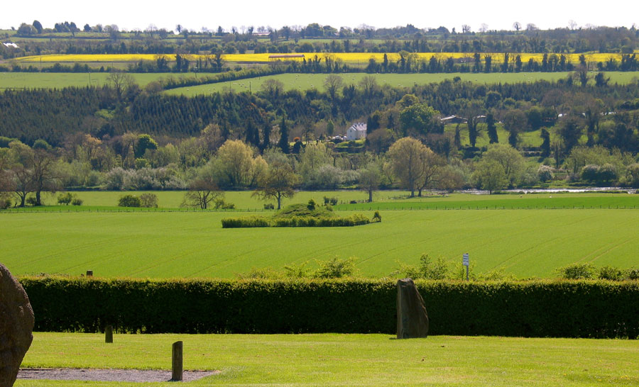
Sites A and B are two of the forty or so satellite monuments which surround the Boyne Valley. Satellite mounds are a common feature of this type of monument, where smaller mounds are built around a larger and probably later monument.
The best example is Knowth, which has eighteen smaller mounds encircling the main monument. The Carrowmore complex in County Sligo had almost forty satellites arranged around the main monument, the large cairn at Listoghil.
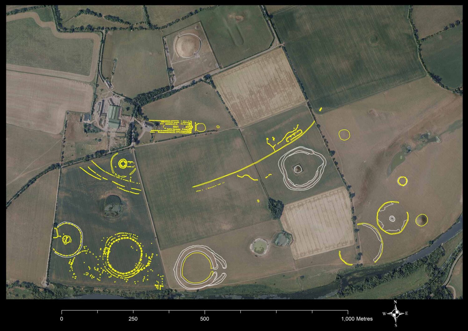
Newly discovered features on the floodplain beneath Newgrange, June 2018
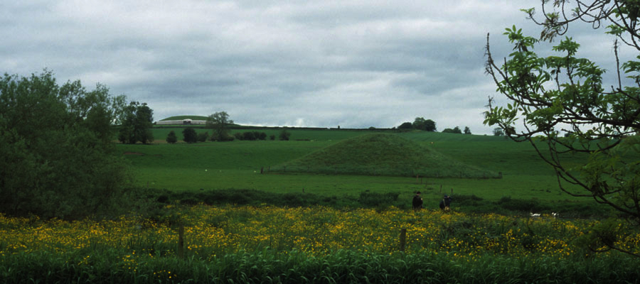
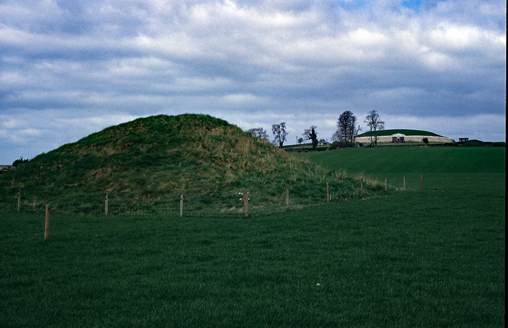
Sites A and B in the Boyne Valley are both located on the floodplain near the river below Newgrange. Site A is a large mound, about twenty-three meters in diameter, which has never been excavated or opened. The mound is encircled by an enclosing bank measuring 175 meters in diameter, which is now mostly ploughed out.
The mound is not in the centre, but offset to one side. Enclosing banks seem to have been a common enough feature of passage graves. They also survive at the Giant's Ring in County Down, Knocknarea and Muckelty Hill in County Sligo, Croughan cairn in County Donegal, and Eochy's cairn north of the village of Cong in County Mayo.
National Monuments Report
This monument is described by Stout (1991, 268) as: This monument (Newgrange Site A) was first recorded on the OS first edition (1837). A mound, within the ‘ring’ north-west of centre, was termed ‘moat’. Coffey (1912, 42) referred to the mound as Tumulus A and wrote that it ‘appeared to have been encircled, at a distance of two hundred feet from the mound, by a vallum, a portion of which is still traceable at the east side.’ This eastern segment was levelled in 1965.
The embanked enclosure is situated on a terrace beside the River Boyne. The underlying brown earth soil has a shallow depth and is derived from outwashed sands and gravels. Newgrange passage tomb is in a prominent position on the terrace above and north of the enclosure. Knowth and Dowth are prominent features to the north-west and north-east respectively. Most closely associated with Site A is the embanked enclosure, Newgrage Site O (ME026-006), which lies at the edge of the Boyne only 370 meters to the south-west. The denuded earthwork is roughly circular in plan with a maximum external diameter of 175 meters.
Prior to the destruction of the better-preserved bank segment, Crawford (1927, 97) calculated a diameter of 140 meters from aerial photography. The interior deepens towards the centre, giving the monument a saucer shape. There is no evidence for a ditch and it is probable that the interior was scarped to obtain the bank material. The bank was constructed from locally available materials including gravel and boulder clay (O’Kelly 1968, 114-15). It reaches 0.7 meters in maximum height in the north-west, where it has a width of 24 meters. In the south, where the bank is most poorly preserved, it has a maximum width of 42 meters. There is a 13 meter wide opening in the east (80 degrees T). Inside this probable entrance is a marked depression, which is probably the result of recent quarrying. This is also the area of the enclosure which was levelled in 1965.
A resistivity survey detected a 5 meter-wide linear feature inside the line of the bank at the west side of the enclosure. More work is necessary to determine the nature of this feature. A flat-topped mound, formed of gravel and water-rolled boulders, lies north-west of centre in the interior of Site A. It has a maximum diameter of 27 meter and a maximum height of 3.2 meters. There is no sign of a kerb despite the extensive damage caused to this site bay cattle, but it is most likely to be a passage tomb.
M. J. O’Kelly (1968, 114-17) collected 165 pieces of flint from Site A, most of which were covered by the spread soil from the bank levelled in 1965. Twenty four of these flints were artifacts, mostly scarpers. Exceptions to this were a plano-convex knife and a possible discoidal knife.
Site B
Site B, another satellite of Newgrange is right on the banks of the River Boyne. The mound is about thirty-seven meters in diameter, eight meters high, and has never been opened. The scant remains of another possible monument are located close by. One of the interesting things to note about the Newgrange satellites is that they all fall on the arcs of circles drawn using Knowth and Dowth as centres, which would suggest that Newgrange was the last of the three mounds to be built.