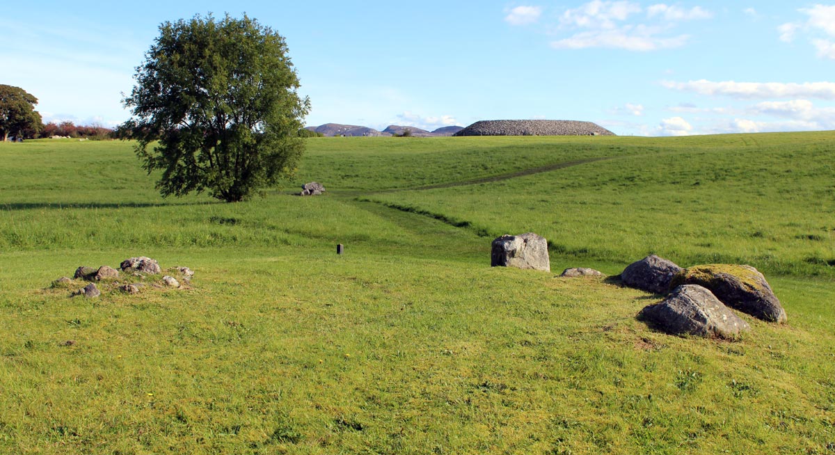
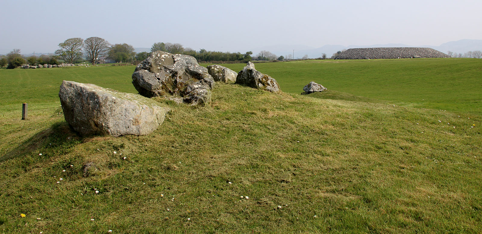
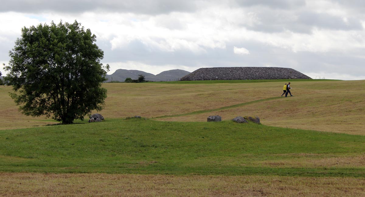
Circle 55 at Carrowmore in County Sligo, looking south towards Carrowmore 54, a largely destroyed passage-grave and the large rebuilt cairn at Carrowmore 51, the central monument known as Listoghil.
Carrowmore 55
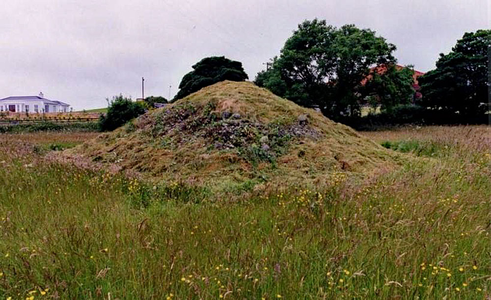
Carrowmore 55, located just west of the visitor centre, was complete and in fairly perfect condition when George Petrie saw it during his August 1837 visit to Carrowmore. The monument seems to have been dismantled soon afterwards for use as building materials, and was thought to have been destroyed. According to William Gregory Wood-Martin's Rude Stone Monuments of Ireland, which was published in 1886, Carrowmore 55 was completely covered with field stones.
This cairn was still more or less intact in 1984, when it was reported to be 3.40 meters in height
and fourteen meters in diameter. In order to determine whether or not a
megalithic tomb was hidden under the heap of stones, the Dúchas and the Swedish project in
1997 decided to apply for a licence, suggesting that the modern covering material should be
carefully removed with the help of light machinery. Photograph by Göran Burenhult.
The monument was rediscovered by Göran Burenhult and his team of Swedish archaeologists, who began to excavate the monument in 1998.
This circle is more perfect, but of the stones have been removed
to form a garden wall. The cromleac is perect, but covered with stones.
The place of any intermediate circles which may have existed (between
this and No. 1, so as to make the chain perfect) have been occupied by
the road and houses on either side.
- George Petrie, Ordnance Survey Letters, August 1837.
This circle, with its cromleac, which Petrie states was, in 1837, tolerably perfect, is now so covered with stones-the clearing of fields-which had been thrown on it, that a description is impossible
- William Gregory Wood-Martin, 1886.
Situated to the north of the preceding (No. 54) and close to the road. It is
the external chain of circles which commenced with No. 1. From Colonel Wood-Martin's
plan it would appear that this circle is south-west of LXVI (dolmen-circle).
William Borlase, Dolmens of Ireland, 1897.
Burenhult's Preliminary Excavation Report
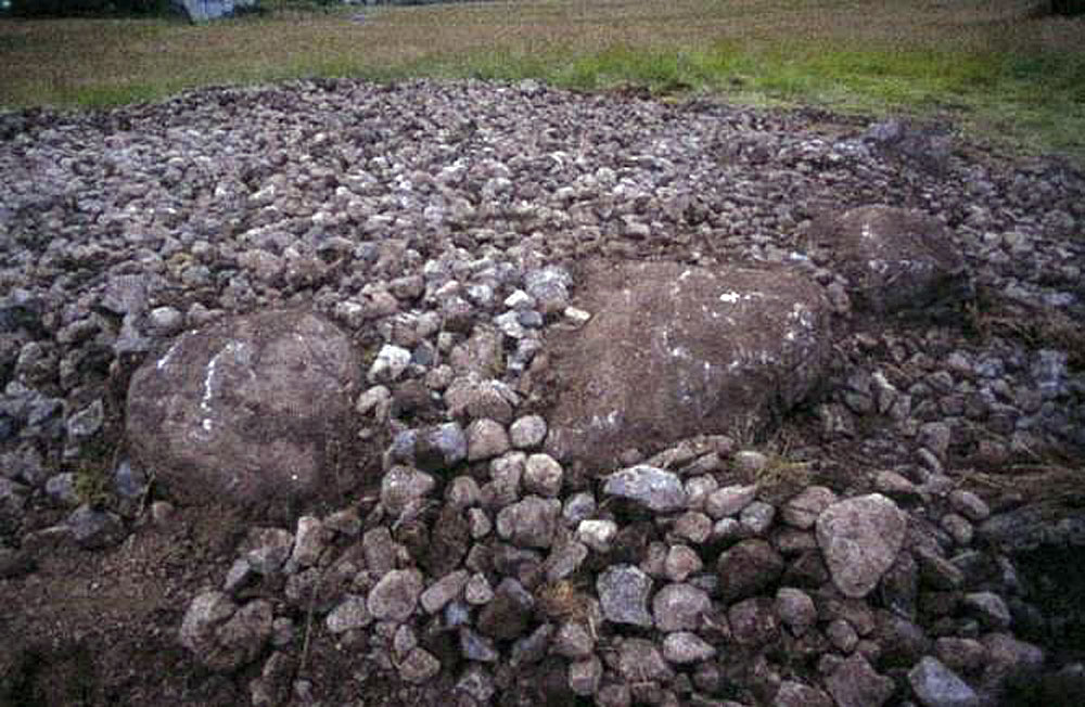
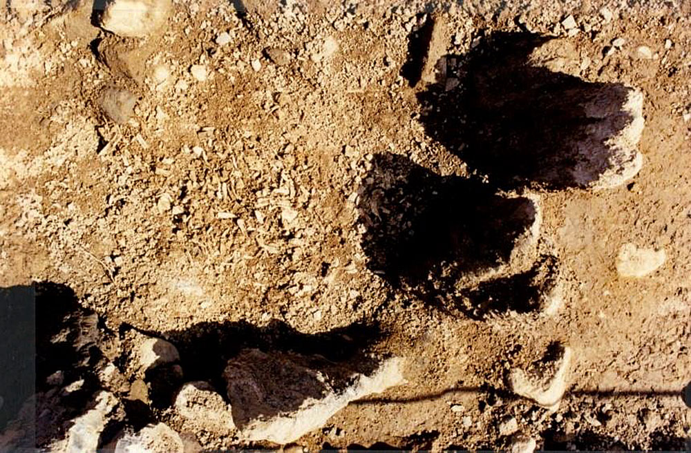
In order to determine whether a megalithic tomb was hidden under the heap of stones, removal of the covering material with the help of light machinery took place during the 1998 season. It was found that the covering material consisted of field stones, thrown up in recent times. Modern glass, fragments of clay pipes and porcelain were found down to the very bottom level of the cairn. On ground level three gneiss boulders were found, placed close together in a slightly rounded shape, but there were no visible remains of any chamber.
Tomb No. 55 during the removal of modern field stones. Three large stones from a
destroyed boulder circle were exposed. As the modern field-stone heap, containing
porcelaine, glass and fragments of clay pipes, continued below the upper surfaces of the
stones, the monument must have been visible and the stones free standing at the time the
site began to be used as a field stone dump. Photograph by Göran Burenhult.
To determine whether the boulders were also thrown into the heap from the surrounding fields or were the remains of a boulder circle of a destroyed megalithic tomb a six meter-long test-trench was laid out from the boulders towards the north. In the first layer more modern material was found, but in the second layer large amounts of cremated human bones were found, together with fragments of mushroom-headed antler pins and bone and stone beads.
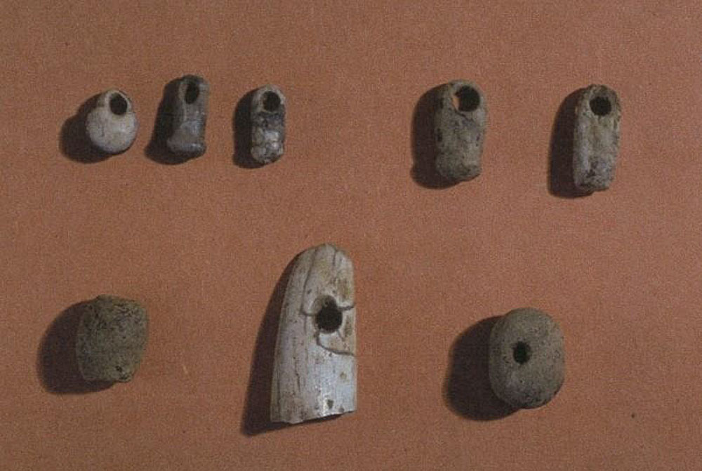
Finds from Circle 55 at Carrowmore in County Sligo. Samples of red deer antler from Carrowmore 3 and Carrowmore 55 were used in a re-dating project, titled Unpicking the Chronology of Carrowmore, undertaken by archaeologists Stefan Bergh and Robert Hensey in 2012.
Radiocarbon samples were taken from among the cremations. One dated sample reveals that the tomb was in use in around 3800 BC. An area of eight square meters was opened, and a full excavation is planned for the 1999 season.
Preliminary excavation report published online by Göran Burenhult in 1988.
Carrowmore 52a, which was discovered during removal of 19th century field walls in 1998.
Burenhult's 1998 Excavations
The field-stone cairn covering the monument was removed during the 1998 season. Light
machinery was carefully used by the Dúchas under strict archaeological surveillance. In order
to create a section through the cairn, the southern half was first removed from the top
downwards, followed by the northern half. It could be determined that the covering material
consisted of field stones, thrown up in recent times. Modern material was found throughout
the cairn down to ground level, consisting of glass, porcelaine, fragments of clay pipes, etc.
Also, considerable amounts of shells had been thrown onto the cairn.
At 52.50 meters above sea level, the upper surfaces of three seemingly large gneiss boulders
were revealed, the stones being placed fairly close to each other in a slightly rounded shape
in the southern part of the site. The machine excavation was immediately stopped and
replaced by hand excavation. There were no visible remains of any chamber or more stones
from a possible boulder circle, but another large limestone was found about 3.40 meters to
the north. With the aim to determine whether the boulders were also thrown into the heap
from the surrounding fields, or actually were the remains of a boulder circle of a destroyed
megalithic tomb, a six-meter long test trench was laid out from the boulders towards the
north-east. The heap of modern field stones continued at a level 30-40 centimetres below the
upper surfaces of the large stones, and more modern material was found, and thus the stones
must have been exposed and free-standing when the site began to be used as a dump for
field-stones. At 52.28 - 52.08 meters above sea level, the modern material decreased in
frequency, and at the same time a firm ground level with soil and stones replaced the loose
heap of field stones. This level was determined as the first archaeological stratum, the Upper
Layer.
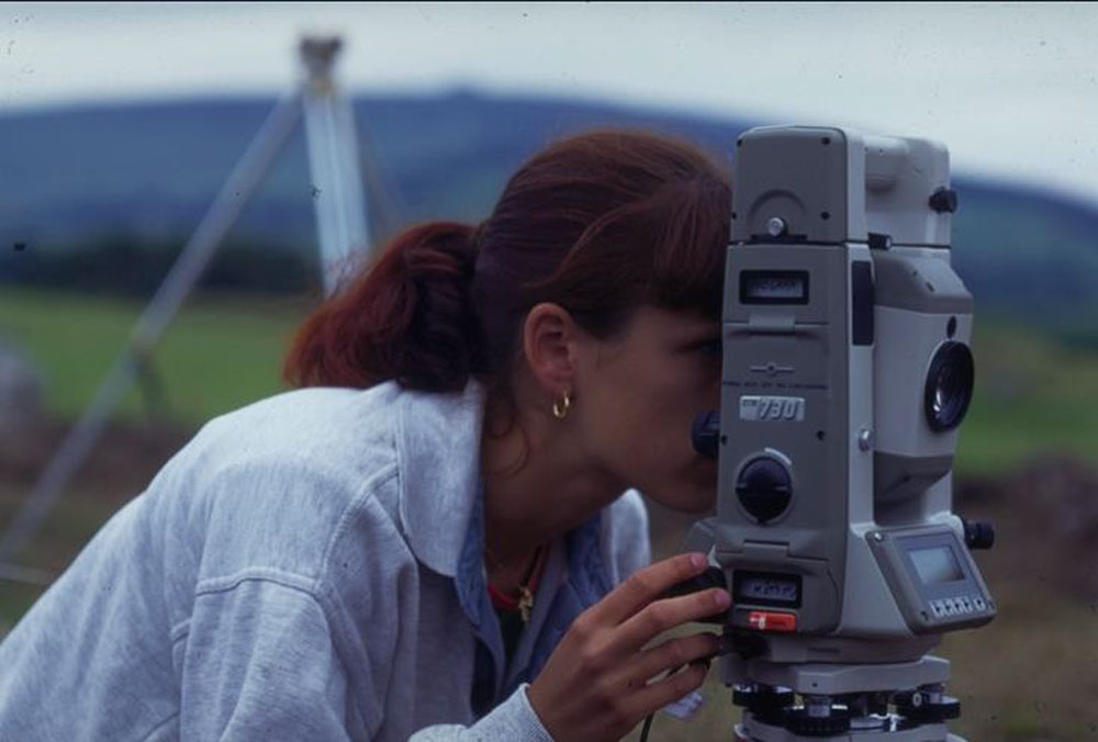
Documentation with totalstation at Carrowmore 55 in 1998.
For educational and training purposes, conventional documentation and drawing was
conducted, as always within the Carrowmore project, using levelling instruments, measuring
tapes and millimetre paper. However, the final documentation and presentation is based on
modern digital techniques, using totalstation and digital photography. The final drawings are vector drawings, based on digital, vertical photographs. The
measuring accuracy allows a maximum error of ± 2 millimetres. Such accuracy cannot be
reached with conventional documentation techniques. All X, Y and Z values are totalstation-based, and finds are given unique ID numbers. All finds are registered in the field in an Excel
D-base, using portable computers, and at the end of each day transferred into a MapInfo or
MicroStation GIS environment.
The Excavation
The coordinate system was laid out with the X-axis in a north-east south-west direction and
the Y-axis in a north-west south-east direction. The point of origin was placed in the southern
part of the site, next to one of the two boulders, and as a fixed point, the top of the National
Monument sign was chosen, west of Tomb No. 55, at a height of +51.87 m above sea level. A
one-meter trench was excavated along the X-axis towards a hypothetical centre of a possible
former monument, and the main section, A-B.
A stone-packing was unearthed near the two boulders in the southern part of the site, as well
as near the boulder to the north. Two larger stones in this packing may be the remains of an
inner stone-circle, but further excavation is needed to confirm this. In the middle of the trench there were, on the other hand, not as many stones.
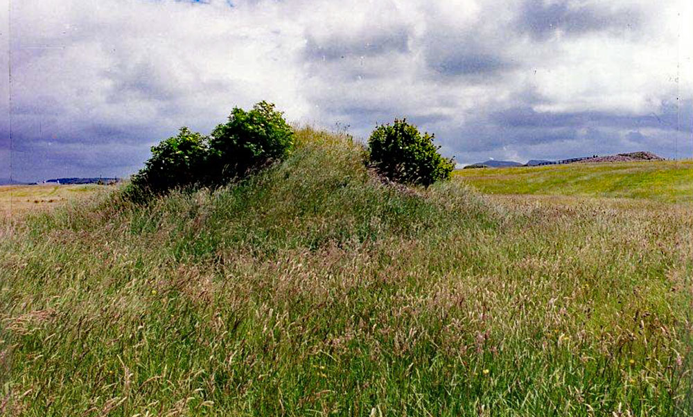
Carrowmore 55 as it appeared prior to excavations in 1998.
At about 51.90 meters above sea level, cremated bones were found in the region near the
boulder to the north. Because of this the trench was widened by one meter to the east. This area was divided into four areas ( 1.25x1.00 meters ) labelled 1-4,
with Areas 1-2 to the south-west and sections 3-4 to the north-east. Subsequent layers
were excavated at 0.10 meters strata, Layer 1 beginning at 51.90 meters. All excavated soil
from these areas was water sifted. Finds found in the sifting process are registered to Cist A
or Areas (A1-4), and Layer (L1-4).
The stone-packing in the north part of the trench appeared to be the remains of a stone-
packing around a possible cist, Cist A. The very rich quantities of cremated bones
and artefacts that were revealed indicate that the site had not been dug into during the 19th
century, as most other tombs at Carrowmore, which may indicate that the heap of stones had
been thrown onto the site before 1800. Cremated bones were found scattered over the whole
area, from X+3.50 to X+6.00. Two larger concentrations where found referred to as Cist A and as Area B. Many
artefacts were discovered among the cremations. A separate section has been laid out
through Cist A and Area B, Section C-D. A clearly defined area
of dark-coloured soil appeared in Layer 1. This layer consisted of
soil mixed with numerous small pieces of charcoal, but was only about 0.02 meters deep. A section was laid out through this dark area, Section E-F, but it did not produce any further information.
Several flat stones were also found in Layers 2 and 3 in the area from x+3.50 to x+6.00. They
measured between 0.20 and 0.66 meters in length and most of them were unearthed in or near
the bone concentrations. It seems probable that these stones had served as some kind of
floor-slabs. The cremation layer, however, continued undiminished below the
floor-slabs and more artefacts were discovered after their removal. This might suggest either
that the site had been used for some time before the floor-slabs were placed in the grave, or
that the slabs were displaced during the destruction of the monument. The spread of the
artefacts and cremated bones may probably indicate the latter, and this will be a major
question for the forthcoming continuation of the excavation. Four 0.10 meters layers (Layers
1, 2, 3 and 4) were excavated during 1998. At the bottom level of Layer 4, rich
quantities of cremated bones still covered a substantial part of the two areas, Cist A and Area
B.
As the excavation of Tomb No. 55 was never completed, wooden planks were placed above
the unexcavated layers as markers before the refilling of the trenches.
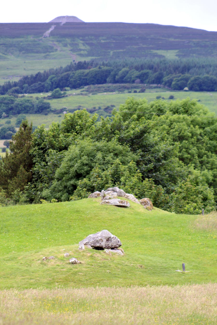
Circles 52 and 53 at Carrowmore looking west to the majestic Knocknarea Mountain and Queen Maeve's cairn in County Sligo.
The Finds
Altogether, 43 artefacts or collections of artefacts, mostly fragments, have been registered. The preliminary classification of the find material includes clay
beads, polished and drilled stone pendants, a bone pendant and some bone beads. It can also
be noted that a great number of antler-pin fragments (over 50 pieces) was unearthed. Two of
these pieces were mushroom-headed and a few other fragments were apparently decorated. Of the 43 registered ID:s, twelve were found in the water sifting process, mainly
antler pin fragments: 8 antler pin fragments, 2 pieces of ceramics and 2 stone pendants. The
sifting finds are not included in the digital distribution maps of plans and sections. Furthermore, 13 samples for radiocarbon dating were collected, all charcoal.
Radiocarbon Dates from Carrowmore 55
Thirteen charcoal samples for radiocarbon dating were collected during the 1998 excavation
season. One of these samples (ID 60512), from the cremation layer below the floor-slabs, has
been dated to about 3800 BC (figs. 19-21). Radiocarbon dating (AMS) of this charcoal sample
from the 1998 excavation season has been carried out at the Tandem Laboratory, Uppsala
University, Sweden.
Ua-13753 Carrowmore, Tomb No. 55, ID 60512, 4970±120 Before Present.
Cremated human remains discovered during the 1998 excavations in Circle 55 at Carrowmore in County Sligo.
The Cremations
Altogether, 27.727 kilos of cremated bones, mostly human, have so far been collected in Areas
1-4 and inside Cist A. Most of the cremated material appear
in Layers 2 and 3 inside Cist A and in Layers 2 and 3 in Areas 3 and 4.
The excavation was not completed during the 1998 season, and therefore the excavation of
Tomb No. 55 will be continued. It is essential that a larger area is opened in the centre of the
site to allow for a thorough documentation of the depositions and former structures. In order
to secure the exposed layers during the winter period, plastic sheets, plywood and thick
wooden planks have been placed in layers over the excavated area, and then covered with
clay and topsoil up to the surrounding ground level. Iron rods have been hidden and covered
under the refilled material as coordinate markers.
You can download the full excavation report at this link.
Carrowmore
55 was buried under a pile of rubble for many years.